Remembrance Gateway, Mount-Royal Park, Montreal, Canada
civiliti.com/ + www.vlanpaysages.ca/
2026 Public Projects / Canada / Built in 2024 /

![Inaugurated in the fall of 2024, Parc des Gorilles is the product of an extraordinary citizen movement that Jane Jacobs would undoubtedly have supported. The design of this new urban space is highly unconventional: a diagonal strip of land cutting through the backyards of former industrial buildings. A brief historical overview helps explain the site’s […]](https://landezine-award.com/wp-content/uploads/2025/05/00-Parc-des-Gorilles_civiliti-600x450.jpg "Parc des Gorilles, Montreal, Canada by civiliti")
![Located in Montréal’s Grands Jardins District, the Franciscan Commemorative Park is part of a string of green spaces planned to keep alive the memory of the large estates that made up the area prior to 20th-century urbanization. The green corridor is now complete, and it extends from Cabot Square, along Atwater Avenue, all the way […]](https://landezine-award.com/wp-content/uploads/2024/05/00-civiliti_01_Franciscan-Commemorative-Park-600x397.jpg "Franciscan Commemorative Park")
![Place Monique-Mercure Place Monique-Mercure is located in Montreal, North America’s largest French-speaking city, known for its friendly neighborhoods, its dynamic cultural life, and its commitment to design. There are several theaters in the city, among them the Outremont Theatre, which dates to the early Twentieth Century. This remarkable Art Deco building’s main entrance faces Bernard […]](https://landezine-award.com/wp-content/uploads/2023/05/00-IMG_4068-600x400.jpg "Place Monique-Mercure")
![In the fall of 2019, after years of preparation, the University of Montreal will inaugurate the first of a series of buildings that will shape its second campus. The MIL Campus is located slightly north of downtown Montreal on a decommissioned railway yard. One of the major challenges faced by the university during the planning […]](https://landezine-award.com/wp-content/uploads/2019/04/12_Dramatic-night-view-of-east-facade-600x452.jpg "MIL Campus Viaduct")
![Montreal, celebrated for its historical architecture and its vibrant urban life, is known for its unique setting on a major waterway, the St. Lawrence River, and for its small, highly emblematic mountain rising from the downtown core. Mount Royal is a protected natural site, which has always been a magnet for Montrealers and visitors to […]](https://landezine-award.com/wp-content/uploads/2019/04/00_Discovery-Halts-600x400.jpg "Discovery Halts (Escales découvertes)")
The geographical context
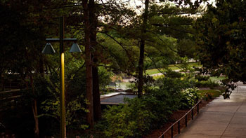
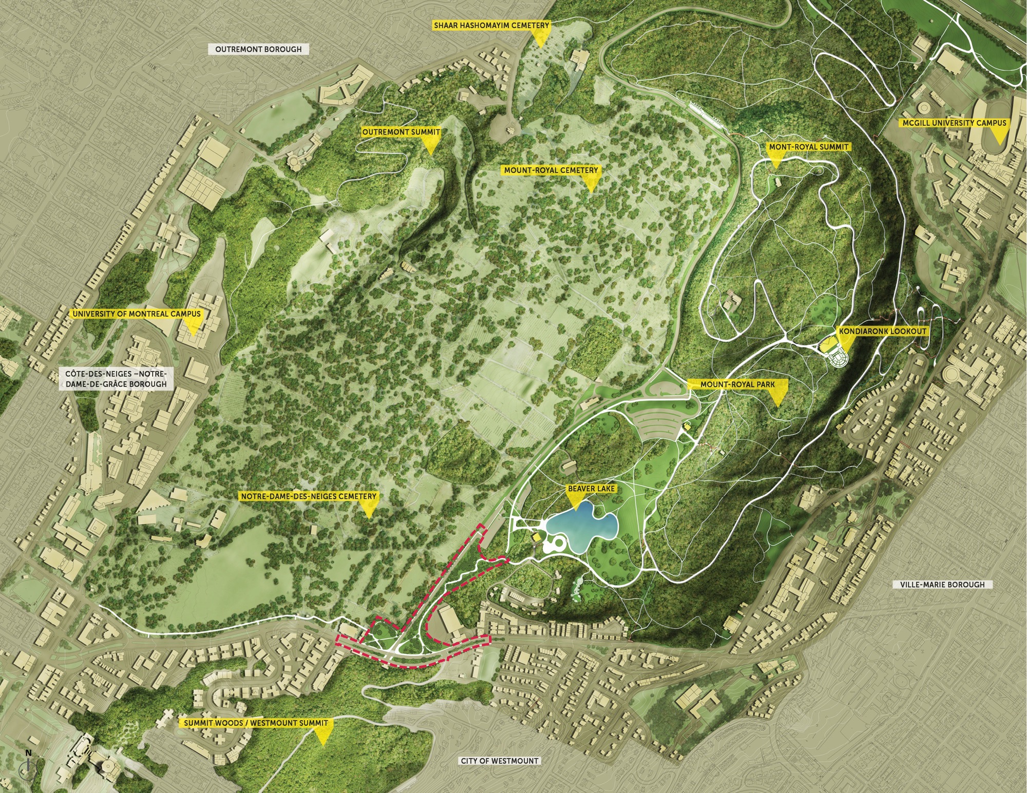
The City of Montreal is blessed with a unique geographic situation, its centre being located between the shores of the St. Lawrence River and the flanks of Mount Royal, a mountain and park which still dominates the city as it has done for centuries. Now a major heritage site, Mount Royal has been the object of several major projects during the last 150 years. Most of these projects aimed at preserving the mountain from development and making it accessible to the greatest number of citizens, for both health reasons and enjoyment.
The historical context
The first significant intervention was that of Frederick Law Olmsted who, in the 1870s, was mandated to draft a plan that would protect the site while turning it into a unique park. When looking at Olmsted’s long and varied practice, his masterplan for Montreal is still viewed today as a landmark achievement.
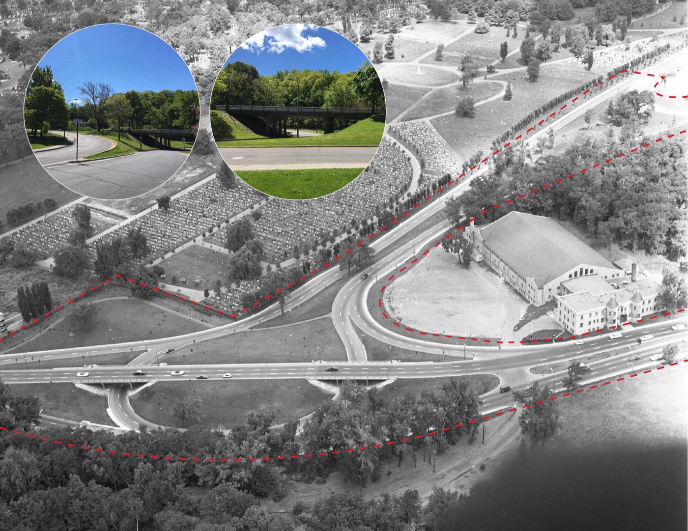
In the 1950s, another major firm, New York-based Clarke & Rapuano, was commissioned to facilitate car access to the mountain. Imagined as a landscaped parkway, two imposing interchanges were built following the plan: the first at the intersection of Park and Pine avenues, and the second located at the crossroad of Remembrance and Côte-des-Neiges roads. Featuring separated roadways, planted medians, and elevated lanes, the infrastructure prioritized cars and created serious barriers for pedestrians or cyclists.
Changing times
By the 21st Century, new emphasis was placed on the preservation and the enjoyment of this unique park setting. The City of Montreal and Quebec’s Ministry of Culture and Communications embarked on a major effort to improve accessibility not only to Mount Royal Park itself, but also to a far wider territory, now designated as the Mount Royal Heritage Site. Apart from the park, this much-praised cultural heritage site encompasses three peaks, two university campuses, and three distinct cemeteries.
Redesigned accesses
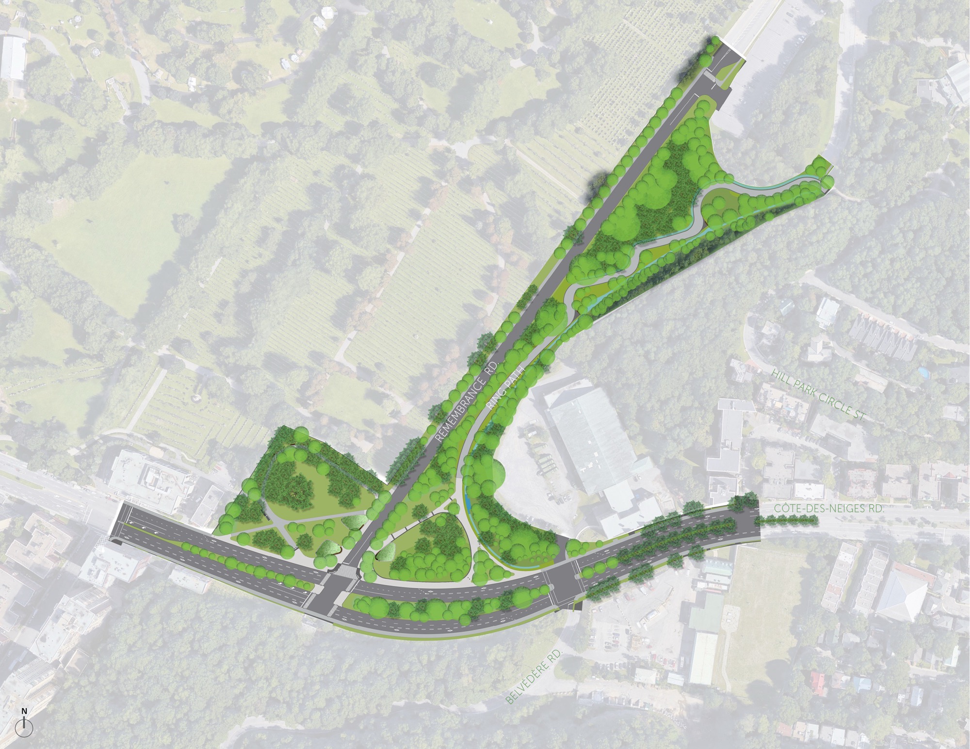
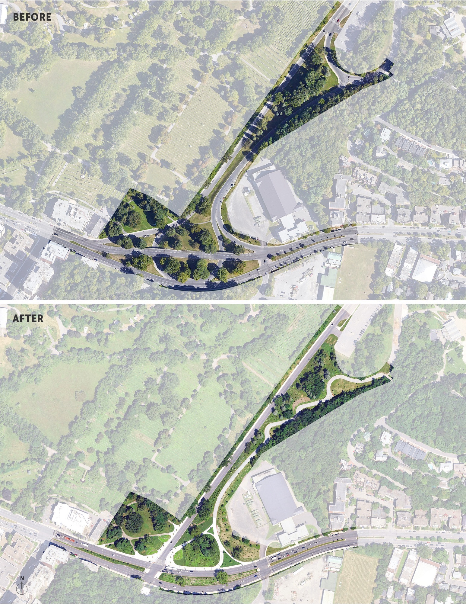
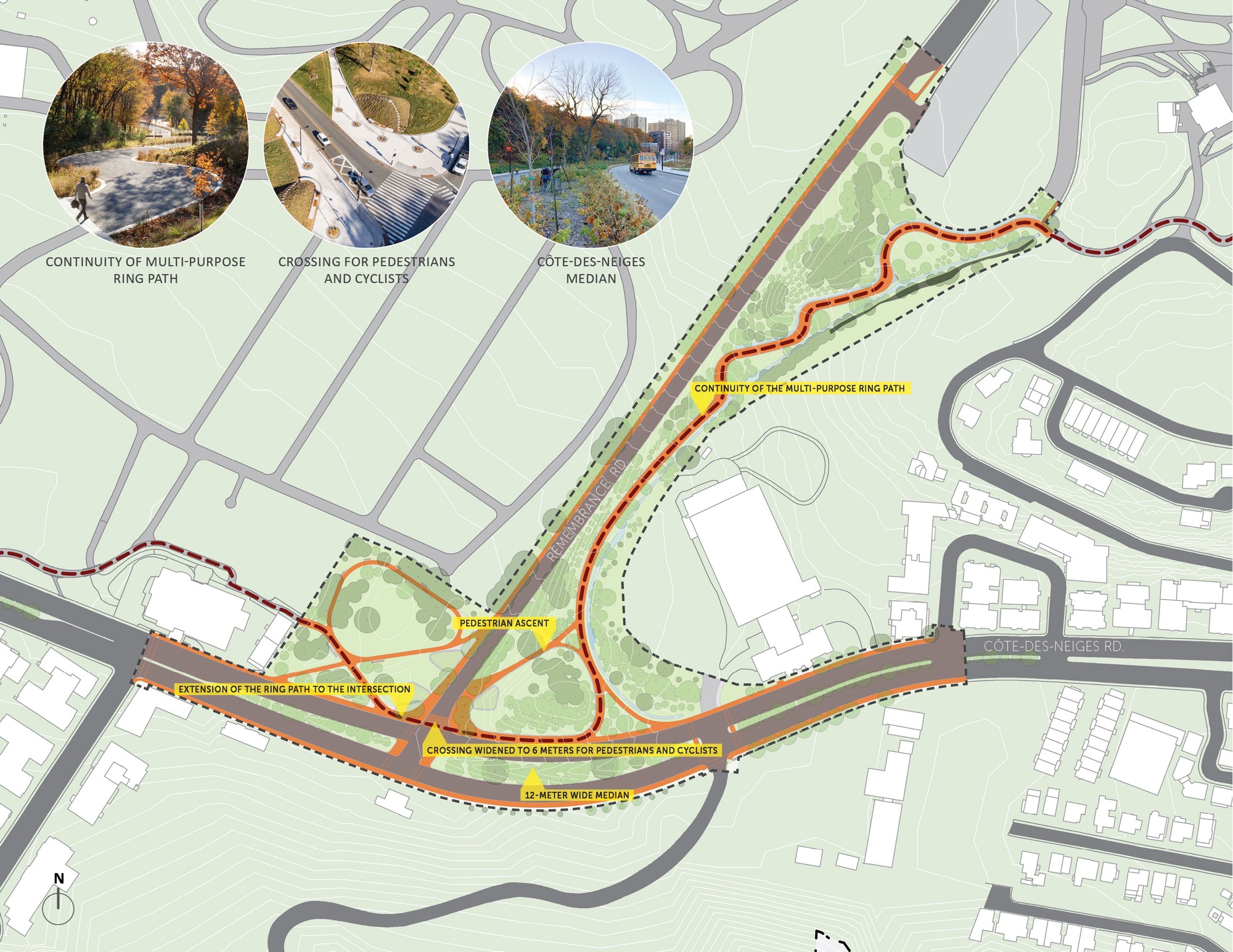
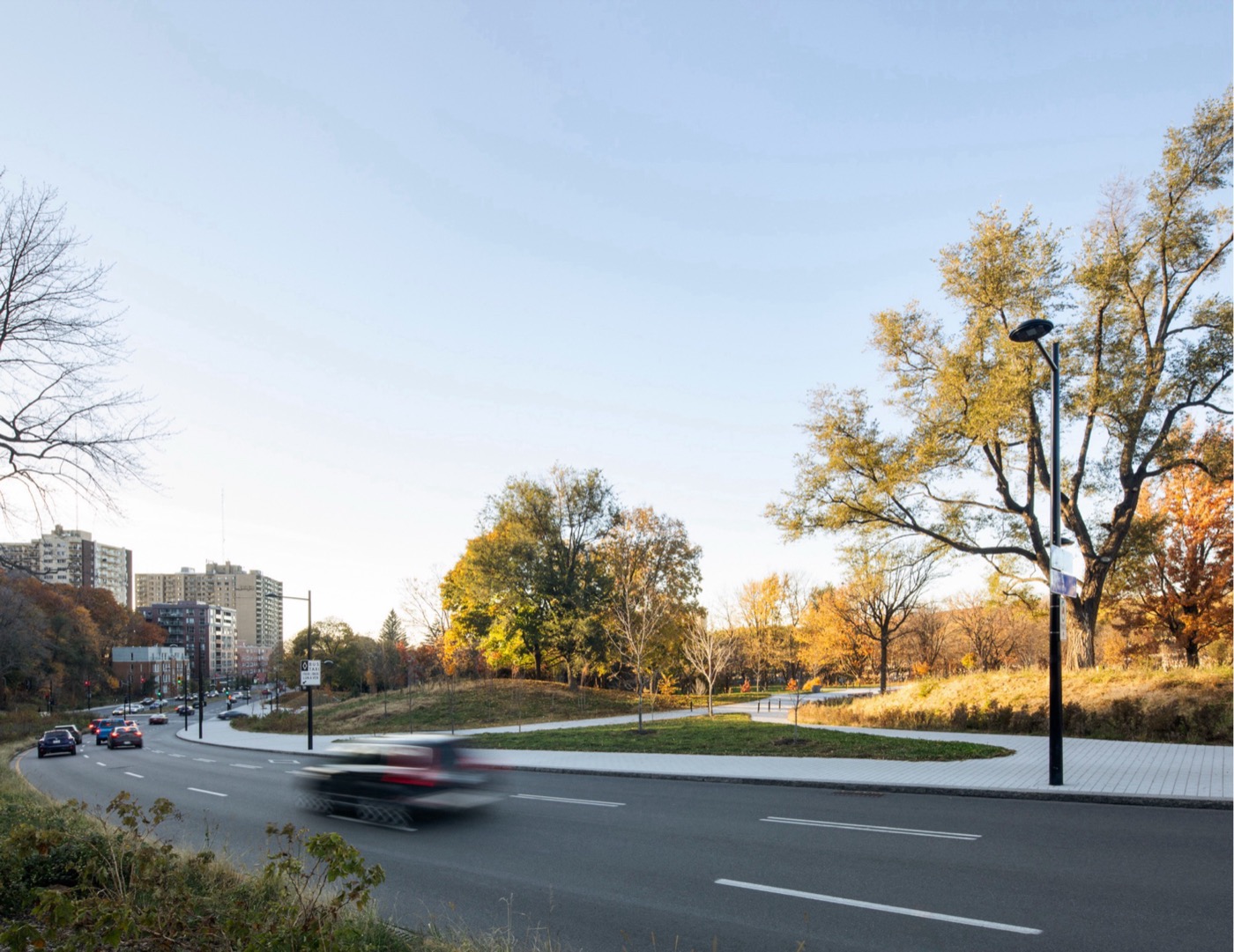
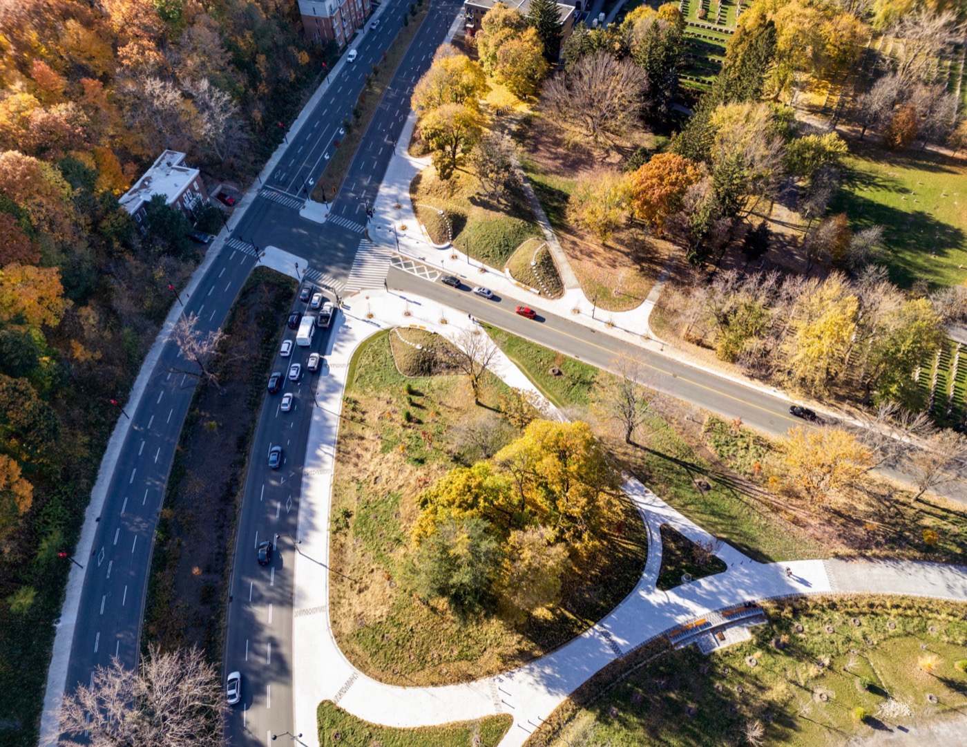
The Park – Pine interchange was demolished in 2005 and replaced in 2008 with a much more amenable project which involved several firms, including our own. We were entrusted with a Design Options Analysis and the Preliminary Design Concept (2003). In 2018, our landscape, urban design, and engineering teams were once again called upon to redesign the Remembrance – Côte-des-Neiges access, making it safer and more accessible for all transportation modes.
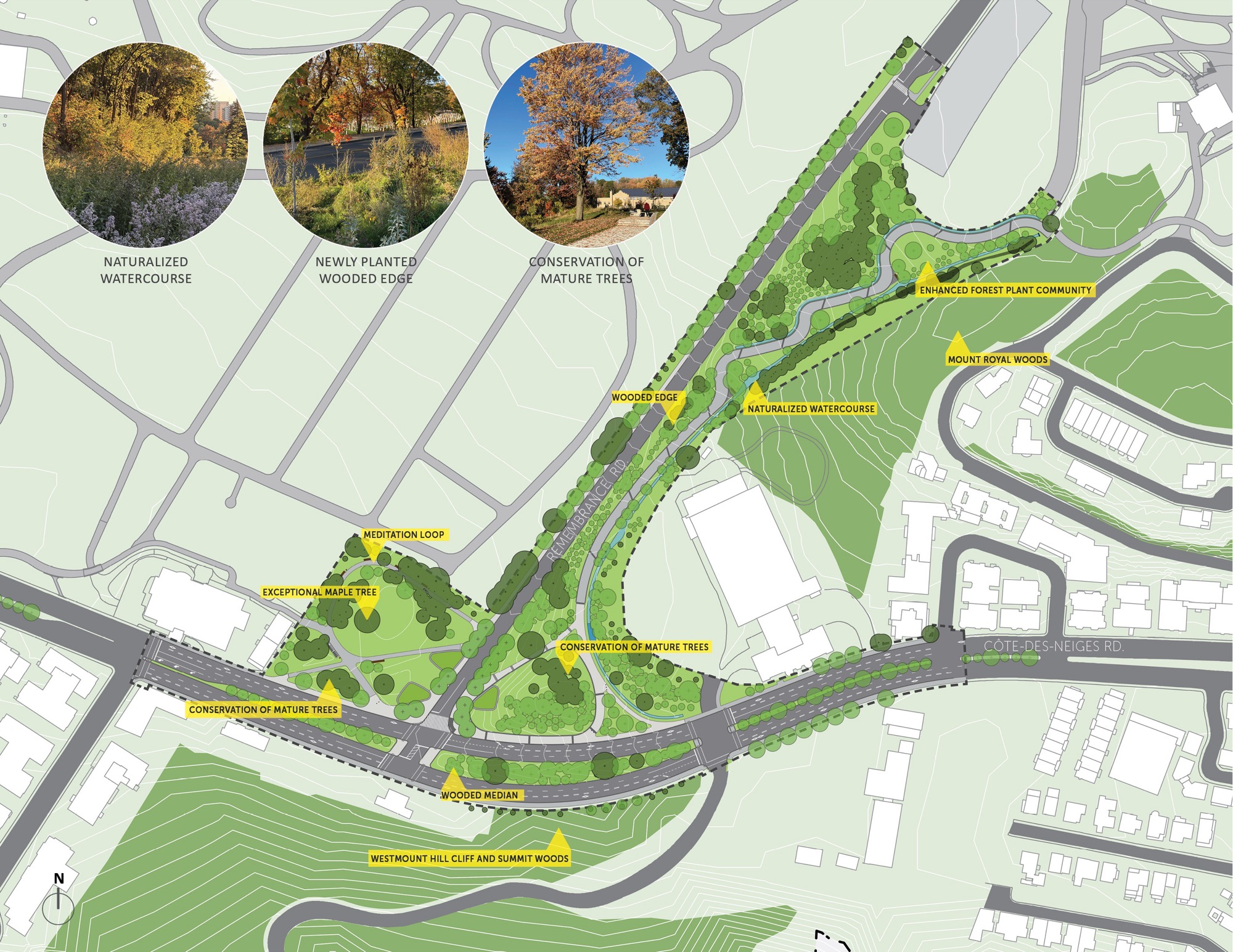
While our contemporary proposal is very distinct from the original Clarke & Rapuano design, it did draw some inspiration from it. As in the 1958 scheme, the plan includes a wooded median, in the middle of Côte-des-Neiges Road. We also preserved the former interchange’s embankments and kept or transplanted many of the existing and mature trees.
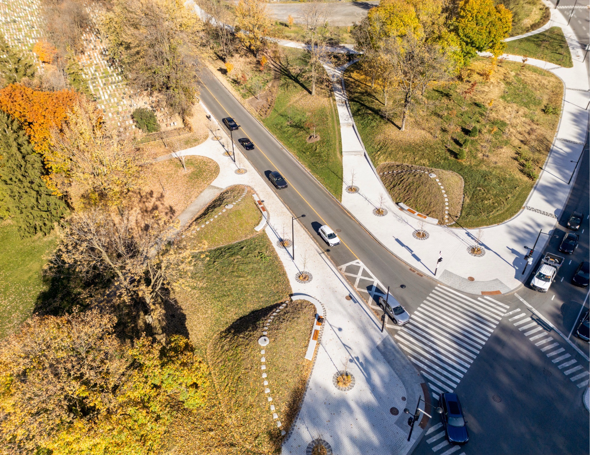
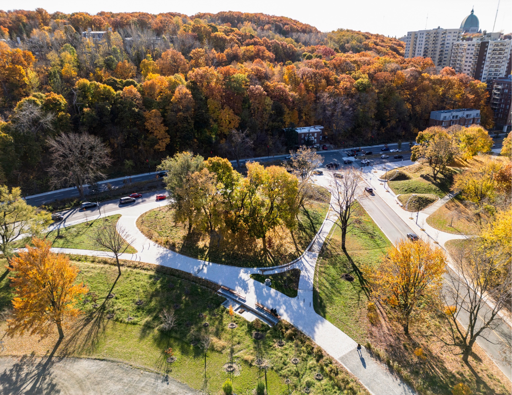
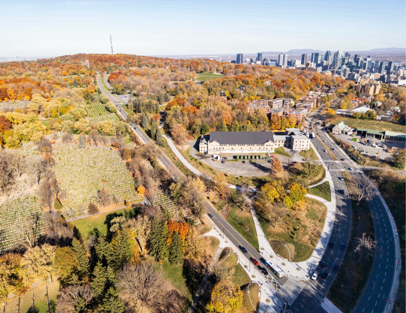
The elevated interchange however has been reshaped by a simple and level T-shape intersection, and the East bound roadway of the parkway has been replaced by a section of the pedestrian and cycling mountain ring path.
Olmsted’s Spirit
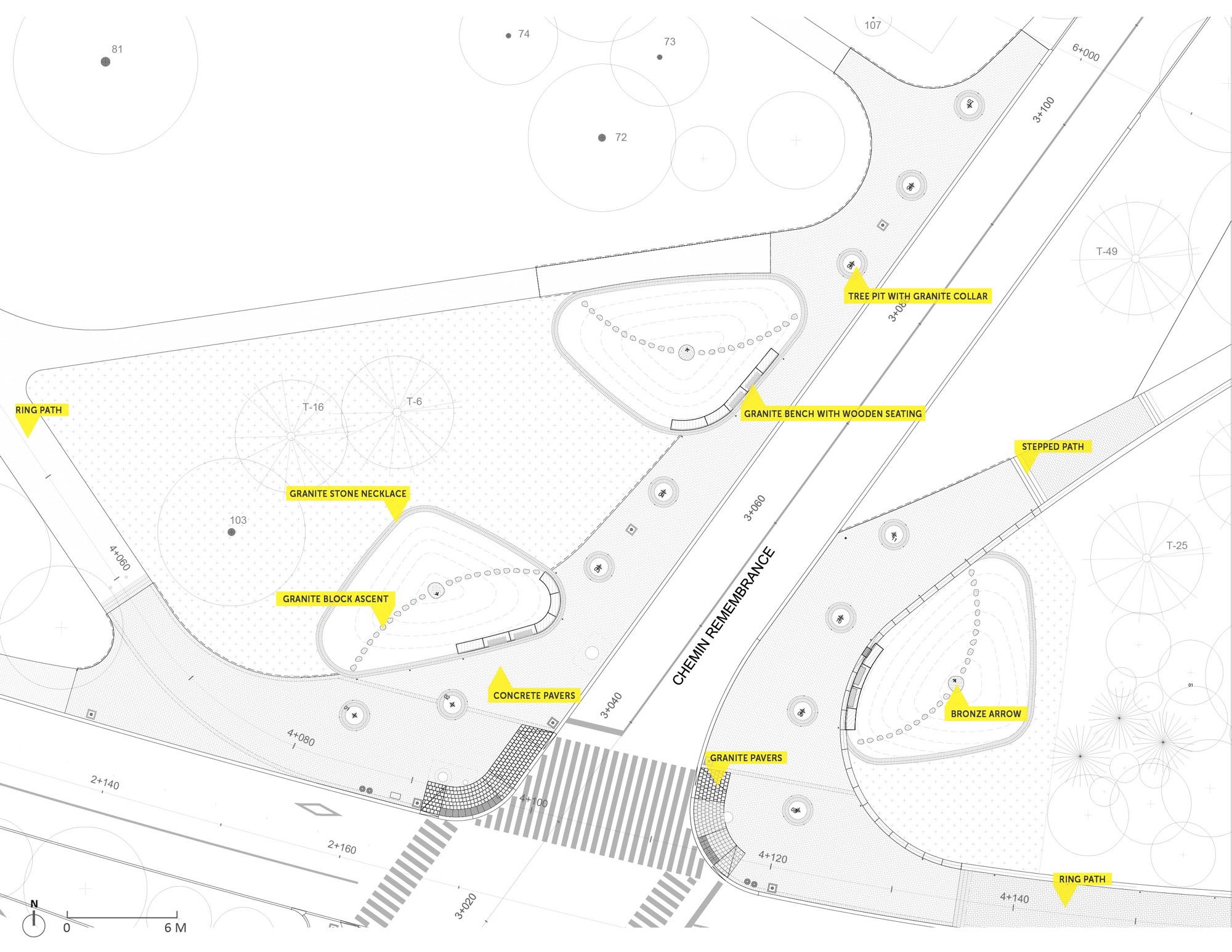
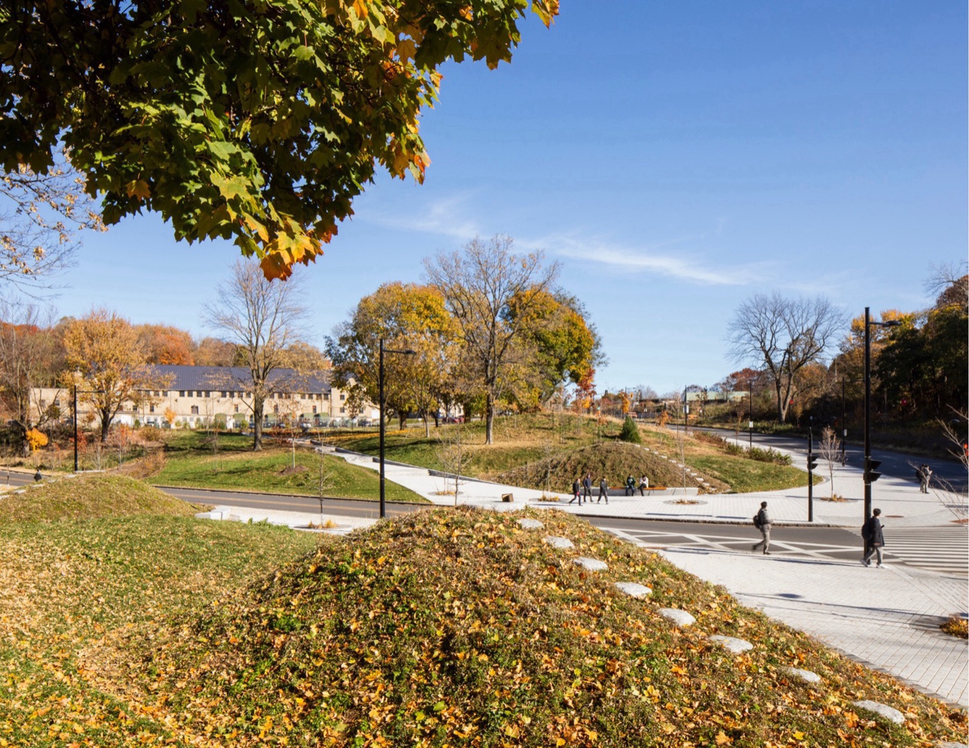
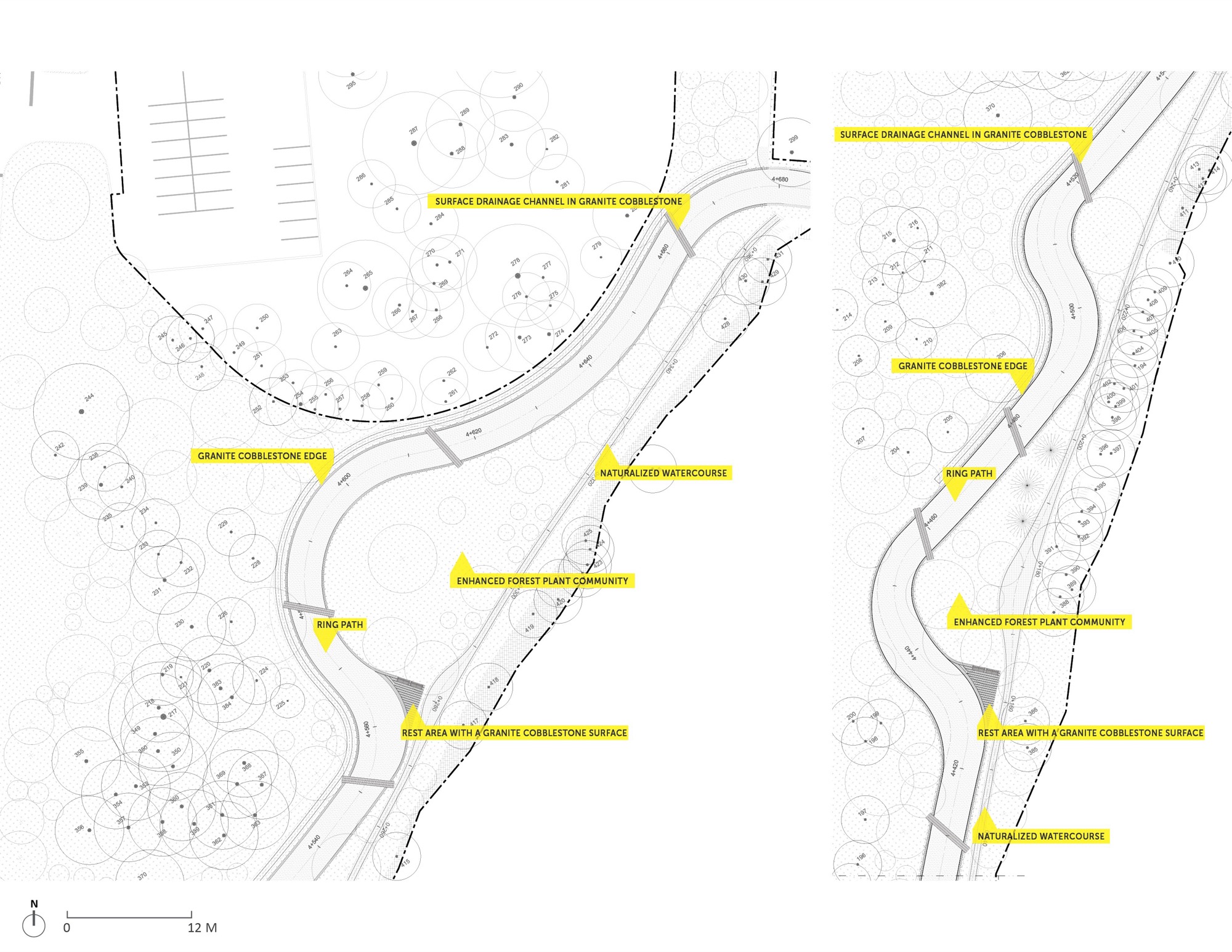
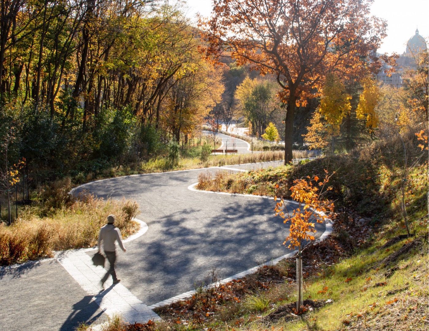
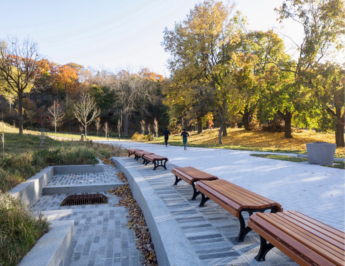
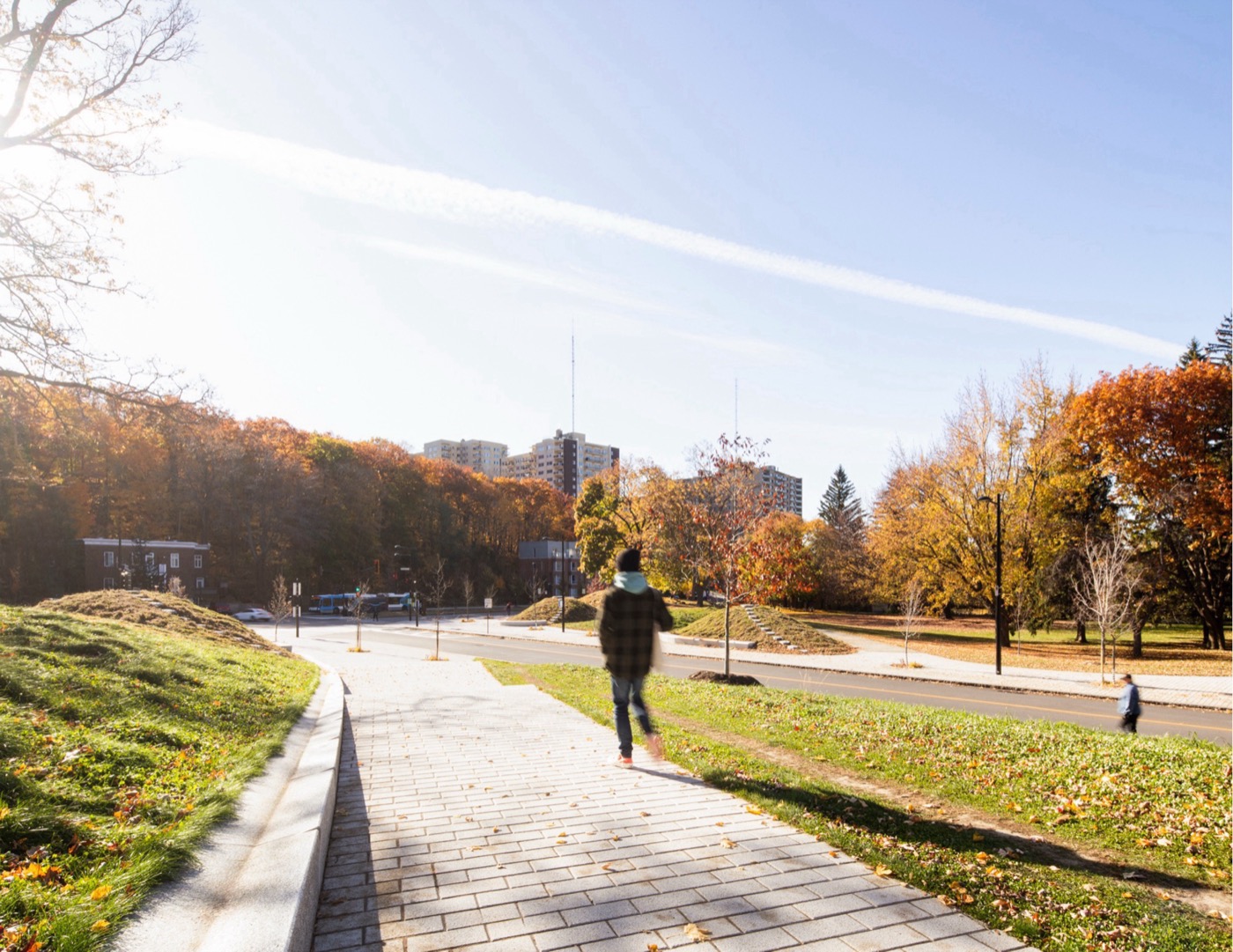
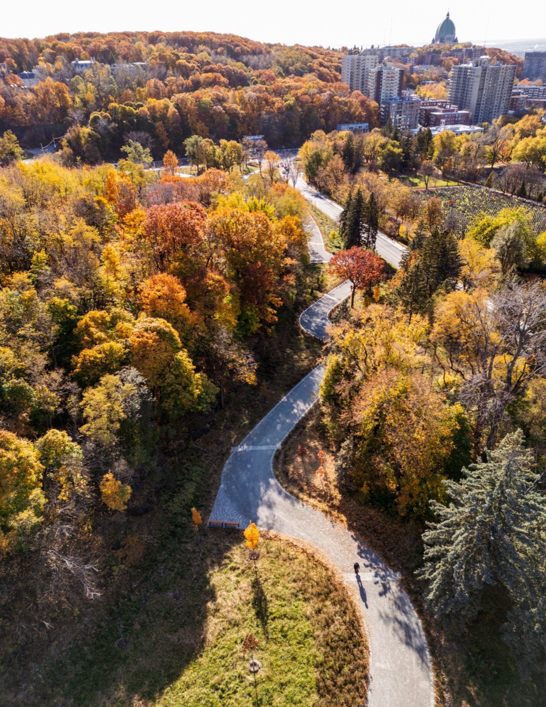
Following one of Olmsted’s key principles for Mount Royal Park, the new layout emphasizes a gradual, immersive and scenic ascent, which starts in the surrounding neighbourhood and gently progresses towards the mountain’s heights. The gravel path is punctuated by granite cobblestones and seating areas, again in Olmsted’s spirit.
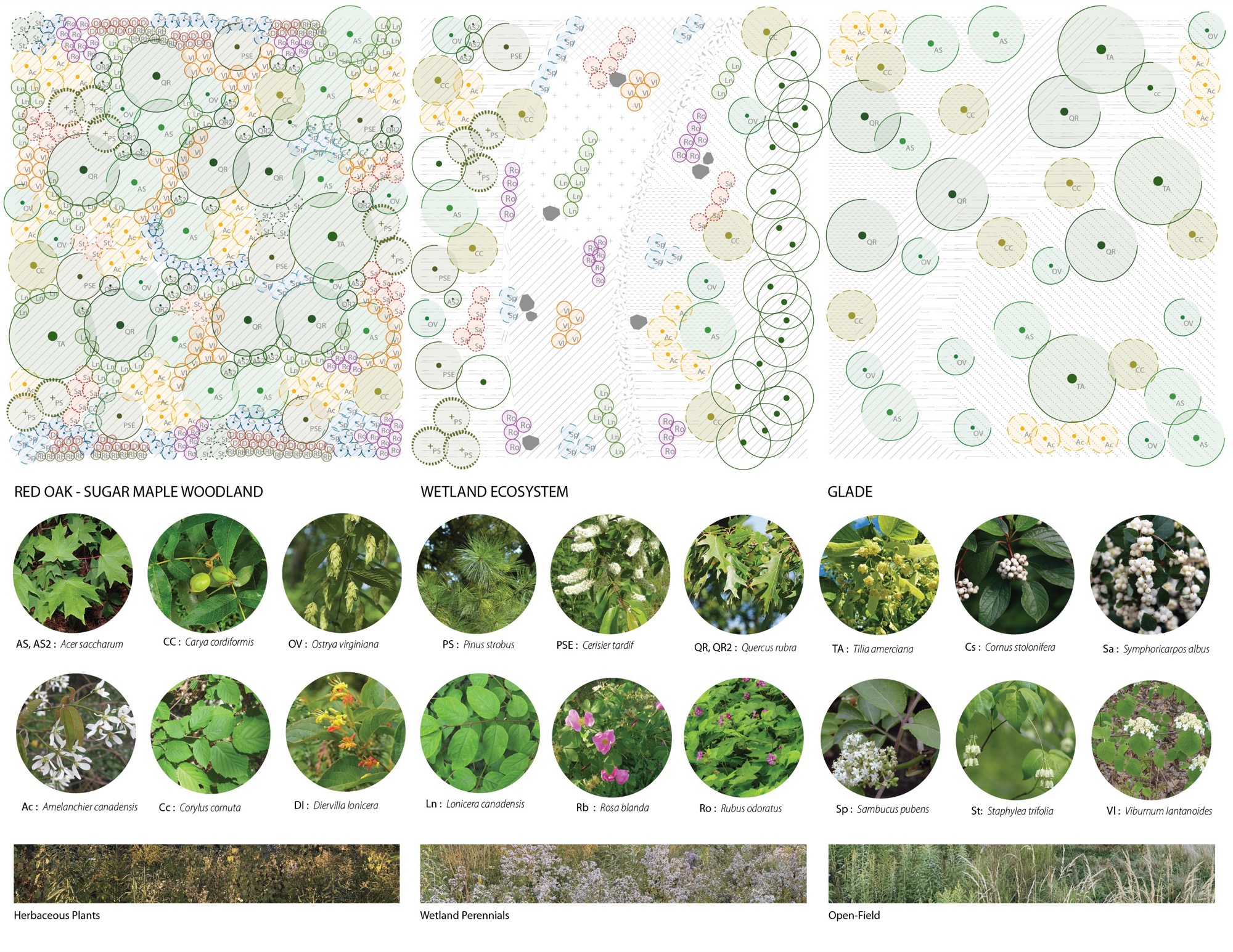
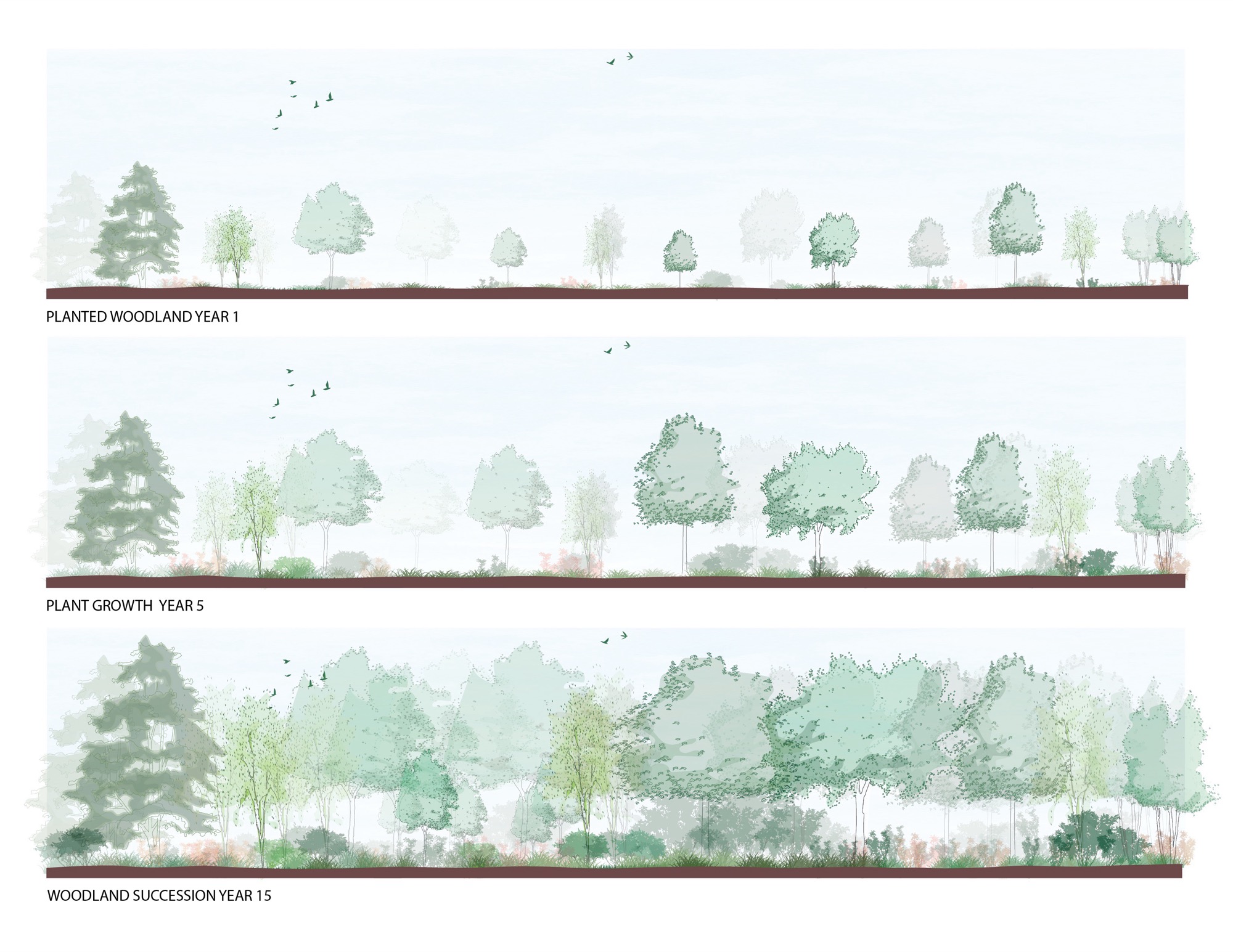
The meandering path adapts to the site’s topography, going through a newly forested environment before reaching the iconic Beaver Lake. New plantings and a naturalized watercourse echo the mountain’s varied landscapes, primarily a red oak and sugar maple forest community and the mountain’s wetland and glade ecosystems. The project involved the planting of hundreds of indigenous trees, shrubs and herbaceous strata.
A poetic evocation
The project also celebrates the Mount Royal Heritage Site’s distinct geography and its three distinct peaks. A triad of mounds forms an evocative, conceptual and interpretive landscape. Stone steps allow visitors to ascend each mound, where bronze arrows point to each individual summit in the distance. The mounds spatially enclose the new intersection, mark the new gateway and shape a threshold to the unique experience awaiting visitors ahead.
Landscape Architecture : Civiliti and Vlan paysages
Forest Engineering : Nadeau Foresterie Urbaine
Engineering : Artelia Canada
Wayfinding Designer : Julie Margot
Client : Ville de Montréal, Gouvernement du Québec (Entente de développement culturel)
https://maps.app.goo.gl/UGUbkHpnfxGpniL16
73542
LILA 2026 Sponsor