CLUSTER landscape & urbanism

![Context Werchter is a small municipality at the confluence of the rivers Demer and Dijle. The village is internationally known for the pop/rock festival Rock Werchter, which attracts hundreds of thousands of festival-goers every year. Rock Werchter celebrated its 40th anniversary in 2014 and its grounds were in dire need of renovation. Festival organizer Live […]](https://landezine-award.com/wp-content/uploads/2020/04/00-Werchter_foto-19-2500-600x400.jpg "Werchter Festival Park, Werchter, Belgium")
![For many years Munthof, located in the historical city center of Antwerp, was an abandoned public garden, urgently in need of renovation. The place was known for its graffiti artworks and its problems with drugs, junkies and vandalism. After a long participatory process with the neighborhood, the city of Antwerp organized a competition for a […]](https://landezine-award.com/wp-content/uploads/2020/04/00-Munthof_foto-2-2500-600x401.jpg "Munthof Park, Antwerp, Belgium")
CLUSTER landscape & urbanism is an office for landscape architecture and urban planning, based in Antwerpen. Its approach to design can be characterized as research driven and conceptual. The office has an inquisitive attitude and works on projects varying in size and scope, ranging from design research to detailed spatial concepts for landscapes or public spaces. Our objective is to formulate clear solutions for complex spatial issues.
CLUSTER landscape & urbanism was founded by landscape architect David Verhoestraete. The design team of 8 people is comprised of landscape architects, urban planners and designers.
Dry Docks Island


The Dry Docks Island is an unprogrammed void between the historic city center of Antwerp and the port. The city has the ambition to transform this old port infrastructure into a fully-fledged urban park. An important precondition for this, is the integration of the planned Sigma-dike which will run across the site, to be integrated into the new park.
The design consists of a large terraced dike that gradually slopes towards the Scheldt. Each terrace has a different elevation. Because each tidal regime has a different water level (low tide, high tide, spring tide, neap tide, storm tide), a differentiation is made to the ecological environmental conditions on a relatively limited area. The design optimizes both the ecological potential of each tidal regime and the potential for aquaculture and saline agriculture.
The drydocks park is designed as a coherent framework of low dikes that as a whole still have the constructive function of a robust flood dike, and at the same time function as a recreational tidal park. The fields in between can be freely arranged in function of the desired program.
The dry docks park forms a polder landscape in miniature, playing with the specific conditions of the river system, and at the same time functioning as an urban garden to stay and to relax. The inner side of the terraced dike is designed as a prolonged building with public services, forming a public façade towards the old drydocks.
(In collaboration with MOP urban design and Witteveen+Bos)
Hoge Kempen National Park


The Hoge Kempen National Park is a unique natural area, covering 5.700 ha of woodlands and heathlands on a poor sand- and gravel soil. It is a unique landscape that unveils the remains of the transformation of a rural area to an industrial society. Apart from its ecological conditions, several relicts can be found of the coal mining era, such as slag heaps, shaft towers and garden cities. Currently, there is an on-going process to recognize the Hoge Kempen National Park as a Unesco World Heritage.
A number of large quarries, from which high quality silica sand and gravel have been extracted, are located in the centre of the National Park. In the east-west direction the E314 highway segments the National Park. In the near future a light rail is planned parallel to the highway. This development will increase the fragmentation of the area.
This project consists of a research through design on the ecological and recreational defragmentation of the Hoge Kempen National Park, the spatial integration of the highway E314 and the planned light rail project ‘Spartacus’. Several strategies have been examined to optimize the spatial and ecological coherence in the National Park. An important precondition within this research, was to define a strategy in which the revenues of the mining activities could be used to realize the defragmentation.
Lillo Fortress


Lillo Fortress is a very small village in the port of Antwerp. It has just 34 inhabitants and is one of the last villages in the port of Antwerp. The village has a strong visual and functional relation with the river Scheldt. Visually, because of the relatively low dike embankment surrounding the village, and functionally because of the small tidal harbor and the pier. The characteristic pentagonal structure of the fortress is still recognizable in the plan.
In 2009 the city of Antwerp organized a competition for the design of a masterplan for Lillo Fortress in the context of the Sigmaplan. The Sigmaplan will protect Flanders from flooding. The embankment has a huge impact on Lillo and threatens the characteristic spatial qualities of the village. The specific qualities of Lillo, the beautiful views over the water, the visual relation with its twin fortress Liefkenshoek on the left bank of the Scheldt and the small tidal harbor, were threatened by the embankment plans.
The design of the new embankment, combines the harbor and the new dike into one integrated structure, an inner-dam harbor. It allows the reconstruction of the ancient fortification into its historical pentagonal shaped bastion. The moat is reopened and the old bastions at the side of the Scheldt are reconstructed according to the typology of the existing fortification. On the flanks of the fortification, trees are planted, reinforcing the pentagonal structure of the fort.
Mediaplein Antwerp


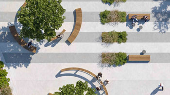
Mediaplein is a small square located at the back entrance of Antwerp central station. The square is enclosed by office towers, the railway viaduct and the recently built Media building. Today the square offers few residential qualities. The surrounding neighborhood is a densely built 19th century residential area with very little greenery. The design assignment consisted of creating a new square that could on the one hand facilitate events in function of the new Media building and on the other hand form a high-quality residential space for the neighborhood. The design consists of a slightly raised semi-paved tree-square with steps along the edges. The elevation is necessary to create sufficient space for the roots of the trees. The slight elevation of the ground level in combination with the low treetops creates a safe atmosphere. The new square is designed as an autonomous spatial stature. Due to the twisted location of the square in relation with the surrounding buildings, the bicycle flows are led to the underpass of the railway viaduct. In addition to a quality resting place for the neighborhood, the square also functions as a slightly raised tribune for events at the Media building.
Slachthuissite Antwerp


The Slachthuissite is an undeveloped site of 18 ha, located in Damwijk in the north of Antwerp. Due to the closure of the slaughterhouse district in 2006, the current destination of the site has become obsolete. Today the site is mostly unused, with the exception of a few meat processing companies at the outskirts. The Damwijk is a densely populated 19th century district which is located between an old harbor dock (Lobroekdok) and the railway. The city has the ambition to redevelop this district into a lively neighborhood with high-quality parks and squares that offer space for neighborhood-oriented activities.
The design of the new public spaces consists of a park (Kalverwei), a square (Lobroekplein) and various residential streets. The Kalverwei is designed as three successive parks in different sizes. The oval-shaped formes creates a distance towards the high buildings at the edge of the park and creates a pathway around the park that connects to the various side streets. Lobroekplein is designed as an elongated square with semi-paved areas and a tree grid. The existing street with parking on both sides will be deduplicated, inwhich crossing ability will be greatly improved. The new square forms a central link between the existing nineteenth century buildings and the new housing developments.
LILA 2026 Sponsor