Hungry Point Cliff Top Walk
www.taylorbrammer.com.au
2026 Public Projects / Australia / Built in 2025 /
![Located to the south of Sydney’s city district the suburb of Waterloo is a 21st century neighbourhood that once existed as a 19th century heartland of heavy industrial factories. Its recent revitalisation as a medium to high density residential area explores the modern notion of a living and working environment, thereby encouraging a sense of […]](https://landezine-award.com/wp-content/uploads/2025/05/00-bamboo-walk-600x387.jpg "Waterfall by Crown by Taylor Brammer Landscape Architects")
![Located in Sydney, Australia, Taylor Brammer Landscape Architects with Welsh + Major Architects created a new contemporary vision for the 140-year-old bushland cemetery. The site is located on the land of the Bidjigal people on Dharug country. The brief was to respect and embrace the existing natural and commemorative character of this traditional bushland cemetery […]](https://landezine-award.com/wp-content/uploads/2023/05/00_Castle-Hill-Cemetery_JamesHeron-600x354.jpg "Castle Hill Cemetery")
![Located on the east coast of Australia in the Illawarra region, 75 kilometres south of Sydney, the name Red Point is taken from the distinctive colour of the rock of the headland as it juts out into the Pacific Ocean. The project involved the integration and celebration of Country through the provision of a landscape […]](https://landezine-award.com/wp-content/uploads/2023/05/00-44415_Red-Point-James-Heron-600x464.jpg "Red Point, Port Kembla")
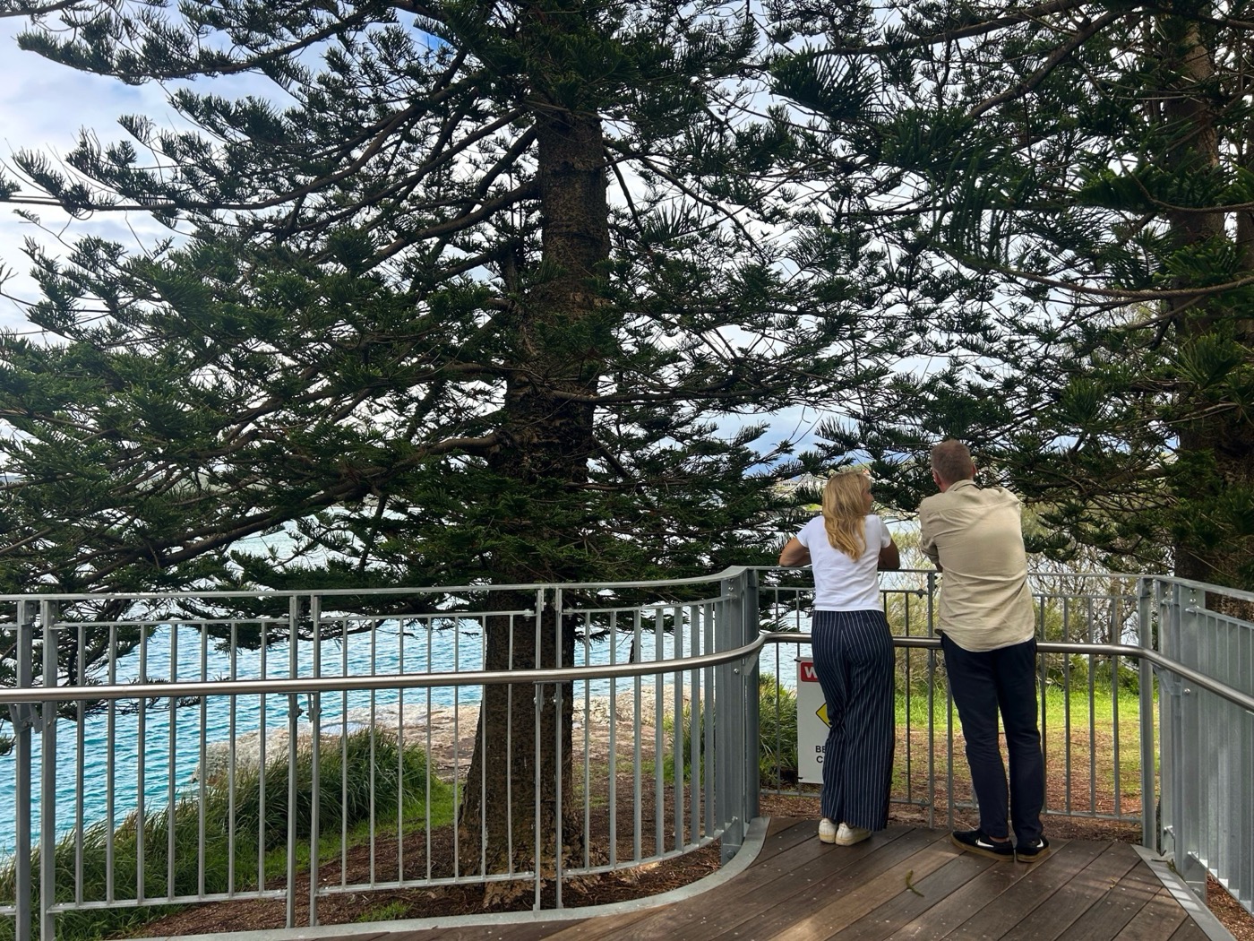
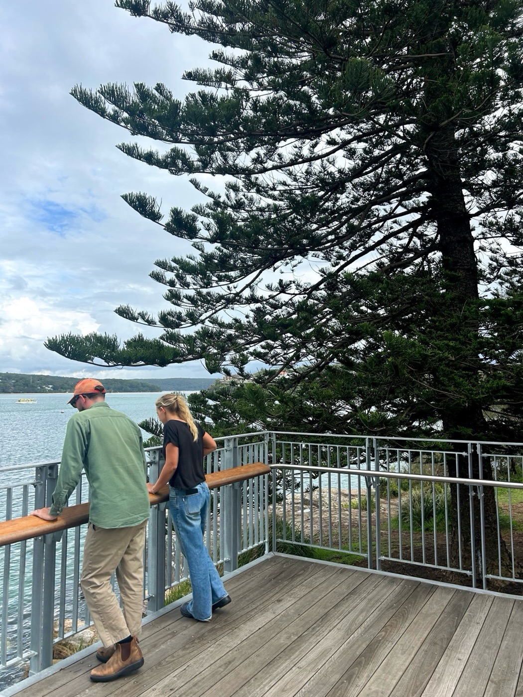
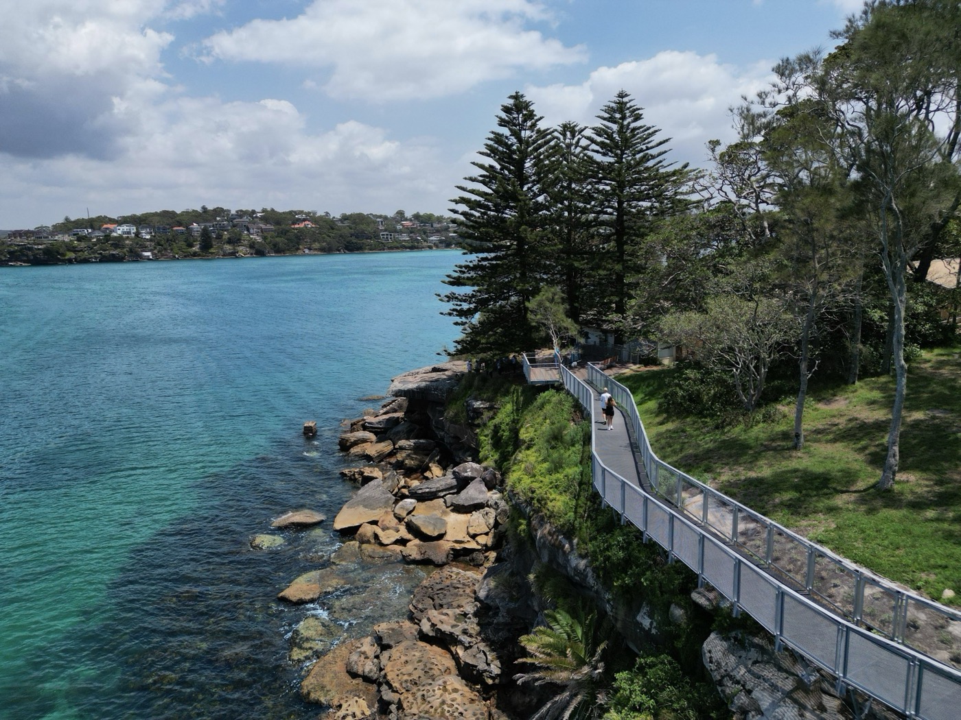
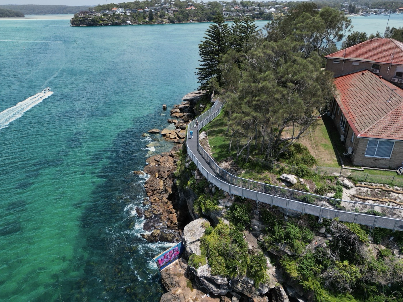
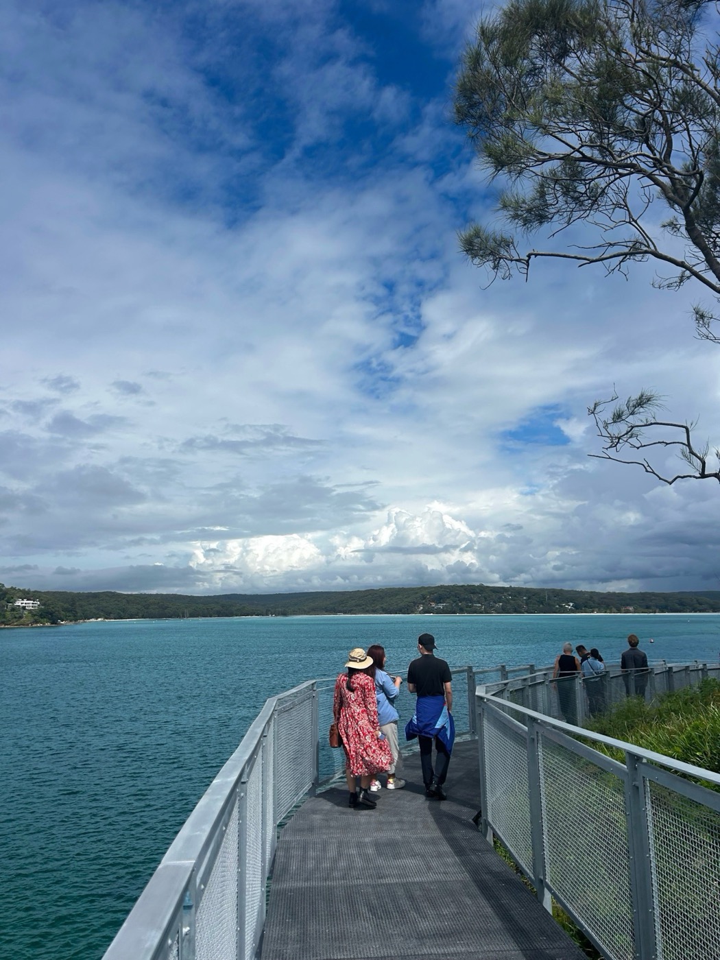
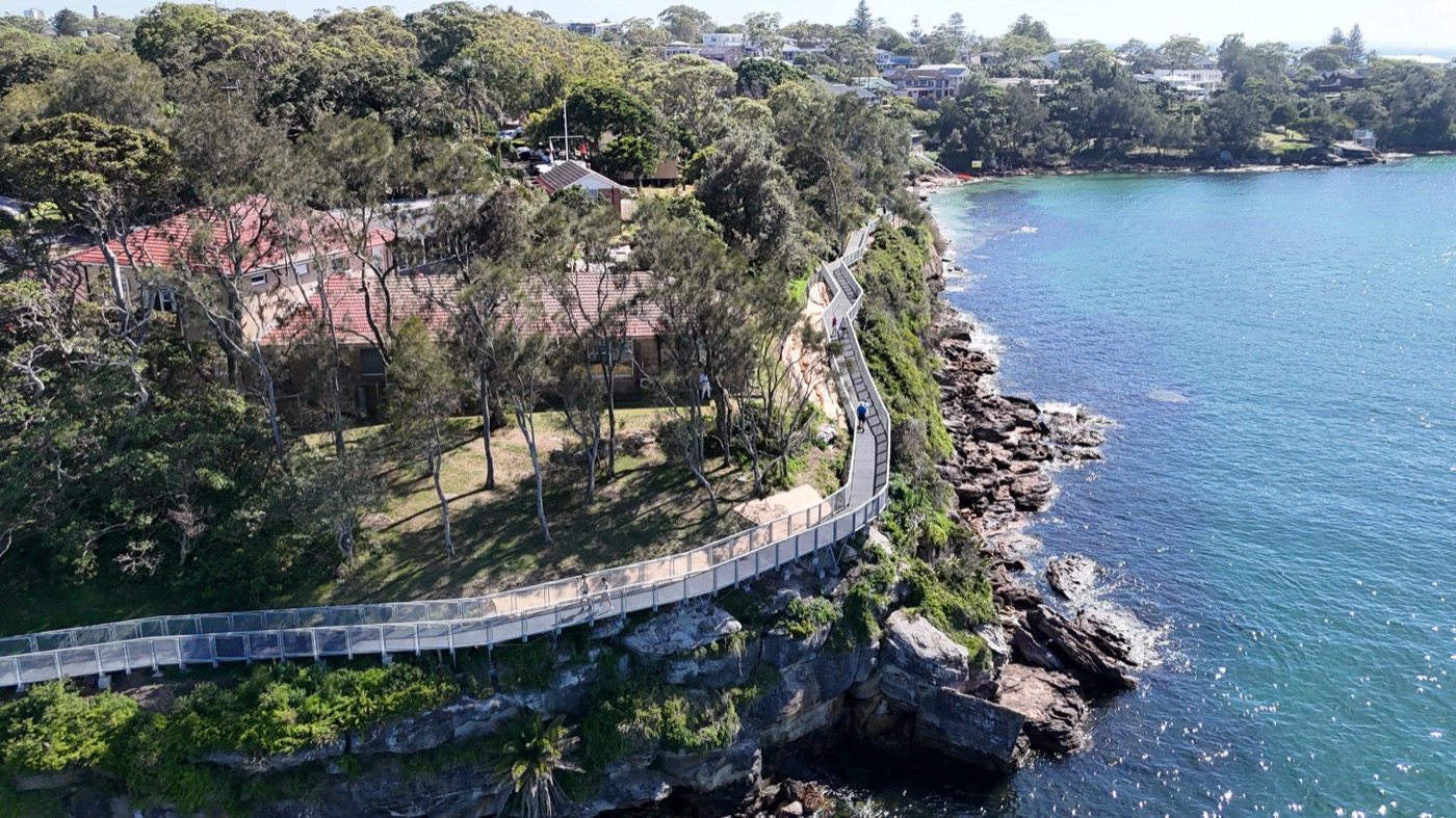
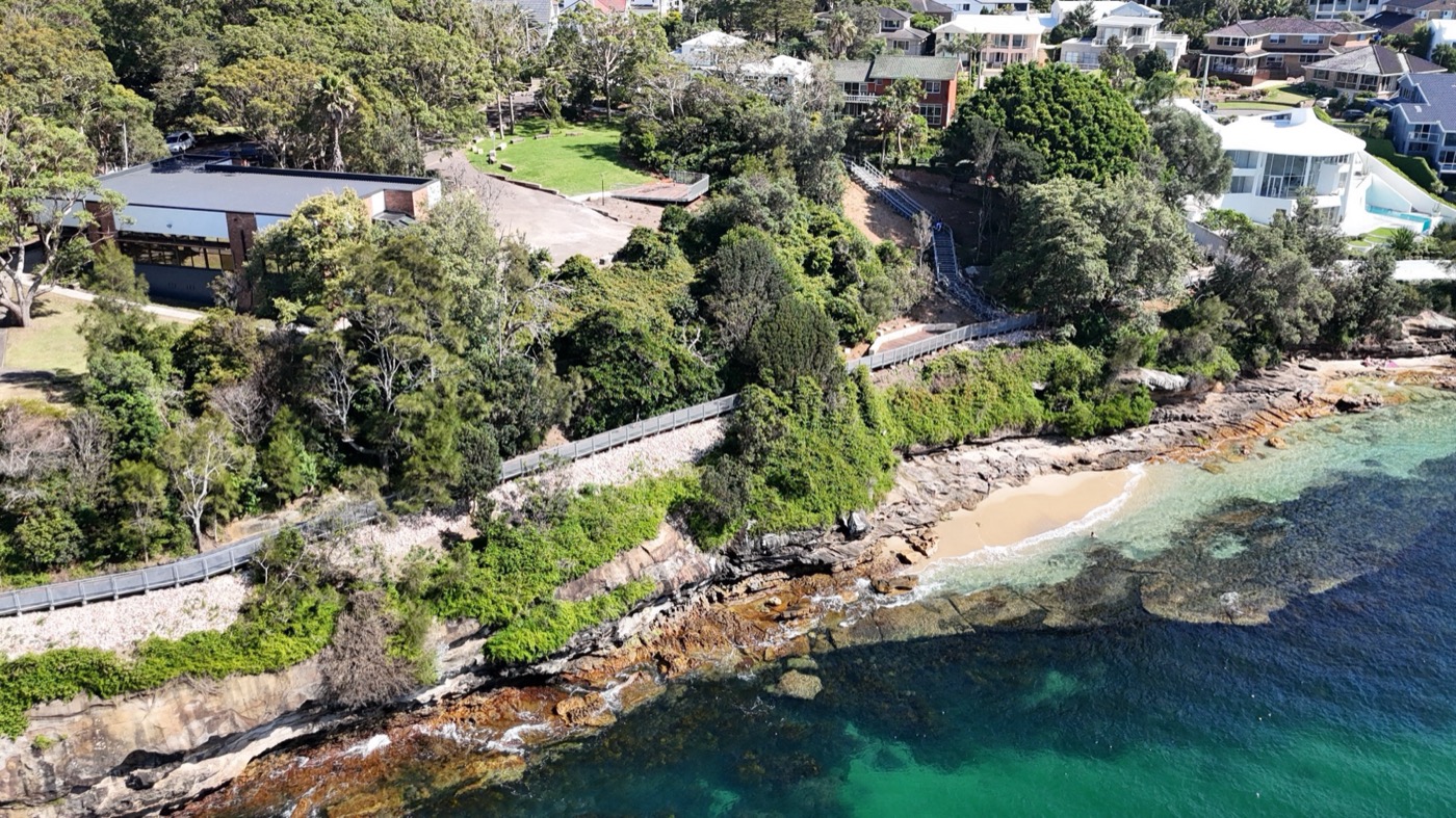
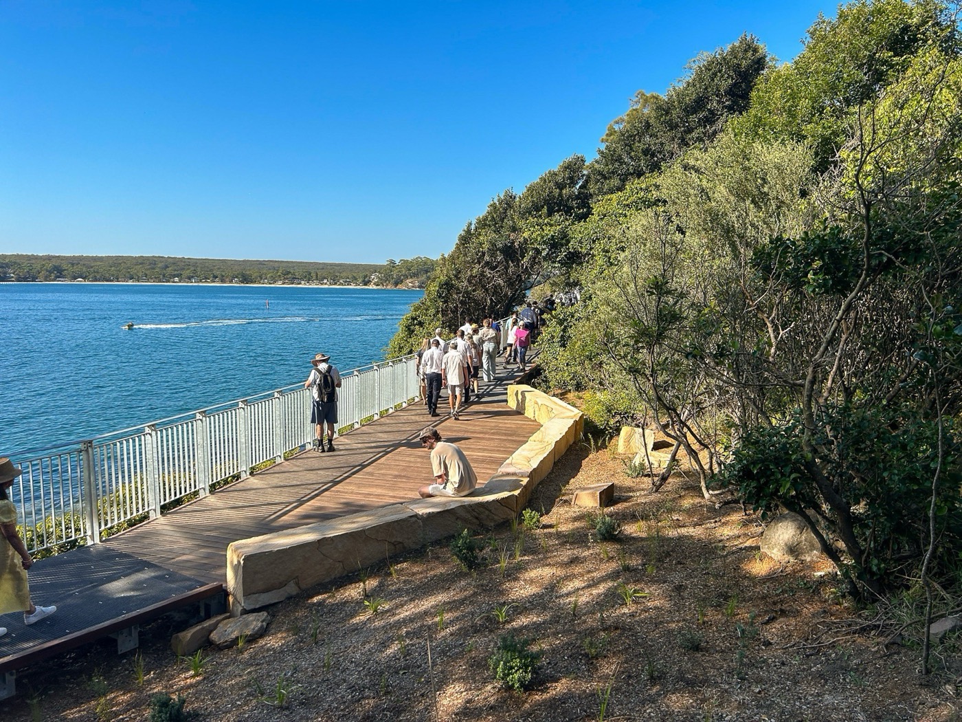
On Australia’s dramatic and world-renowned east coast, a new boardwalk unlocks public access to the iconic heritage listed Hungry Point Headland. Suspended above the ocean, the structure is conceived as a lightweight insertion around a single guiding principle – leave no scar on the landscape – carefully designed to engage the site while protecting its cultural and heritage values.
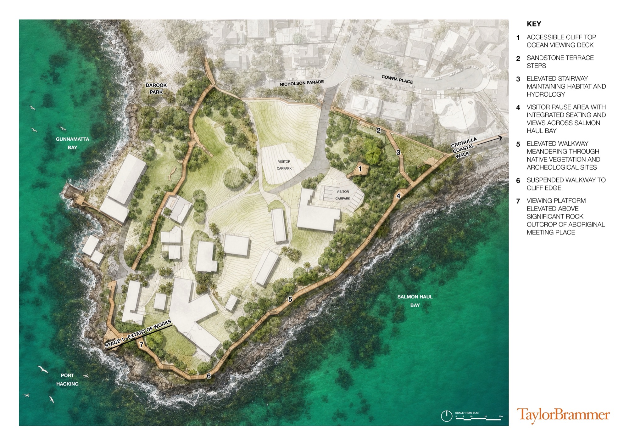
Led by designers; Taylor Brammer Landscape Architects, the project extends the iconic Cronulla Coastal Walk around a previously inaccessible landscape to Hungry Point. Situated on Dharawal Country approximately 30 km south of Sydney’s CBD, every design decision protects the headland’s cultural identity. The aim was to improve public access to a headland that had long been out of reach, open up views across Port Hacking, and increase public visitation, with future stages continuing the connection to Darook Park. The brief called for a structure that complemented rather than competed with the place it inhabits.


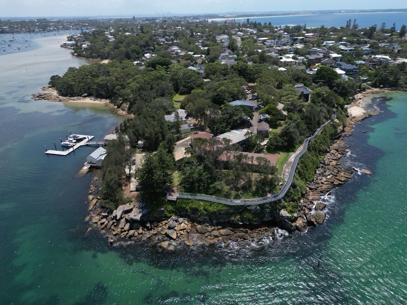

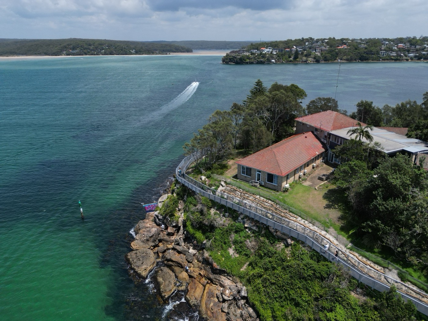

Recognised on the NSW State Heritage Register, the headland carries exceptional layered significance — extensive shell middens and evidence of long-term Aboriginal occupation along the Port Hacking foreshores, and the site of Australia’s first marine fisheries research establishment. Landmark scenic qualities, remnant native vegetation and a distinctive cultural landscape setting guided the conservation policy for Hungry Point, providing the foundation for a sensitive design response, developed in close collaboration with the client and design team.
Stage 1 of the Hungry Point Cliff Top Walk, completed in December 2025, establishes the first section of this broader connection and sets a framework for future stages.
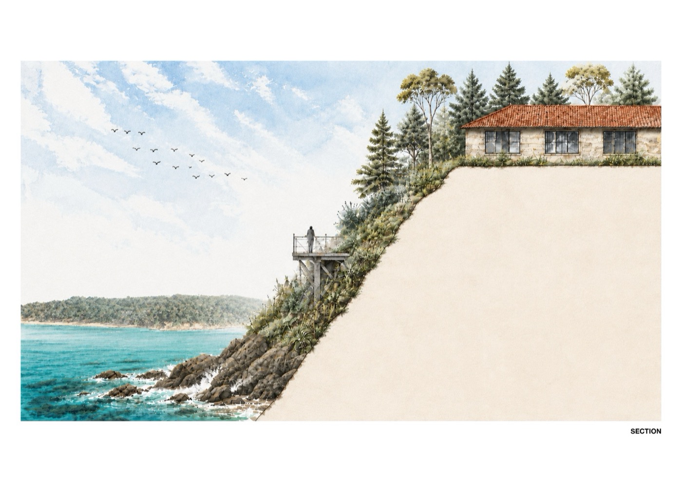
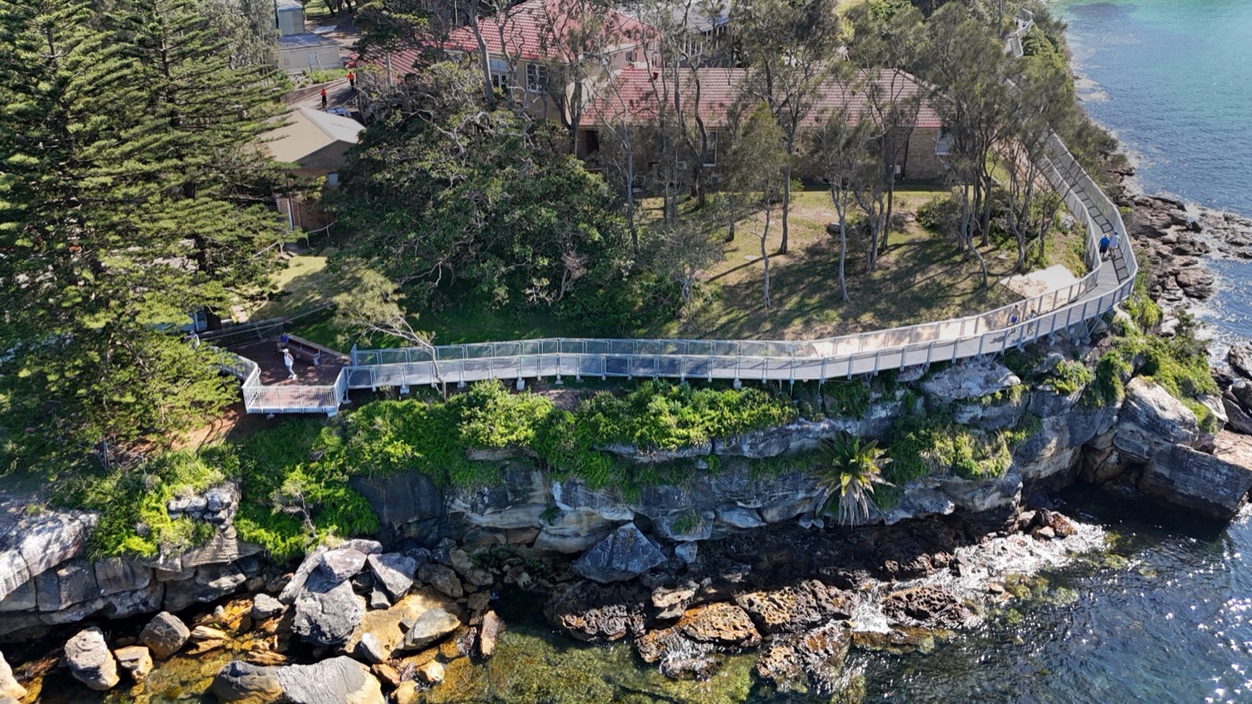
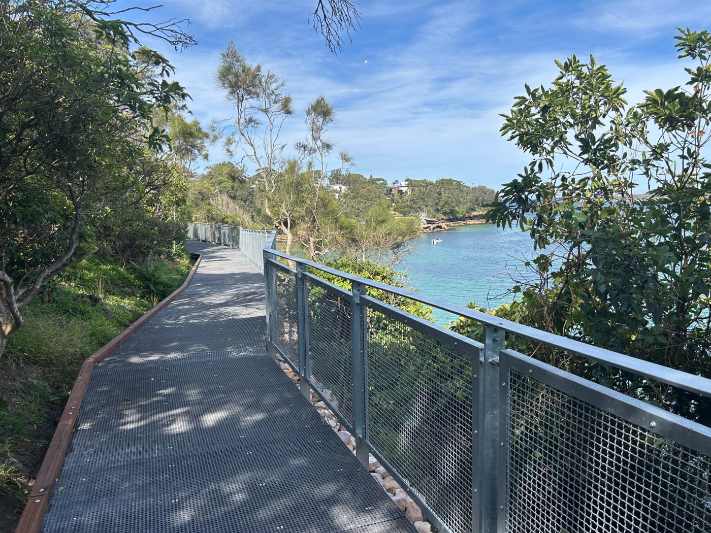
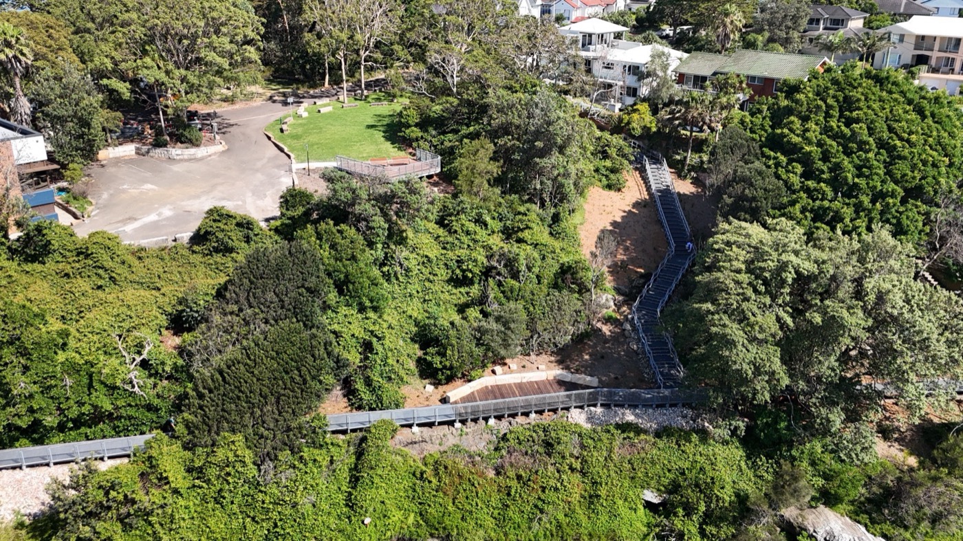
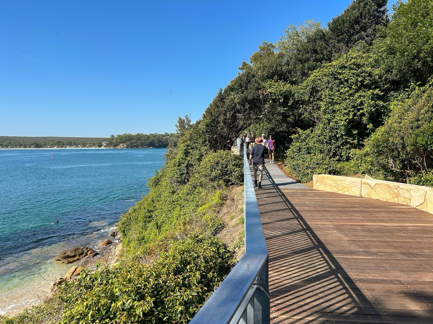
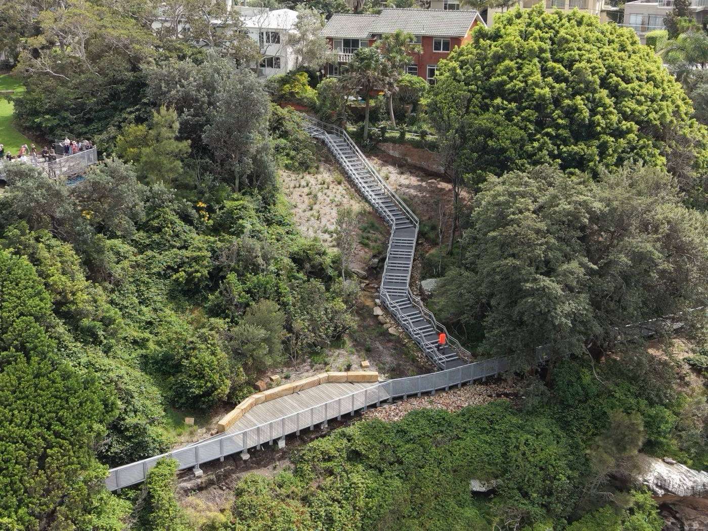
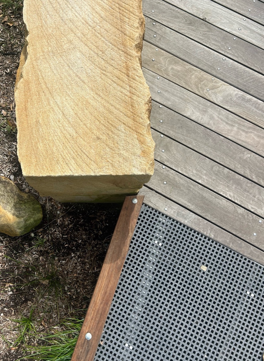
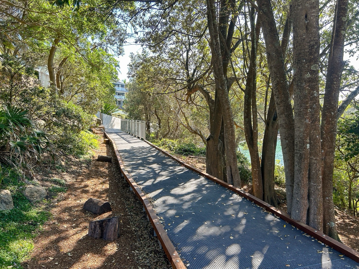
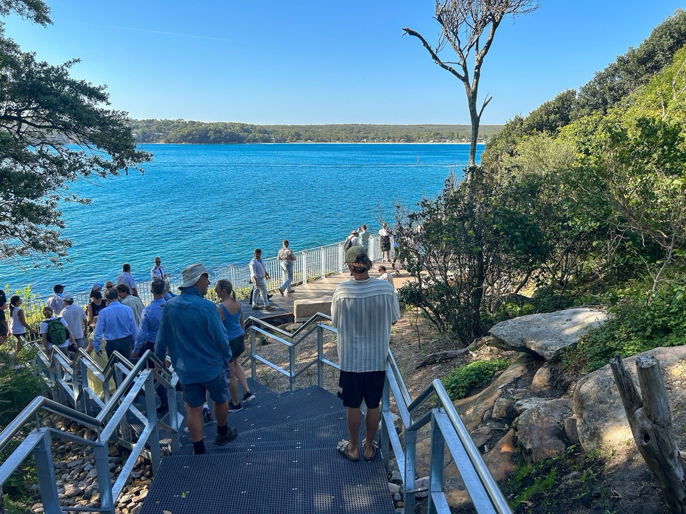
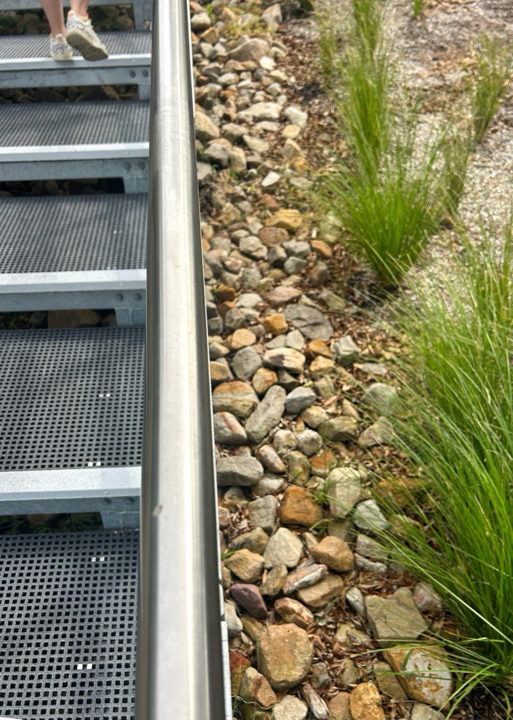
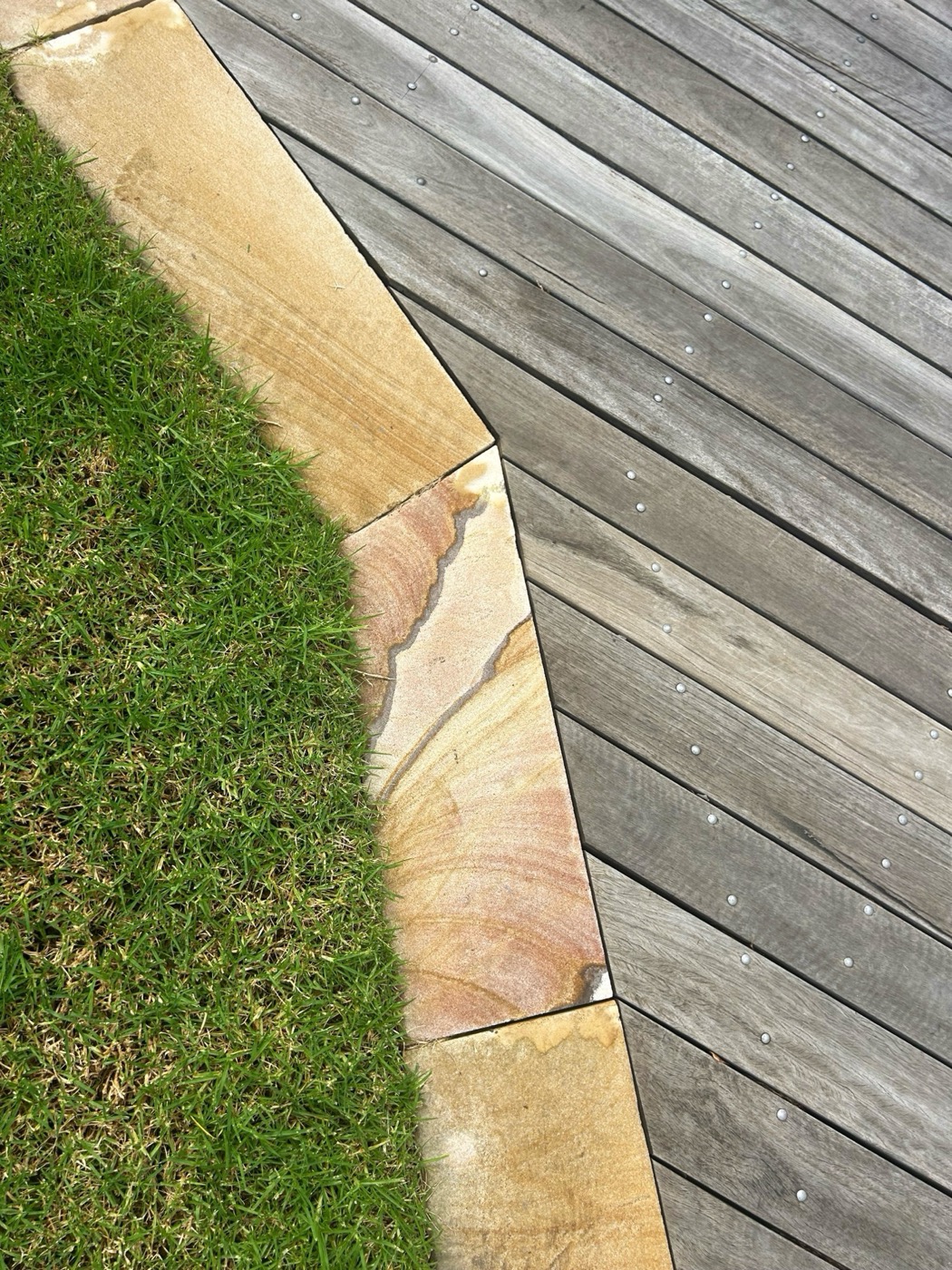
Leaving no scar meant every decision was interrogated against the landscape. The walkway is aligned along the periphery of the headland and elevated above the ground to minimise disturbance to heritage fabric, archaeological deposits and vegetation. Low impact structural elements are strategically positioned within rock shelves, ensuring known and potential midden locations are protected. Stair access points were located in response to natural topography, following the lines of water flow rather than imposing geometry onto the land. The boardwalk threads through the tree canopy, moving between sheltered enclosure and open panoramic views. Handrails are minimised, appearing only where required, keeping sightlines open and the experience uninterrupted. The patina of the structural steel was a deliberate design decision so that the landscape slowly absorbs the structure with each passing season.
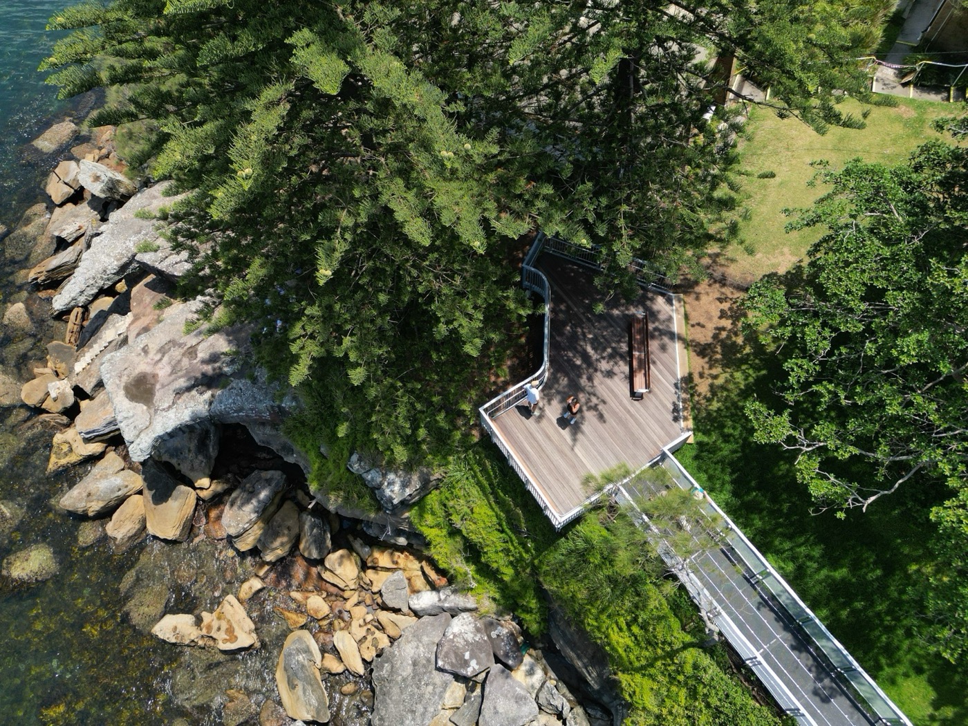
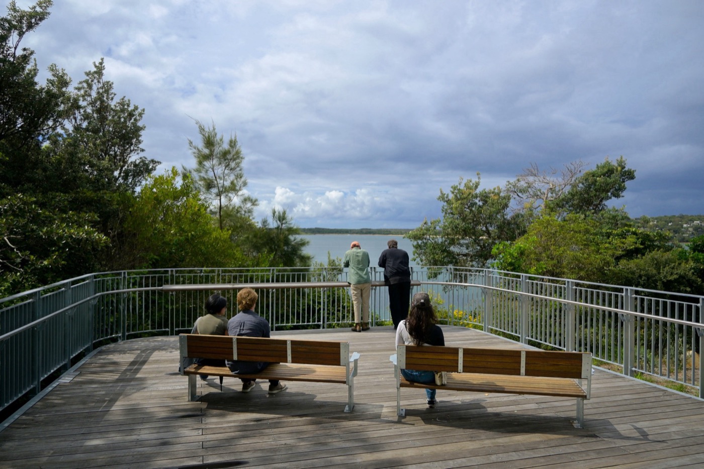
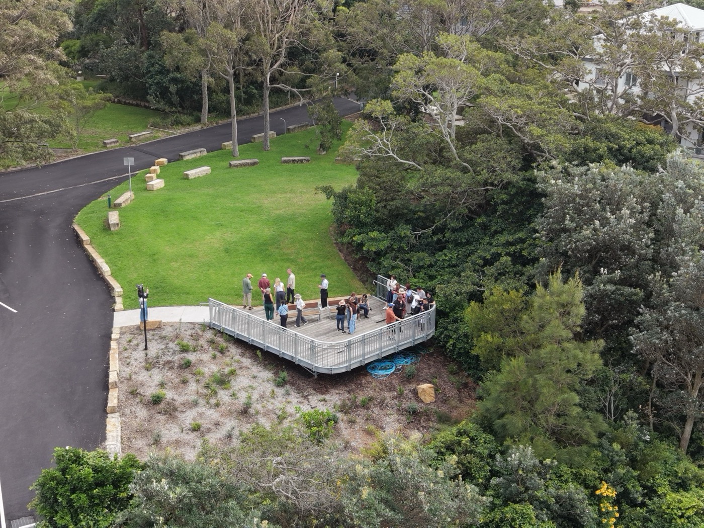
The modest scale and proportions complement the informal arrangement of the existing built form, remaining subordinate to the site’s historic character. The existing fisheries complex and other heritage buildings are retained without alteration. Open balustrades and lightweight materials preserve both key views and the historic relationship between buildings, landform and coastline, with subtle material changes at each viewing area where vertical balustrading replaces mesh to mark arrival at a place worth pausing.
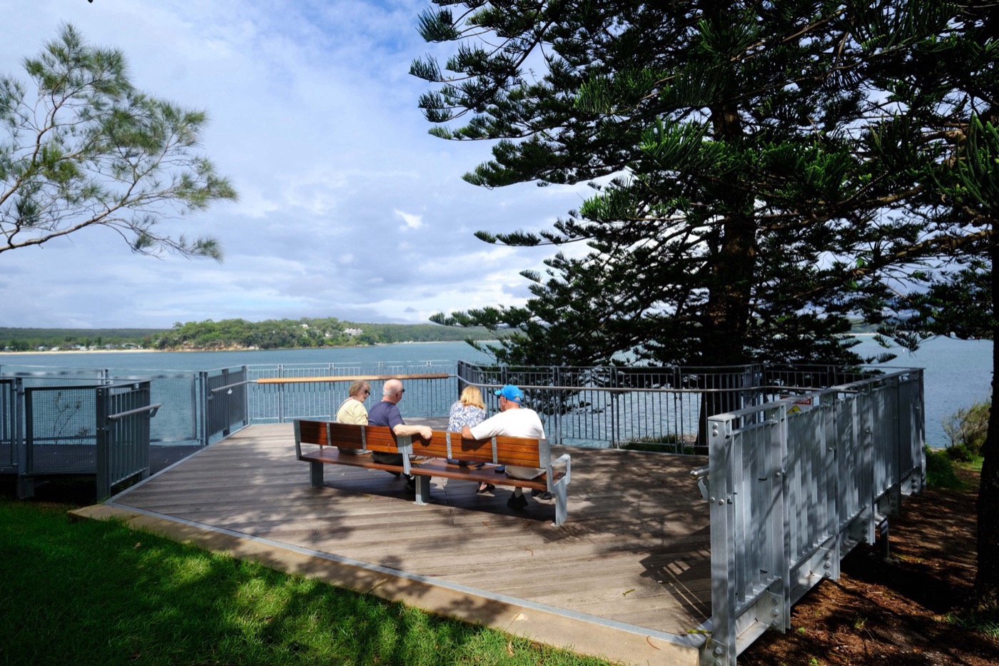
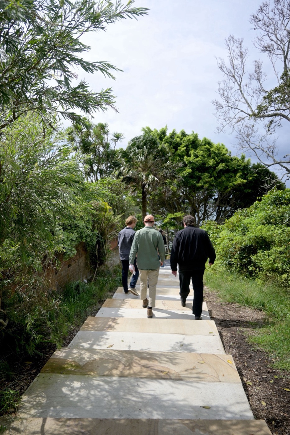
The experience begins at the elevated viewing platform, descending via a new sandstone stair to the connecting walkways. Sandstone seating at the base of the stairs offers a moment to pause and take in views of Salmon Haul Bay before beginning the walk along the headland’s edge. From there, the path moves between sheltered canopy and open sky, punctuated by viewing areas out across the water. At the southern tip, a dedicated viewing platform marks a site of Aboriginal gathering, where the broader Port Hacking cultural landscape comes into full view.
Since opening in December 2025, the walkway has been embraced by the local community and visitors alike. The heritage values, archaeological resources and landscape character of Hungry Point Reserve are maintained and improved. The walkway delivers safe public access to a previously inaccessible stretch of coastline, enhancing access while strengthening the values it was designed to protect.
The Hungry Point Reserve Cliff Top Walkway has quietly written a new chapter in the headland’s long history, floating above thousands of years of human presence – first the Dharawal people, and more recently European maritime heritage. These histories are woven into the walkway, and can now be walked, understood and shared.
Client: Sutherland Shire Council
Landscape Architecture & Heritage Impact Statement: Taylor Brammer Landscape Architects
Aboriginal & Historic Archaeological Assessment: AMBS Ecology and Heritage
Planning: Planning Ingenuity
Geotechnical Engineering: Douglas Partners
Structural Engineering: JJ Marino and Associates
Arborist: Moore Trees
Ecology: Ecological Australia
Stormwater & Traffic: Jones Nicholson
Contractor: Green Civil
Structural Supplier: Teleo Structural
-34.07242832953261, 151.14850486345335
76949
LILA 2026 Sponsor