Shortlisted for LILA 2024 Jury Award:
Loures Riverfront
topiaris.com
2024 Public Projects / Portugal / Built in 2023 /
![Barrocal is a 40ha area with elements of geological, archaeological and natural value. It is located on the outskirts of Castelo Branco, a city located in the interior of Portugal and a two-hour drive away from Lisbon. Its landscape character is determined by – and named after – the presence of huge granitic natural blocks […]](https://landezine-award.com/wp-content/uploads/2020/04/ProjBarrocal_2T4A9590_©PedroMartins-600x400.jpg "Barrocal Park")
The initial premise of Loures Riverfront was to complete the intermunicipal pedestrian and cycling continuity, connecting Lisbon to Vila Franca de Xira, and consolidate an important strategic plan that aims to implement a continuous route along the Tagus Riverfront in the Lisbon Metropolitan Area (LMA).
At the same time, it was intended to encourage the connection to the Loures urban areas, isolated by roads and railway infrastructures, and with no access to the river. As a result, this pedestrian and cycling route constitutes an important mobility infrastructure with a significant impact on the current daily commuter matrix, contributing to the reduction of CO2 emissions and positively affecting the lives of the surrounding communities. It should also be noted that the route complies with the regulations on pedestrian accessibility, thus constituting an inclusive route.
An analysis of the project area and its surroundings revealed a surprising landscape: a mosaic of natural ecosystems in the vicinity of a highly urbanized zone. Despite its proximity to Lisbon, the area was isolated and inaccessible. However, just minutes away from densely populated neighbourhoods, one can find mudflats, salt marshes, native reed beds, all supporting a diverse array of flora and fauna habitats. Recognizing its ecological significance, the area is protected under various national and international legislation, including Sites of Community Importance (SCI), Special Protection Areas (SPA), and National Ecological Reserves (REN).
The project sought to weave together the initial focus on mobility with the opportunity to create a unique walkway. This path would not only serve as a circulation and recreational route, but also as a platform for research, nature interpretation and public education, raising public awareness for the importance of estuarine ecosystems, biodiversity conservation, and ocean management.
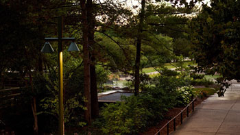
Instead of providing a quick journey from point A to B, the project was designed to encourage a slower experience of the environment. It invites visitors to observe the birds, rest while overlooking the river, and immerse themselves in the sounds of the marsh. The Loures Riverside trail stretches for 6.2 km along the right bank of Tagus River. Taking inspiration from the meandering drainage lines, the trail avoids straight lines in favour of a gentle, curving path, that allows observation of the habitats from different perspectives.
To preserve the marshes, the entire path consists of a raised wooden boardwalk on a stilt foundation, 3.50m wide, to accommodate both pedestrian and cycling traffic. Its variable elevation (between 1 and 5,50m above to ground level), allows for the free flow of water, protecting this structure from flooding while simultaneously offering diverse experiences. The mudflat areas, of extreme importance for the feeding and nesting of the birds, have been fully safeguarded.


Along the riverside trail, five OBSERVATION AND REST AREAS invite visitors to stop. These refuges, slightly suspended off the main path, offer a break from the journey. Equipped with benches and bird observation counters, and shaded by a wooden structure, that reduces the temperature during the summer months, these areas provide a comfortable place to stay. In between, twelve SHADING TUNNELS offer a protected stretch for both pedestrians and cyclists, allowing a moment to slow down and even pause for a few minutes.
Restored from the site’s industrial past, two concrete PIERS are now integrated with the boardwalk, offering access to the river, and became a spot for local fishermen.
At km two from south, a special feature diverts from the path: The Tagus Circle. It forms a perfect loop and was created to enable the observation of the salt marsh in its different stages, showcasing its high ecological value, and highlighting its resilience and vulnerability.
As we walk around its perimeter, we observe the sequence of distinct sub environments, each playing a vital role in the marsh’s ecosystem:
⎯ Mudflats: the unvegetated areas, exposed at low tide. Refuges for birds and fish, used for feeding, spawning, nesting, and maternity. They play a crucial role in reducing water velocity and consequently in sediment accumulation.
⎯ Lower Salt Marsh: the humid margins where the first patches of vegetation appear, pioneer herbaceous plants such as Spartina maritima, capable of withstanding long periods of submersion.
⎯ Mid Salt Marsh: the intermediate zone where sub-shrubs predominate, such as Salicornia ramosissima, Sarcocornia fruticosa or Atriplex portulacoides, among others.
⎯ Upper Salt Marsh: the dry margin, at a higher elevation, where salt and freshwater mix, and where Phragmites australis, Suaeda vera, Atriplex halimus appear.
The project’s construction followed rigorous management protocols. A comprehensive set of precautionary measures were foreseen, the main one being a strict delimitation of the construction corridor, minimizing the disruption of the surrounding habitat. Furthermore, the project encompassed landscape restoration actions, including the planting of trees, shrubs, and sub-shrubs, along with reintroducing salt marsh vegetation at the construction area.
Strategically placed signage acts as guides, revealing the particularities of the estuary ecosystem. Visitors can learn about the diverse flora and fauna, that includes fish, crustaceous, mammals and amphibious. Interactive exhibits can further enhance the learning experience, explaining the crucial role of salt marshes in mitigating the effects of climate change, and in reducing environmental toxicity by absorbing and fixing heavy metals, thereby diminishing the levels of human-caused pollution.
Location: Loures riverfront area, between Parque das Nações and Santa Iria
Design year: 2016-2019
Year Completed: 2023
Landscape architecture team
Catarina Viana
Teresa Barão
Luis Ribeiro
Ana Lemos
Elsa Calhau
Rita Salgado
André Godinho
Henrique Mateus
Nuno Lecoq (landscape ecology consultant)
Photography
João Guimarães
Structural Engineer – FTD / JETSJ
Pedro Delgado, Alexandre Pinto, Nuno Silva
Signage – DESENHARIA
Pedro Silva e Sousa
Environmental Impact
Bioinsight
Building Company: ABB Group; CARMO; GEOCONTROLE
54652
LILA 2026 Sponsor