Mula-Mutha River Rejuvenation
hcp.co.in/
2026 Public Projects / India / Built in 2024 /

The Mula-Mutha river system, located on the deccan plateau, has historically shaped the urban form, ecology and cultural life of Pune. Over time, rapid urbanization transformed these rivers into polluted, inaccessible channels, burdened by untreated sewage, solid waste, degraded floodplains and encroachment.
The Pune Municipal Corporation initiated a comprehensive river rejuvenation plan, envisioning a “Safe, Clean, and Integrated River Edge.” The project repositions the river as a resilient urban spine integrating ecological restoration, flood management and public realm interventions.

Restoring River Health
The rejuvenation strategy restores the river’s health by addressing severe pollution. Interceptor sewer lines along the river edges capture and divert untreated sewage to treatment facilities. Riverbanks are cleared and stabilized to discourage dumping, while obstructions such as redundant weirs and causeways are rationalized. Low-crest barrages are introduced to maintain perennial water levels without interrupting flow, transforming dry stretches into active ecological zones.


Shaping Resilience Through Terrain
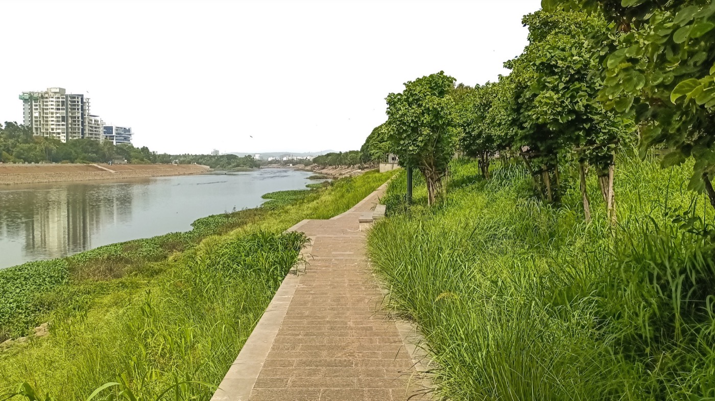
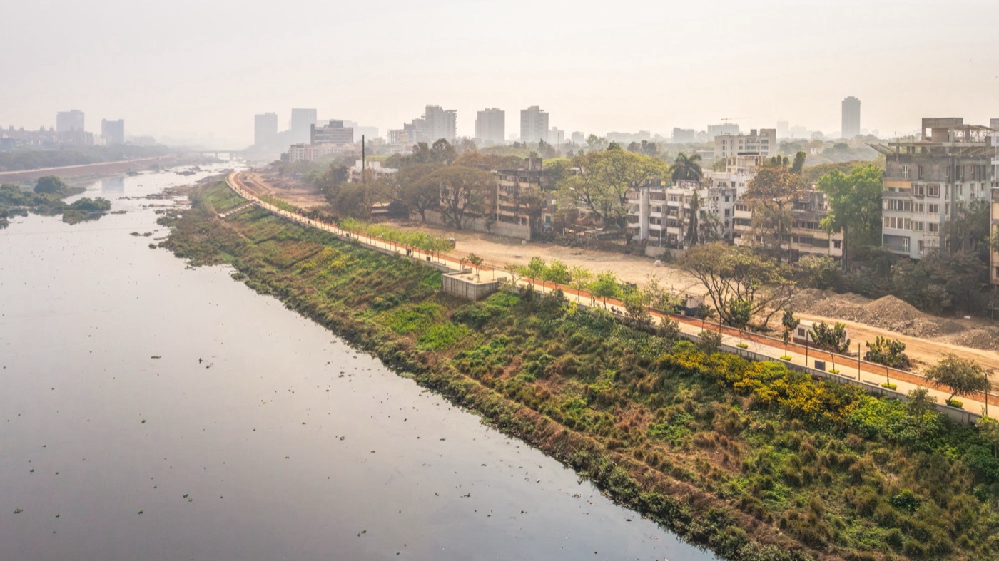
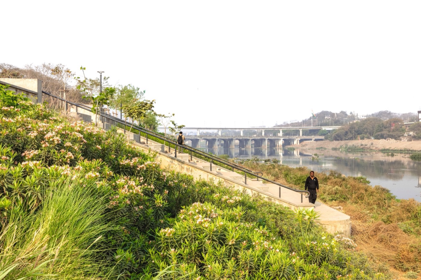
Flood resilience forms a key design driver. A 100-year hydraulic study informs a calibrated embankment system that protects low-lying areas while maintaining the river’s natural dynamics. Rather than rigid barriers, the 44-kilometer embankments on both sides are conceived as multifunctional landscapes. About 85% of the river edge is designed as green, sloped sections using compacted earth, stone pitching and vegetation. This stabilizes banks, dissipates hydraulic energy and enables groundwater recharge.
Layered Riparian Landscapes
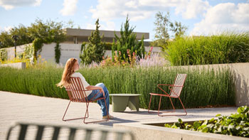
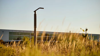
Ecological restoration is achieved through a layered planting strategy that reimagines the river edge as a living riparian system through the introduction of porous, green embankments. Planting is structured across four zones: aquatic edge, slope stabilization, promenade interface, and urban forests. Native aquatic species such as Typha and Canna help filter pollutants, improve water quality, retain moisture and support biodiversity. Vetiver grass is extensively used for slope stabilization due to its deep root structure, which prevents soil erosion and strengthens embankment integrity during floods. Promenade edges are lined with indigenous avenue plantations, creating shaded, thermally comfortable corridors. In residual spaces, dense urban forests based on vertical stratification replicate natural ecosystems, enhancing biodiversity and reducing urban heat. The planting palette prioritizes indigenous, flood-and-drought-tolerant species, ensuring long-term ecological performance.
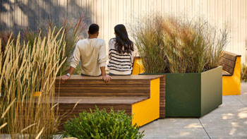
A modular landscape design approach ensures efficient implementation, flexibility and contextual responsiveness along the extensive river corridor. A series of landscape modules based on recurring design elements such as decks, staircases, ghats, seating edges, trails and viewing platforms, allow phased execution while maintaining a coherent riverfront identity. The modular strategy also responds sensitively to surrounding urban conditions. For example, fragrant landscape modules introduced near barrages and sewage treatment plants improve the sensory quality of the environment and enhance public experience.
This integrated landscape approach delivers significant environmental benefits. Permeable embankments support groundwater recharge, while the continuous green corridor restores habitats and improves microclimatic comfort. The system responds dynamically to seasonal variations by absorbing floods, retaining moisture and moderating temperatures.
Ecologically Responsive Design
At ecologically sensitive zones such as the confluence of the Ramnadi, a tributary of the Mula River, the project adopts a context sensitive intervention – “room for the river” approach that allows for seasonal expansion, supported by flood-resilient planting and minimal intervention.
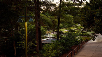
Reconnecting the City to the River
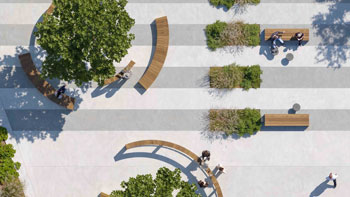
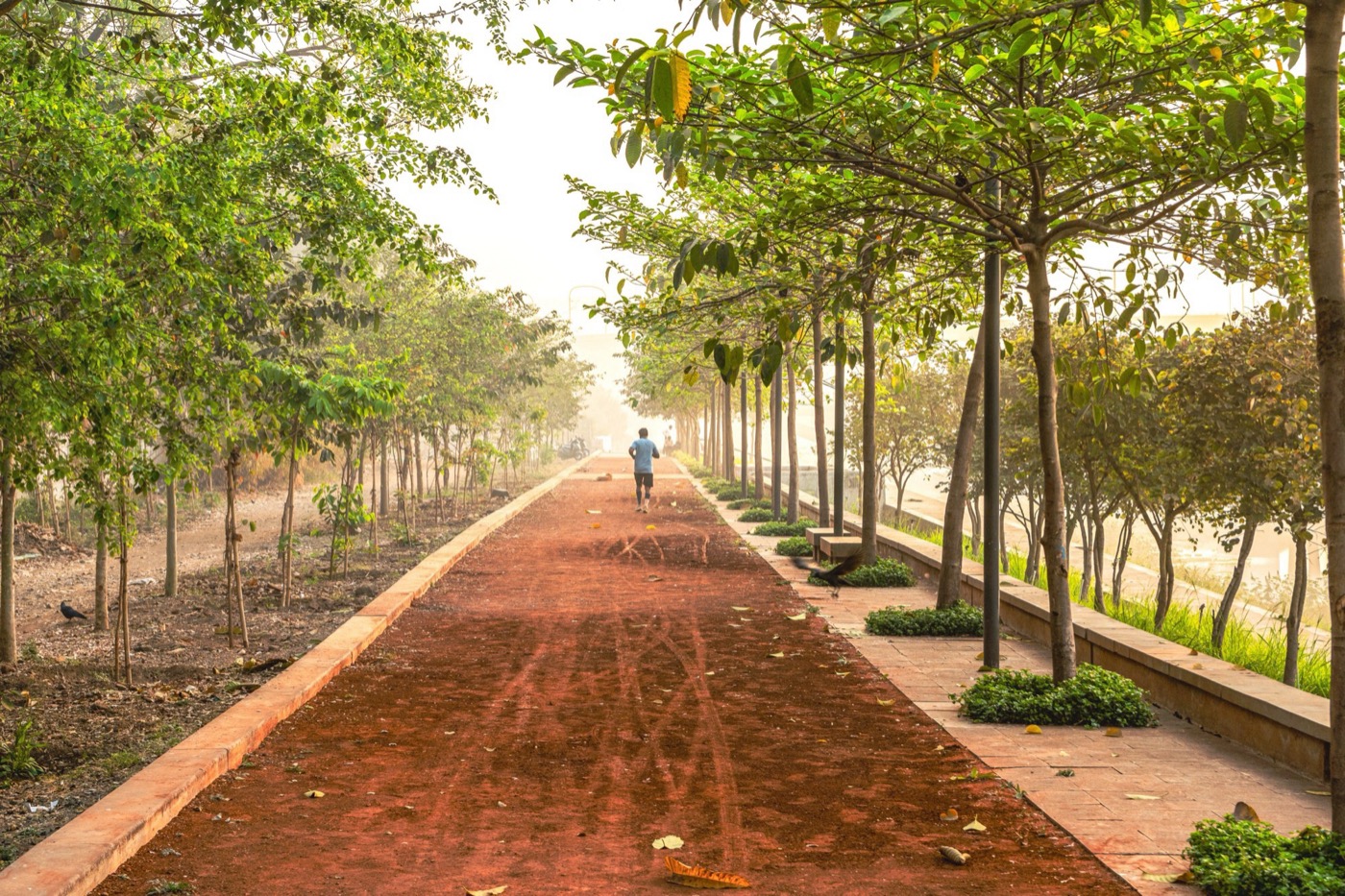
The project re-establishes the river as an integral part of urban life through a continuous network of promenades, cycling tracks, ghats, decks, and trails that create seamless public access along the riverfront. Multi-level embankments adapt to fluctuating water levels, ensuring safe access while preserving flood-carrying capacity.
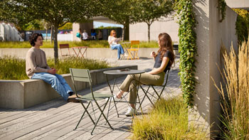
Public spaces are graded into active, tranquil and restricted zones, accommodating diverse uses – from recreation and fitness to cultural and religious activities. Programs such as boating, vendor zones and immersion facilities activate the river edge, reinforcing its social relevance and transforming neglected river edges into vibrant public spaces. Early implementation stretches already demonstrate improved safety, increased footfall and renewed public engagement with the river.
By integrating hydrology, ecology and public life, the project transforms the river corridor into a resilient, biodiverse and inclusive urban landscape at the heart of the city.
18.543627549038693, 73.88081897570949
73989
LILA 2026 Sponsor