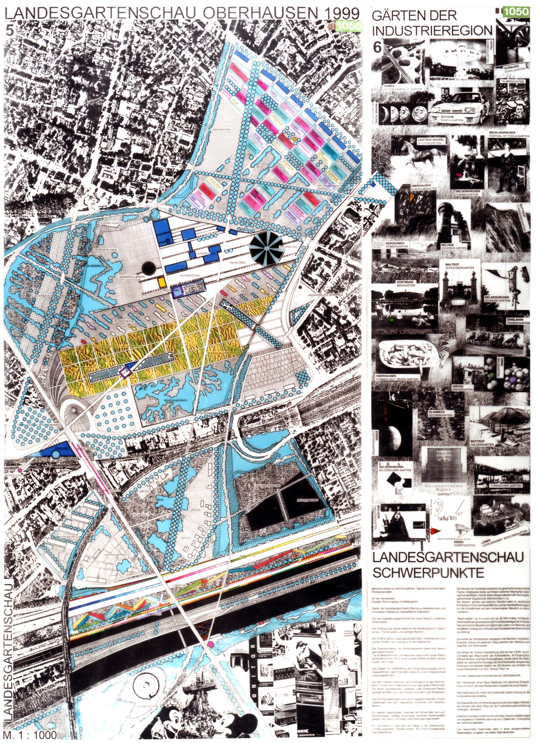
Oberhausen Regional Garden Exhibition 1999
www.die-planergruppe.de/
2026 Revisited Landscapes / Germany / Built in 1998 /

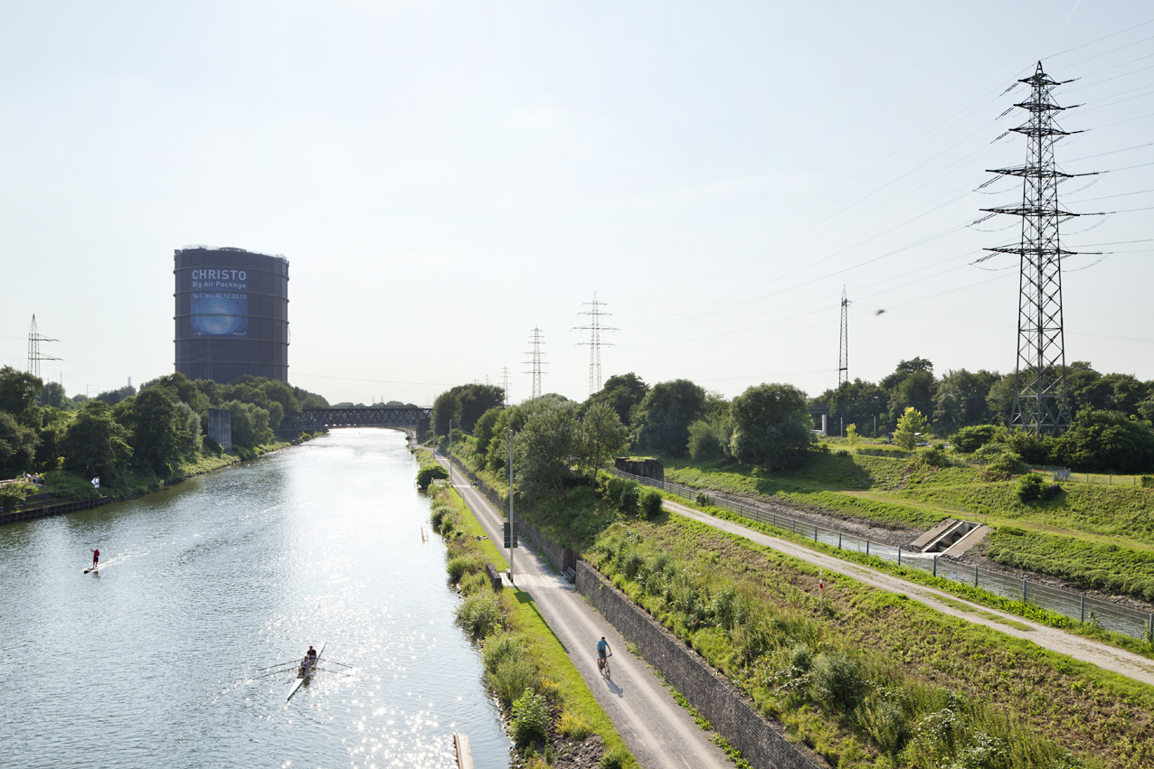
Railway embankments, wastelands, bridges, building blocks, contaminated soils and blackberry thickets, allotment gardens, wild gardens, canals and herbaceous vegetation, the Gasometer, rail tracks, gardens, multi storey housing and grassy slopes.
What reads like a poem about urban leftover spaces forms the opening of the competition text submitted by the Planergruppe Oberhausen for the 1999 Oberhausen Regional Garden Exhibition. Their entry received 4th prize in 1993, and subsequently the group was commissioned to realise the southern part of the garden show – the unfenced area outside the main exhibition grounds in Osterfeld.
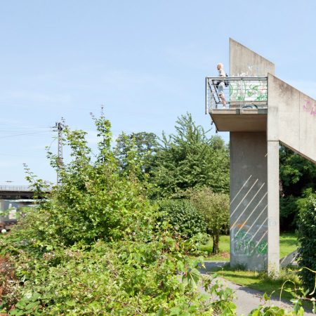
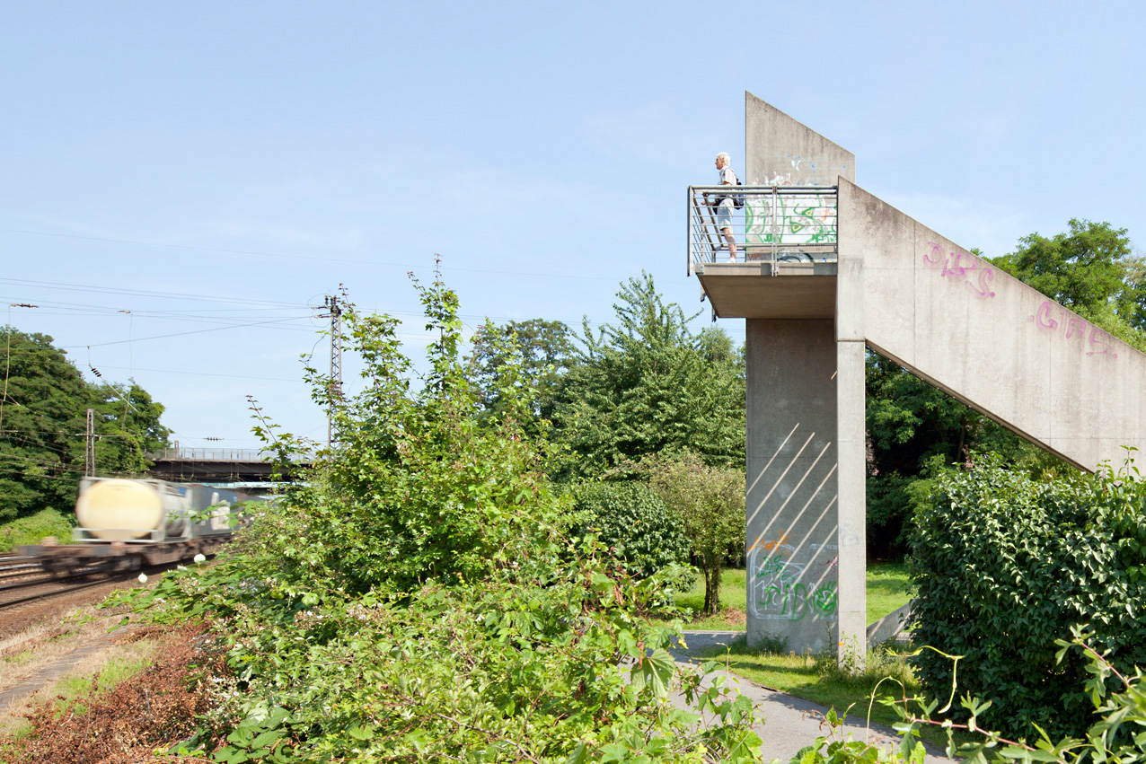
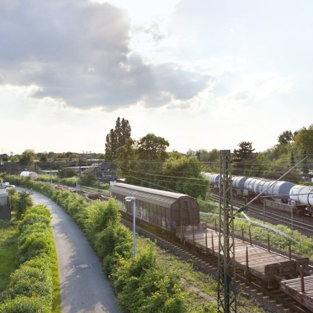
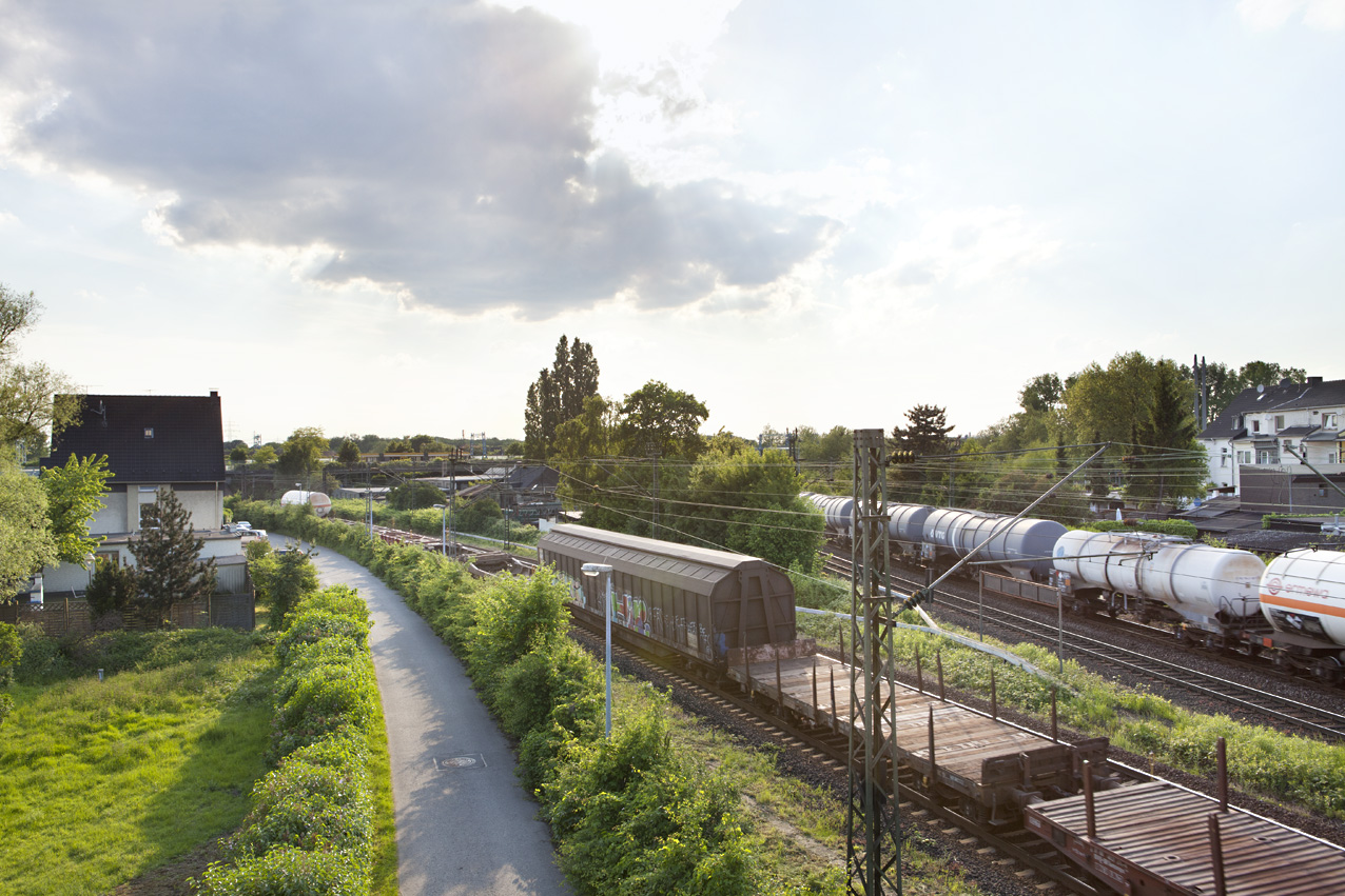
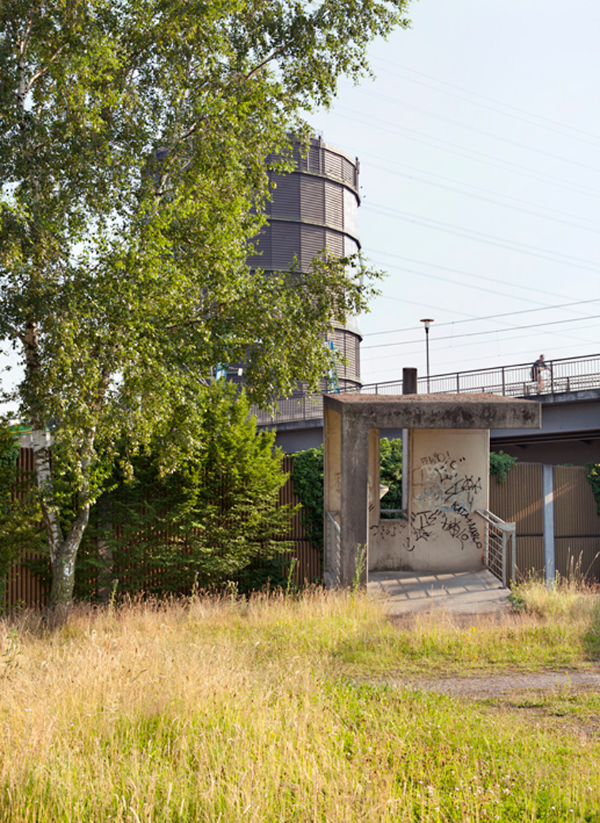
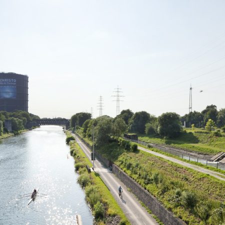
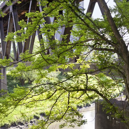
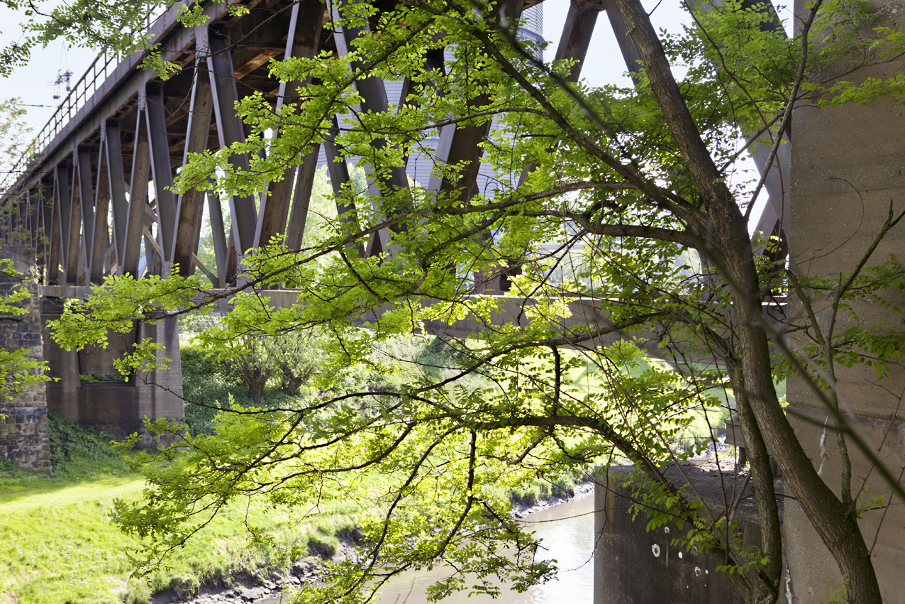
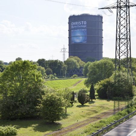
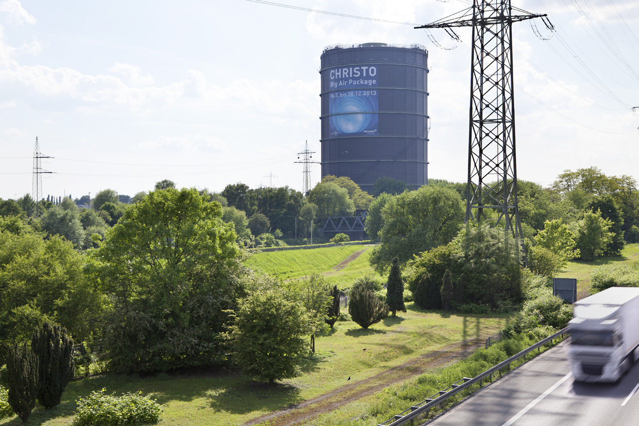
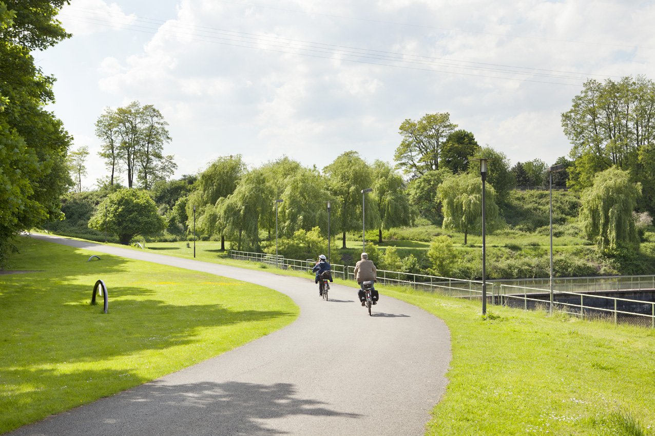
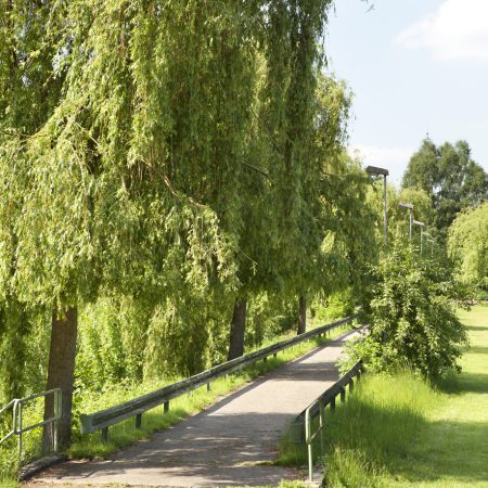
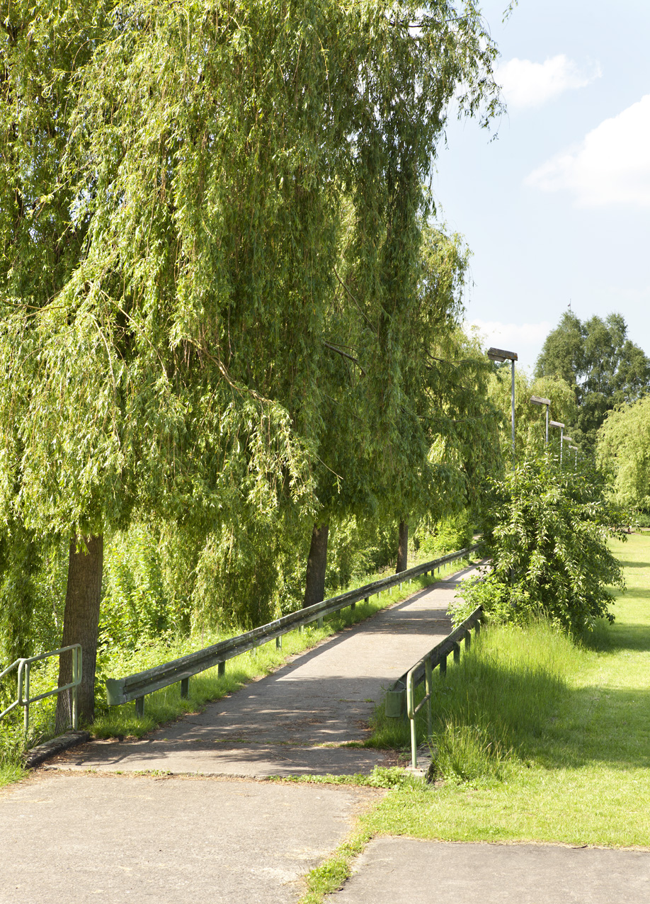
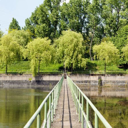
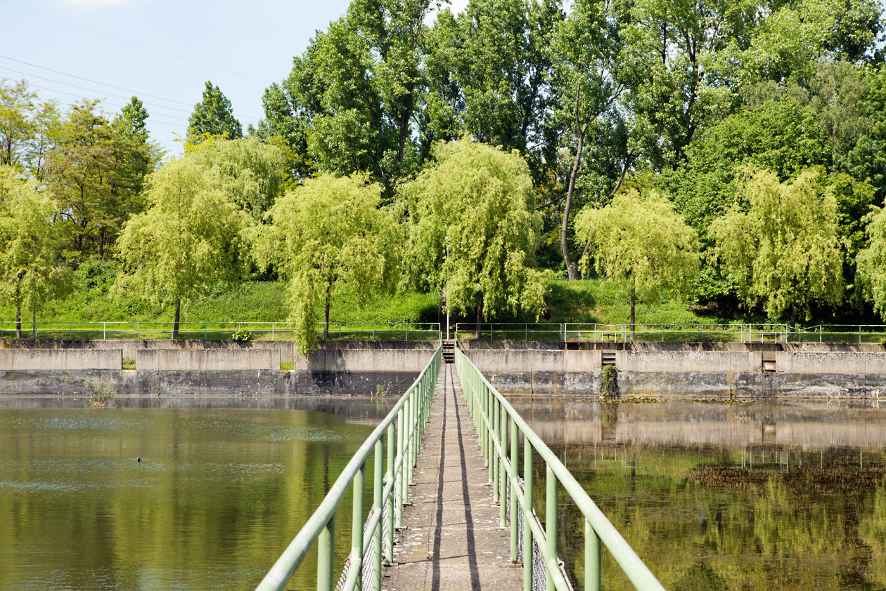
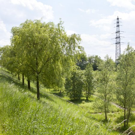
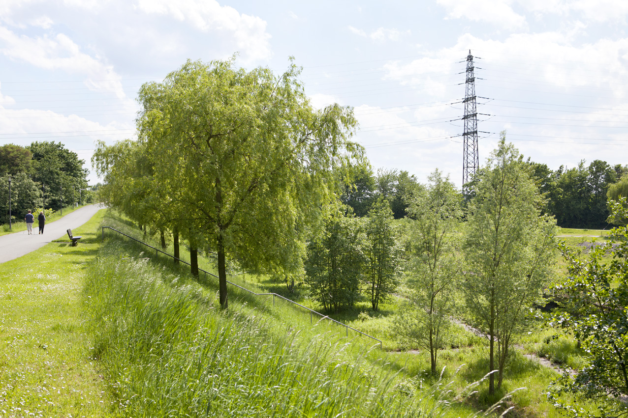
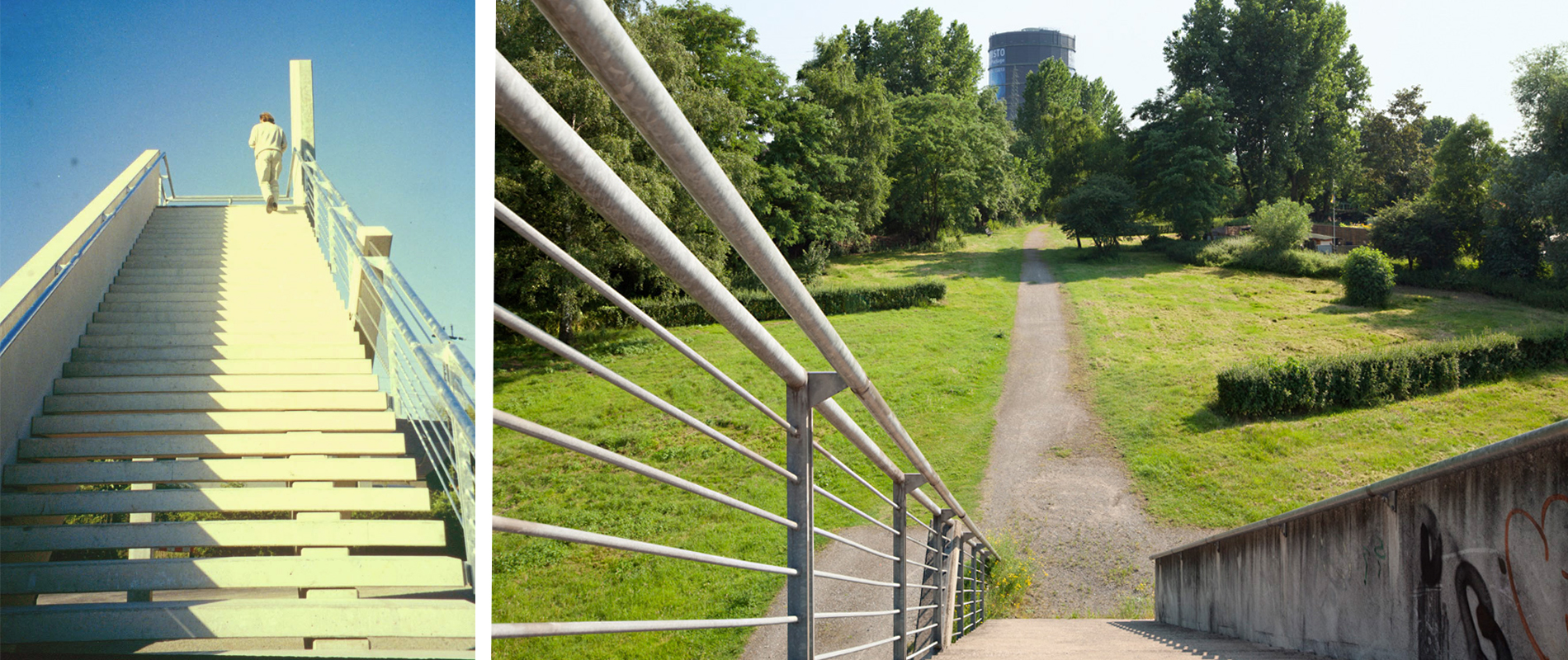
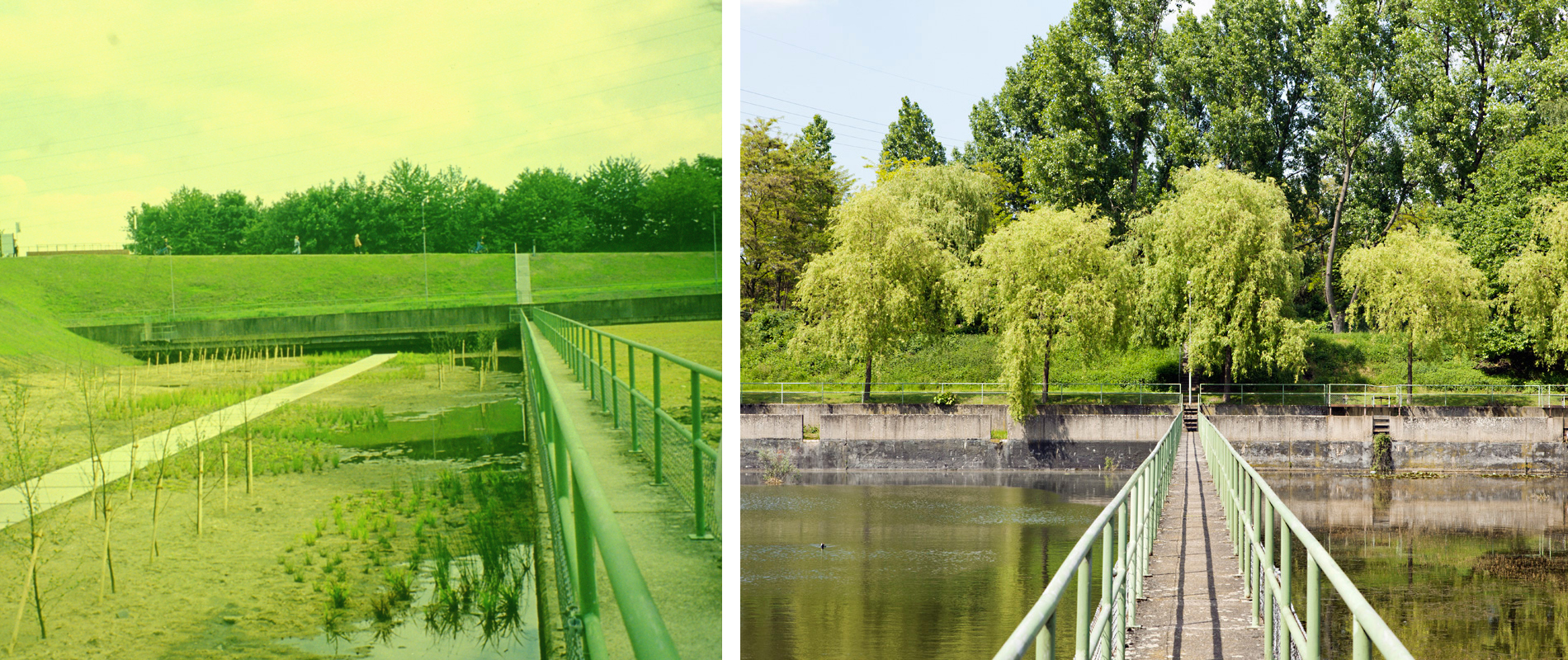
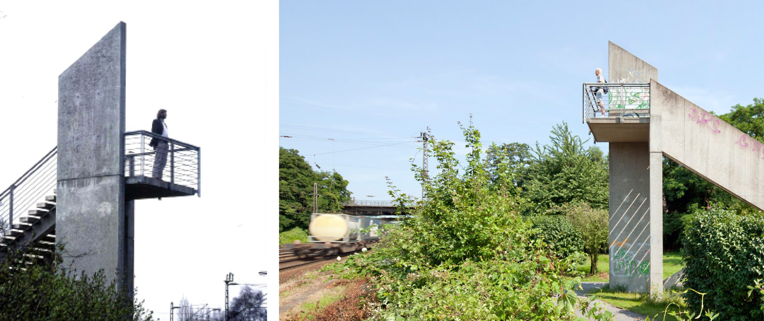
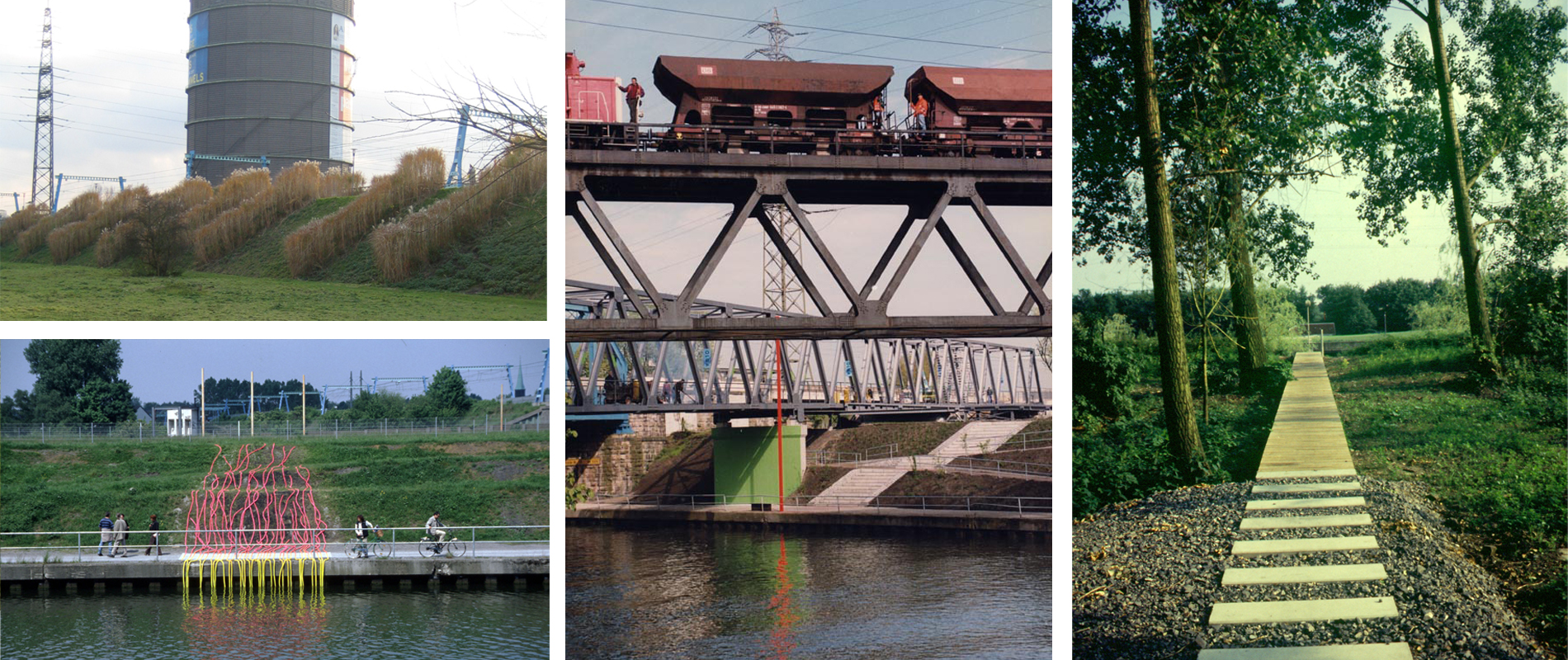
The southern section of the Regional Garden Exhibition consisted of six very different spatial units. Major infrastructure corridors – motorway, the Emscher River, the Rhine Herne Canal, high voltage power lines and gas pipelines – cut through the site from east to west, leaving behind a landscape full of restrictions, with the Oberhausen Gasometer at its centre. As part of the garden show, two new bridges were built to connect these fragmented spaces, making the landscapes between the infrastructures accessible.
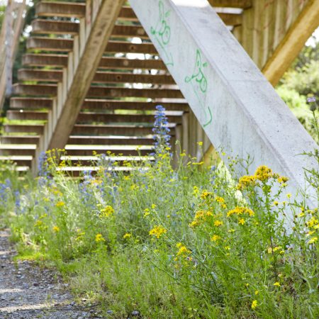
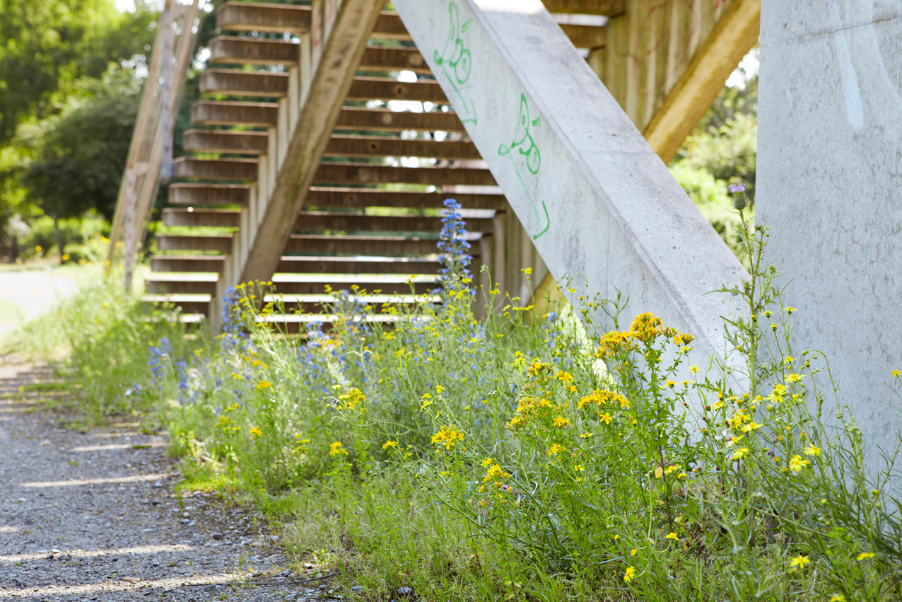
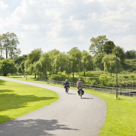
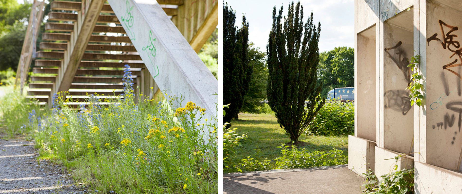
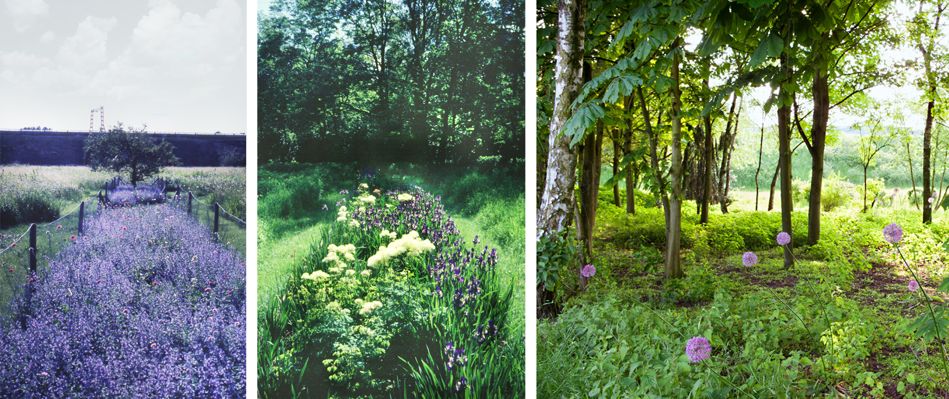
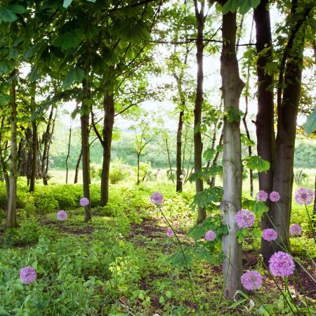
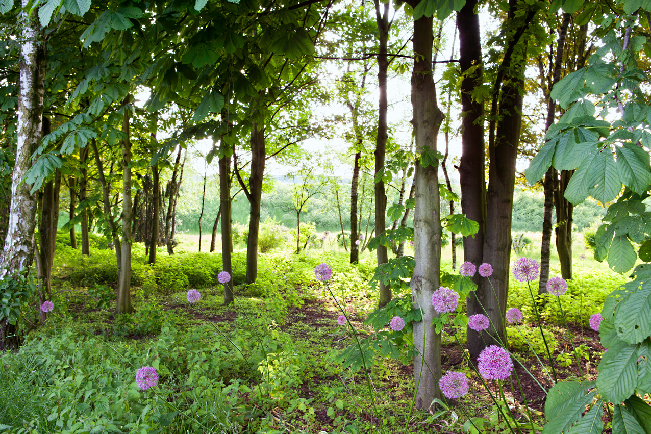
The design by the Planergruppe drew on formal principles of garden art – axes, extended avenues, geometric topographies, diagonals. These were woven into the urban fabric, and path connections were developed from the existing spatial order. The spontaneous urban nature, shaped by ruderal vegetation, was composed in striking contrast with formal grid structures; this system was filled with collage like landscape images derived from the site’s history. The Planergruppe worked with deliberately artificial interventions in the existing qualities, reinterpreting the places and transforming former residual spaces into usable open space for the people of Oberhausen. Around the settling basins of the Osterfeld colliery, weeping willows were planted – turning the functional industrial site into a romantically atmospheric landscape reminiscent of a classical landscape park.
-
- –
-
- –
-
- –
-
- –
-
- –
-
- –
-
- –
-
- –
-
- –
-
- –
-
- –
-
- –
-
- –
-
- –
-
- –
-
- –
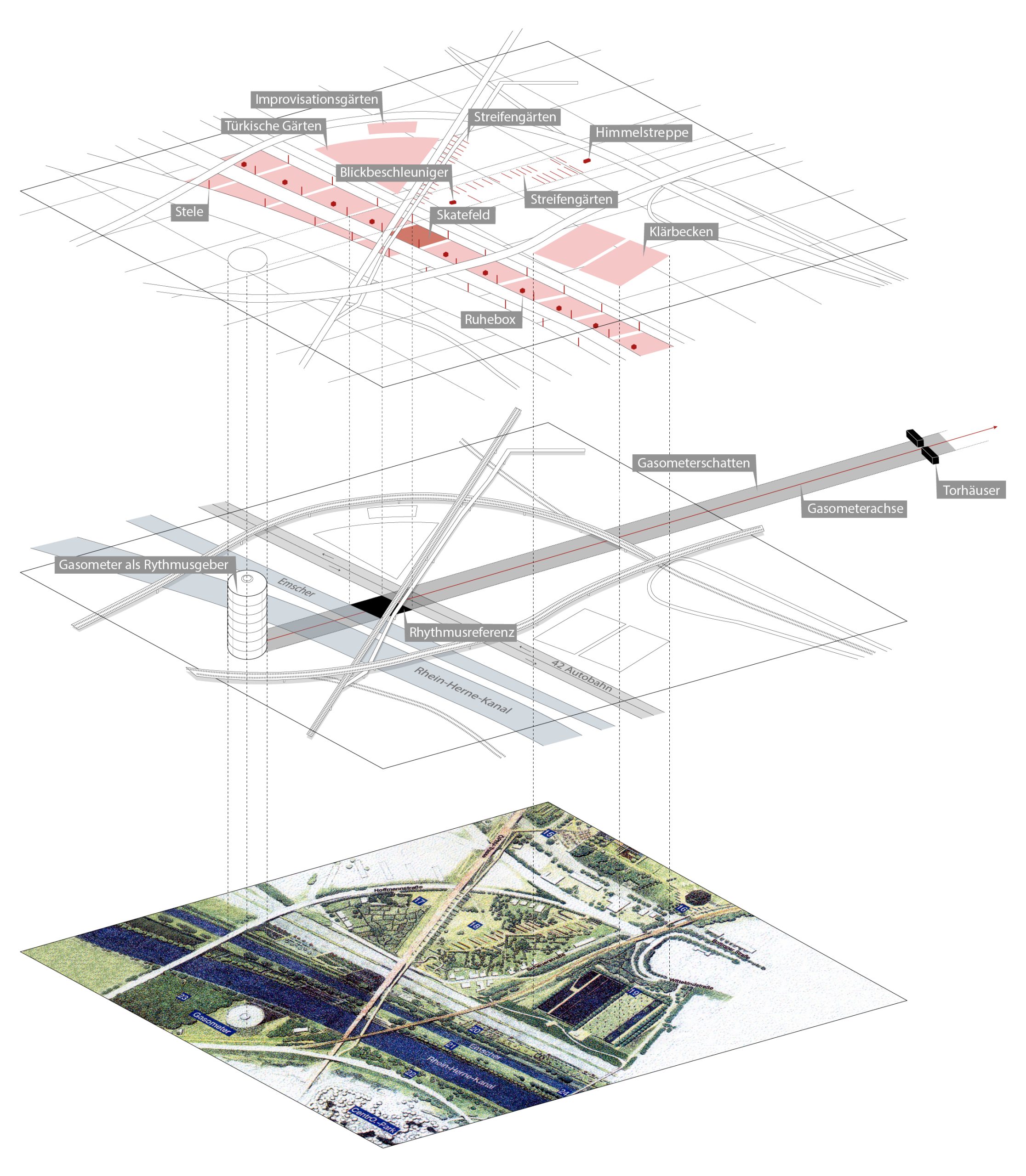
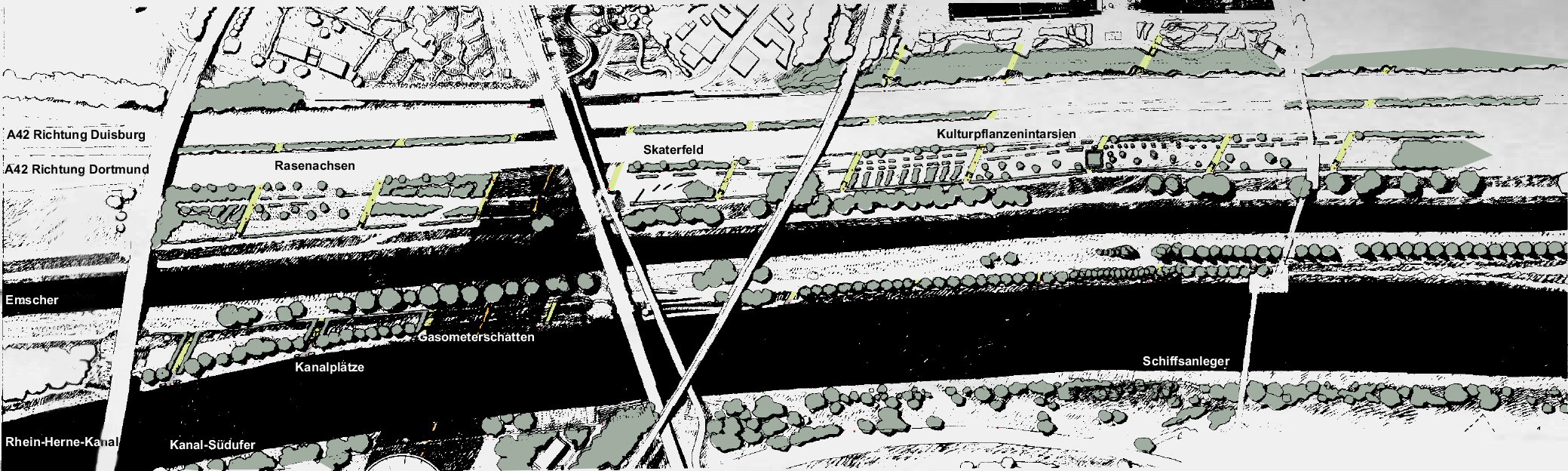
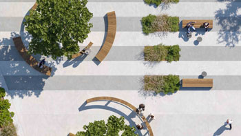
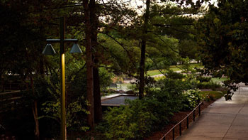
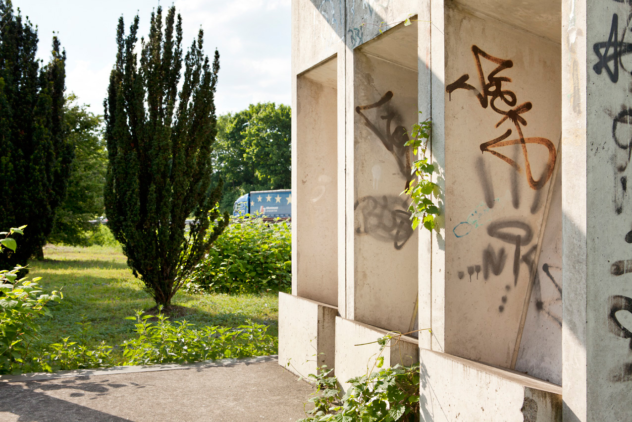
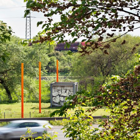
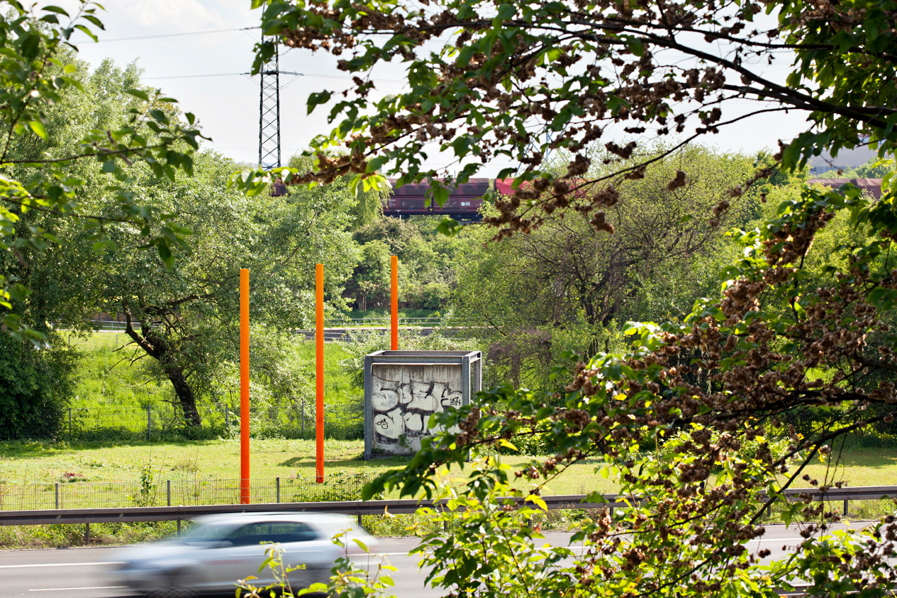
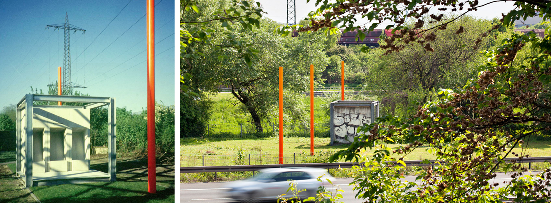
The core idea of the garden show was the “Linear Park of Speeds,” which elevated the infrastructural elements along a one kilometre stretch to components of the garden show, valuing them beyond their functional purpose. A grid divided the east west bands into manageable fields. The guiding element was the connecting axis from the centre of the Gasometer to the gatehouses of the Osterfeld colliery, which formed the entrance to the main exhibition grounds. The Gasometer served as a unit of measurement, casting a shadow one hundred metres wide; projected onto the garden show site, it defined ten axes running from southwest to northeast across the artificially shaped topography of the infrastructures. Visible markers of this grid were bright orange steel steles, each cut to the same elevation and placed at the topographic transition points. Users moving at different speeds along the various transport lines became, for the brief duration of their transit, elements of the park – like trees, shrubs or grass. The measuring lines created a rhythm specific to each speed, momentarily directing attention to the landscape.
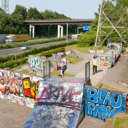
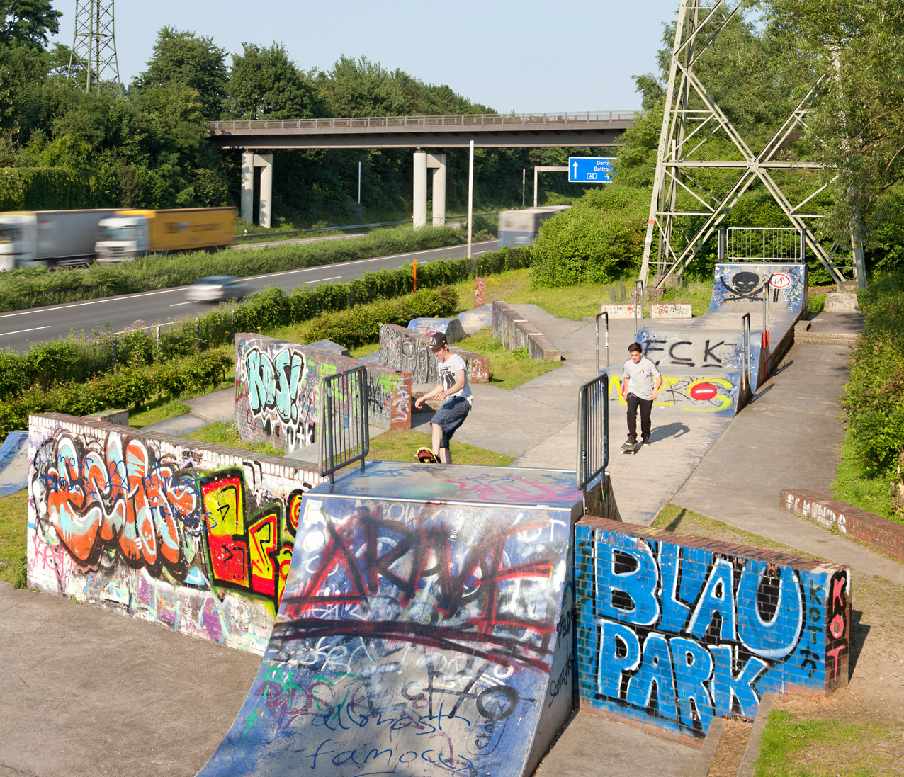
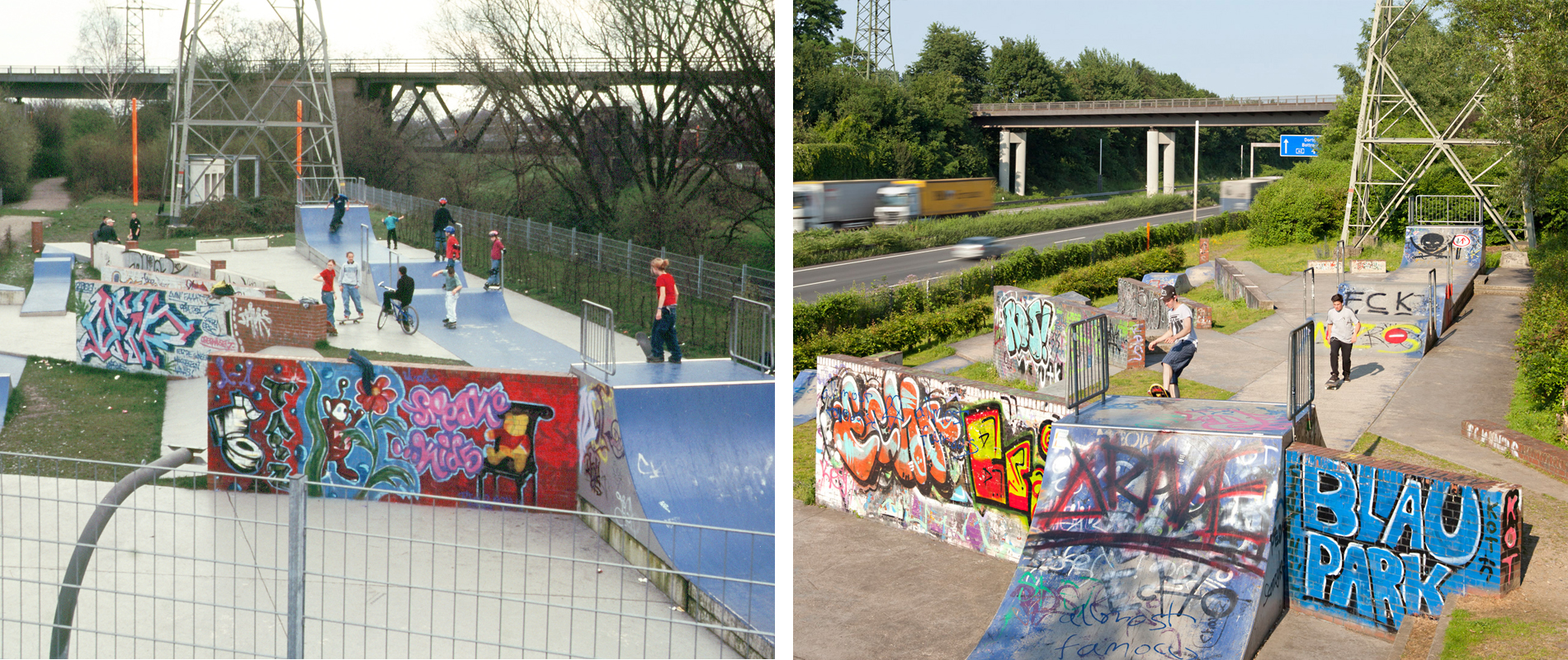
A skate park – at the time still an uncommon feature in public parks – between the motorway and the Emscher added a new element of movement to the park. The skate facility was more sculpture than sports infrastructure, partly due to the still emerging field of skatepark design. This did not stop young users from immediately and enthusiastically claiming it as their own.
In the wasteland between the A42 motorway in the south and the northern freight rail line, the “Strip Gardens” emerged, planted with perennials and grasses reflecting garden fashions of past decades. The planting was intended to be supplemented by residents of the adjacent houses with “garden escapees” that had fallen out of fashion. The opposite occurred: the new plants gradually migrated into the neighbouring private gardens.
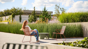
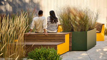
At first glance, the park was not a garden for glossy magazines. It was loud, yet immensely fascinating and full of tension. The Ruhr region’s defining principle revealed itself here in all its facets. A garden for fearless explorers. Through small interventions in the existing landscape, the residual space evolved into a place with new uses and new meaning. The aim was a colourful garden image, as heterogeneous as the Ruhr region itself, growing into the surrounding wasteland. Existing urban nature remained an integral part of the landscape. Existing garden uses were supported through careful, minimal interventions.
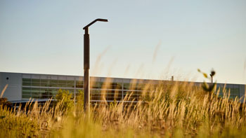
Today, only traces of the garden show remain. As intended, they have grown into the partially returning wasteland, accompanying paths, rivers, canals and roads, leaving many a casual visitor with a puzzled expression. The gradual rewilding of these once activated residual spaces was always part of the concept.
https://maps.app.goo.gl/PeXAeWvxB4opQrSt8
74889
LILA 2026 Sponsor