San Cristoforo cycling-pedestrian bridge by AOUMM
aoumm.com
2025 Built Landscapes / 2025 Entries / 2025 Infrastructure Projects / Italy / Built in 2025 /

The San Cristoforo cycle-pedestrian bridge is a strategic infrastructure project for Milan, connecting two districts marked by complex infrastructures. Designed as a ribbon flowing sinuously between its ends, its central feature is a large helical ramp that descends into the central park. It acts as a junction between two urban areas long divided by insurmountable barriers.
To the north lies Piazza Tirana, a very active public space on the edge of an area characterised by a massive presence of public housing. Overlooking the square is the San Cristoforo railway station, an important connection for the development of Milan’s future “circle line,” a peri-urban transport system that uses the existing railway lines in the city’s outer ring. At the centre is the terminus of the M4 line, recently inaugurated and connecting the east and west edges of the city. The terminus is located between the old railway yard and the Naviglio Grande, an area set to become a large public linear park as part of the general redevelopment plan for the disused rail yards. South of the Naviglio lies the Ronchetto district, a peripheral area on the border with the municipality of Corsico, characterised by numerous historical and cultural landmarks linked to local agricultural and artisanal activities. The connection must be considered both at the neighborhood scale—uniting areas that today are disconnected except by car—and at the urban scale; in fact, the bridge is a fundamental piece for the continuity of a long urban green corridor (Ecological Corridor No. 5) that starts in the north at Parco delle Cave and reaches the Parco Agricolo Sud, immediately after the bridge ramp in the Ronchetto area.
The theme of infrastructural connection in a setting like this was approached through a broader analysis of the urban bridge concept. A survey of all crossings over the Naviglio revealed that there is no recurring “type,” but rather a collection of structures responding to different formal, functional, and historical logics.
“The bridge is losing its characteristic as a strong territorial landmark, mainly due to the poor quality of its environment. For example, a footbridge that is not well-lit, open, with high-quality finishes and a high degree of maintenance, is perceived as a place to avoid, dangerous to personal safety.” (“I ponti di Milano. Tutti gli attraversamenti dei Navigli milanesi e pavesi” – Milan, Ed. Mursia, 1998. p.108)
What makes some examples more interesting than others is their role as “territorial landmarks,” – independently from their style or age – and this was the guiding principle in giving substance to an infrastructure project that was not generically functional or engineering-driven, but capable of incorporating the layered local, urban, and historical context, and ultimately possessing strongly identifiable architectural characteristics. Thus, the central helical ramp, beyond optimising ground footprint to leave more space for the future park, becomes a symbolic knot that unites the two neighbourhoods previously separated.
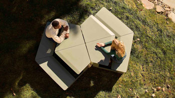
The main deck, in its being as neutral a line as possible, recalls the structural C-shaped construction of a chiatta (the traditional metal boat of Milan’s canals), with thick steel side walls and a hollow core. The deck is supported by slender ground elements—steel piers and concrete elevator shafts. These are treated as small architectural episodes, each inspired by and paying tribute to a Master of Milanese architecture. Moreover, the bridge is not just a passage; the insertion of several transversal structures at the points of ascent takes advantage of the height of the walkway to create areas not strictly functional to crossing, but designed as opportunities for pause and for offering new scenic viewpoints from above—an unprecedented way of experiencing the local context of the Naviglio Grande, which is typically encountered at street level.


At its ends and in the center, the walkway lands in three distinct public green areas: Piazza Tirana to the north, returned to the public as a collective space; the future Linear Park in the center; and the Ronchetto area to the south, an intermodal exchange zone (metro–bus–tram–bike) that becomes a neighborhood garden closely connected to the Carleschina canal, which branches off from the Naviglio and runs openly along the north-south axis toward the Agricultural Park.
The design experience of the San Cristoforo cycle-pedestrian bridge proved crucial in addressing urban connectivity within a highly complex context marked by multiple infrastructural barriers—railway lines, a rail yard, the M4 metro terminal, and the Naviglio Grande canal. The opportunity to reconnect two adjacent districts, historically divided by the railway and canal, was approached to create a new crossing that not only serves as infrastructure but also weaves historical layers and contemporary elements to redefine the identity of the site.
Other landscape architecture offices involved in the design of the landscape:
AOUMM (L. Astorri, R. Balzarotti, R. Locatelli, M. Poli)
Architects involved in the design:
AOUMM (L. Astorri, R. Balzarotti, R. Locatelli, M. Poli)
Other credits:
Structural Engineering: M Ingegneria (A. Miazzon, L. Rampin)
Location:
Milan, Italy (Piazza Tirana / Via Lodovico il Moro 149)
https://maps.app.goo.gl/crP1BMB6fbW2Qg2q8
61349
LILA 2026 Sponsor