Shortlisted in Public Landscapes category 2023:
Tbilisi Urban Forest
ruderal.com
2023 Public Projects / Georgia / Built in 2022 /


![Sarah Cowles is the Director of Ruderal, based in Tbilisi. Ruderal is a landscape architecture and planning studio focused on the emerging development markets in the Caucasus region. For Cowles, every site project is a forum to negotiate and invent new relationships of culture and ecology. She leads multidisciplinary teams to realize complex landscape-focused projects […]](https://landezine-award.com/wp-content/uploads/2022/02/Sarah-Cowles-1200x1200-1-600x600.jpg "Sarah Cowles")

In 2020, the City of Tbilisi initiated a plan to diversify and improve the health of the Mtatsminda Urban forest and enhance public access with trails and facilities. Ruderal adapted the initial analytical work of botanists, zoologists, geographers and environmental scientist to create detailed spatial plans of coherent patches of plant communities keyed to different soil and slope conditions. New trails will wind through these patches, providing hikers with the variety of colors, scents and textures of the different plant communities.
The new public forest is grafted into a pine tree monoculture planted in the early Soviet period throughout the city and its surrounding areas. These pine trees were selected for their ability to grow quickly in poor soil conditions. Planting continued through the 1950s-60s, but the plantations are now experiencing infestations of pests and fungi, causing their decline. In contrast to other municipal tree planting projects in Tbilisi, the trees planted in the project were grown in Georgian nurseries. Specimen trees were grown in a project-specific nursery within Tbilisi while saplings were grown at a regional nursery that specializes in forest restoration.


The project includes the analysis, design, and replanting of two zones within the larger 700-hectare public Tbilisi Urban Forest: The Narikala Ridge, a north-facing cliffside between the historic city center and National Botanical Garden of Georgia, and Okrokana, a south-facing slope in a peri-urban settlement in the hills above Tbilisi.
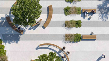
Ruderal designed forest patches that include low-growing shrubs and taller trees to provide cover for birds and wildlife and provide visual interest. Unlike the pine and cedar monoculture planted in the late 20th century, the new patches create varied conditions and experience. They include texture-rich open shrubland (the ‘Savanna Edge’ patch) to silver-canopied mountain woodland (the ‘Celtis Forest’ patch) to the immersive, colorful, bountiful forest (the ‘Fruit Grove’ patch). Each of the patches is distributed across the mountain in massive drifts.
The scale and complexity of the urban forest project required innovation in design technology. We developed a custom planting design tool in Grasshopper, a digital modelling software, that allows designers to integrate broad-scale GIS with field-sourced data such as soil depth and composition. These tools produces rapid visualisation of the patches at different scales, optimised plant quantities, and allows us to simulate the interaction of diverse species over time.
Architecture offices involved in the design: Planning and Research: Geographic, Inc.
For publicly accessible projects please include exact address.
https://goo.gl/maps/TZ9hSVzeRTXPAhjy5
Narikala Ridge, Sololaki Street terminus
Design year: 2020
Year Completed: 2022
44548
LILA 2026 Sponsor