Zibi – Tesasini flood park by CSW Landscape Architects Limited
csw.ca
2025 Entries / 2025 Public Projects / Canada / Built in 2024 /
Text by Christian Matteau Senior Project Manager, Landscape Architect at CSW.
The Outaouais region bore the full brunt of global warming during the floods of 2017 and 2019. The city of Gatineau was faced with exceptional flooding of the Ottawa and Gatineau rivers and had to review its development strategy for its territory. In downtown Gatineau, the Zibi Sustainable District established on both sides of the river incorporates new hydraulic models to provide for resilient open spaces.
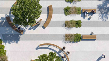
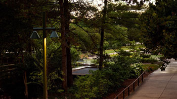
Tesasini Park (meaning “flat rock” in Algonquin) is located downstream from the Chaudière Falls, the park stands along the banks of the river, on the left bank of the Zibi district, the region’s first zero-carbon community. The park is managed by the NCC (National Capital Commission) according to its strategic plan for sustainable development, as well as its monitoring program that measures vulnerabilities and risks associated with climate change. Planning and operational measures include:
• the application of new trail design standards to increase resilience to potential extreme weather events;
• shoreline restoration along the Ottawa River;
• maintaining and increasing forest cover to help manage heat island effect; and
• reducing gas emissions, including the construction of new zero-carbon buildings, as part of the NCC’s Sustainable Development Strategy.
Among its projections, the NCC foresees a rise in average temperatures of +3.2°C by 2050, with an increase in precipitation of 8% (autumn-winter-spring) and 15% for intense precipitation. Resilience in the case of Tesasini Park is expressed on several levels. Firstly, in its relationship with water, in the recurrent management of flooding on the Ottawa River, where the forces of nature pose a high risk of erosion, with flows reaching 5,700 m3/second during spring floods. Secondly, it manifests itself through the transformation of the territory, the mutation of the industrial past of the EB. Eddy’s industrial past and the reconciliation of Gatineau’s river landscape.
In 2018, an initial concept for the park envisaged generous pathways, new planting, and lookouts. CSW landscape architects had to go back to the drawing board and review certain priorities of use to meet environmental challenges and user safety. A year later, the soil had been washed away to an average thickness of 30 to 60 cm, revealing at the same time part of the bedrock. In order to map the risk scales, it was first necessary to listen to the site, analyze the new hydrogeological data, and work with the river’s natural forces, while keeping access open to the public. By this time, it had become clear that the removal of industrial buildings, the exposure of sometimes contaminated soil, and successive floods were making the site vulnerable. More complex adaptation principles were introduced to the park’s design.


Tesasini Park is part of the trilogy of parks set up by the ZIBI project to re-establish a visceral relationship with the river. The city once again opens to the river’s edge, revealing its beauty but also its dangers. What seemed like a constraint became an opportunity for dialogue, with the park becoming a tool in the service of the area’s resilience to prevent future risks. Several changes had to be accepted: a more mineral composition to the detriment of riparian planting, restricted pathways, protective structures, and bank stabilization techniques. Hydraulic dynamics enabled us to outline solutions for each risk level (20, 100, and 500 years). For example, two series of riprap barriers protect the riverbanks and padlock the ground, which is capped with large, flat sedimentary stones textured in different shades, like a turtle’s carapace. Unfortunately, the project had to be sourced from quarries further afield to meet new geotechnical specifications, which will have a significant impact on the project’s carbon footprint. Local stone was too frost-sensitive to meet mechanical requirements.
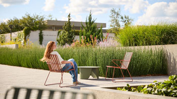
This search for a new landscape design, combining physical constraints and aesthetic forms, has transformed the space towards greater balance between softscape and minerality, interlocked to form balconies overlooking the river. While the lower part of the park remains essentially mineral, the upper part, in contact with the residential units, features dense tree plantings and proposes a strategy of landscape renaturalized slopes. For the Algonquin Council, it was important that the use of Indigenous vegetation convey a certain ancestral symbolism. Artists were also involved in creating the spaces accessible to the public, and three works of art were installed along the flood-protected pathway.
• Project typology:
Park, shoreline rehabilitation, flood plain, urban
• All landscape architecture offices involved in the design of landscape:
CSW Landscape Architects Limited
• Other credits:
Engineering: QDI / CIMA+ / JFSA / Gemtec
Artist: Solomon King
• Location
Gatineau, Québec, Canada
https://maps.app.goo.gl/aWdKF7qjSWxLogxy8
61361
LILA 2026 Sponsor