The Melksteeg ecological corridor
https://hnsland.nl/
2026 Public Projects / Netherlands / Built in 2025 /

![During the renovation of the previously closed sanatorium complex, a protected national monument, maximum effort was made on ‘preservation through development’. The realization of a number of carefully fitted new homes allowed the historic complex, including the garden and park, to be restored. The combination of old and new construction provides surprising perspectives in the […]](https://landezine-award.com/wp-content/uploads/2024/05/00-SMS_2023.09.27_0433_A3plus-600x449.jpg "De Hooge Riet, Ermelo")
![South of Zwolle lies the historic and relatively unknown Windesheim estate. At the back of the site the remains of a garden from the 18th century, the estate’s earliest period, have been wonderfully preserved. The garden’s 18th century water and path structure formed the basis for its renewal. Windesheim, a historic country seat of the […]](https://landezine-award.com/wp-content/uploads/2023/05/00-Evabloem_NEXT-architects_Landgoed-Windesheim-169-600x450.jpg "Parkbruggen Windesheim")
, greenest road of the province of Brabant")

![The Netherlands has a long history when it comes to water safety. Yet, even for the Dutch, the Reevediep is a unique project. The creation of this new delta landscape marks the successful completion of the national Room for the River Program. To enable the IJssel to discharge a larger volume of water, a new […]](https://landezine-award.com/wp-content/uploads/2020/05/00-Panorama-Nieuwendijk-Bridge-image-Hans-vd-Meer-600x180.jpg "Reevediep: Towards a new awareness of the delta landscape")
![Where river and city, nature and men meet – clotted in steel and wood Water Wood is situated at the Brienenoord Island with it’s mesmerizing views on both the city skyline and the iconic Brienenoord bridge, where ships pass by daily and nature flourishes. This point offers a unique place to experience the relationship between […]](https://landezine-award.com/wp-content/uploads/2020/04/00-water-woods-main-photo-2500pxIMG_4666-600x450.jpg "Water woods")

![In order to ensure safe water flow from the IJssel river, a new riverbranch has been designed in the IJsseldelta. The water will now flow on two sides along the city of Kampen to the IJsselmeer (IJssel lake). The new river called ‘Reevediep’ starts narrow on the IJssel and widens further downstream. This new Dutch […]](https://landezine-award.com/wp-content/uploads/2019/04/XX-Aerial-view-Reevediep-central-part-2018-photo-Ruimte-voor-de-Rivier-IJsseldelta-1-600x400.jpg "Reevediep: a new river in the IJsseldelta")
![The design of the Central Axis (N356) and the integration of the motorway into the northern Frisian landscape was considered a cultural challenge due to its high sensitivity. The designers faced this challenge by obtaining a cautious integral design approach. This not only applies to the structures along the motorway itself but also to the […]](https://landezine-award.com/wp-content/uploads/2019/04/XX-SMS_20180507_0697.NiA3_-600x400.jpg "The Central Axis")
![ROOM FOR THE RIVER The Zalige bridge in Nijmegen is the key project within the Urban River Park that was created as part of Room for the River Waal. This is a nation-wide program initiated by the ministry of Infrastructure and the Environment to prevent flooding. Along the historic city centre of Nijmegen the river […]](https://landezine-award.com/wp-content/uploads/2018/04/09_Zalige-bridge_Photography-Rutger-Hollander-MAIN-IMAGE-600x447.jpg "Zalige bridge")

CONNECTING THROUGH COMPENSATION
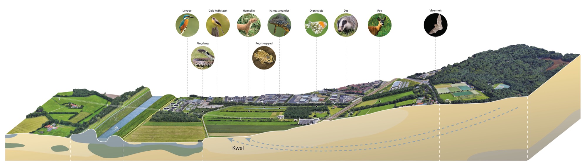
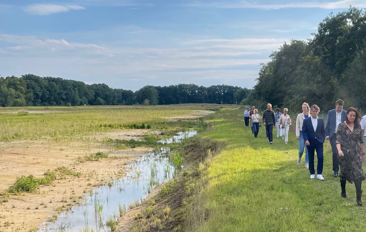
In 2025, the Melksteeg ecological corridor project, a new 19.5-hectare nature reserve on the border of Amersfoort and Soest was opened. As part of fulfilling compensation obligations, the opportunity was seized to further expand the Melksteeg and enhance its significance as an ecological corridor. H+N+S Landscape Architects was asked to bring these objectives together in an appealing design. The result is a nature reserve that has been incorporated into the surrounding landscape in a natural and logical manner.
The project crosses the unique gradient of the moraine ridge from the Utrechtse Heuvelrug to the river Eem, from ‘high and dry’ to ‘low and wet’. Until recently, this land was used for agriculture. Now, more than 19.5 hectares of new natural habitat has been created, including small woodland areas, flower-rich grasslands, and wet hay meadows. The selected habitat types were chosen to match the soil and water conditions. Hardwood floodplain forest and flower-rich grassland are being developed on the drier sandy and clay soils, while softwood floodplain forest and shallow wet areas are being created on the wetter clay and peat soils, which receive a lot of seepage water from the Utrechtse Heuvelrug.
DESINING TO SCALING UP
Initially, this project began with the asignment to develop 3.4 hectares of new nature, but during the project extra funding was secured. As a result, the project expanded to more than 19.5 hectares. A key part of the work was uniting stakeholders, aligning different interests. The project has successfully created a strong ecological link between the Utrechtse Heuvelrug and the Eempolders.
COMPLETING THE CITY EDGE
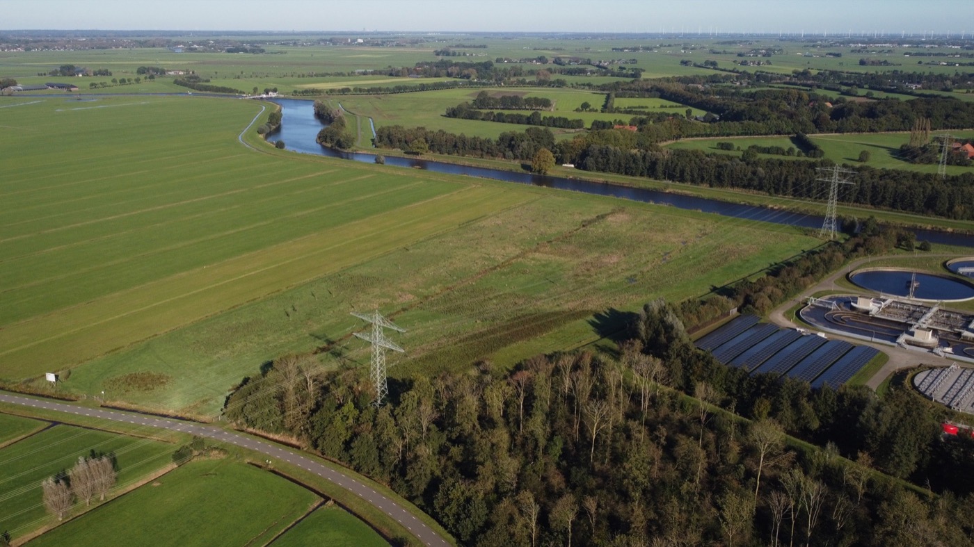
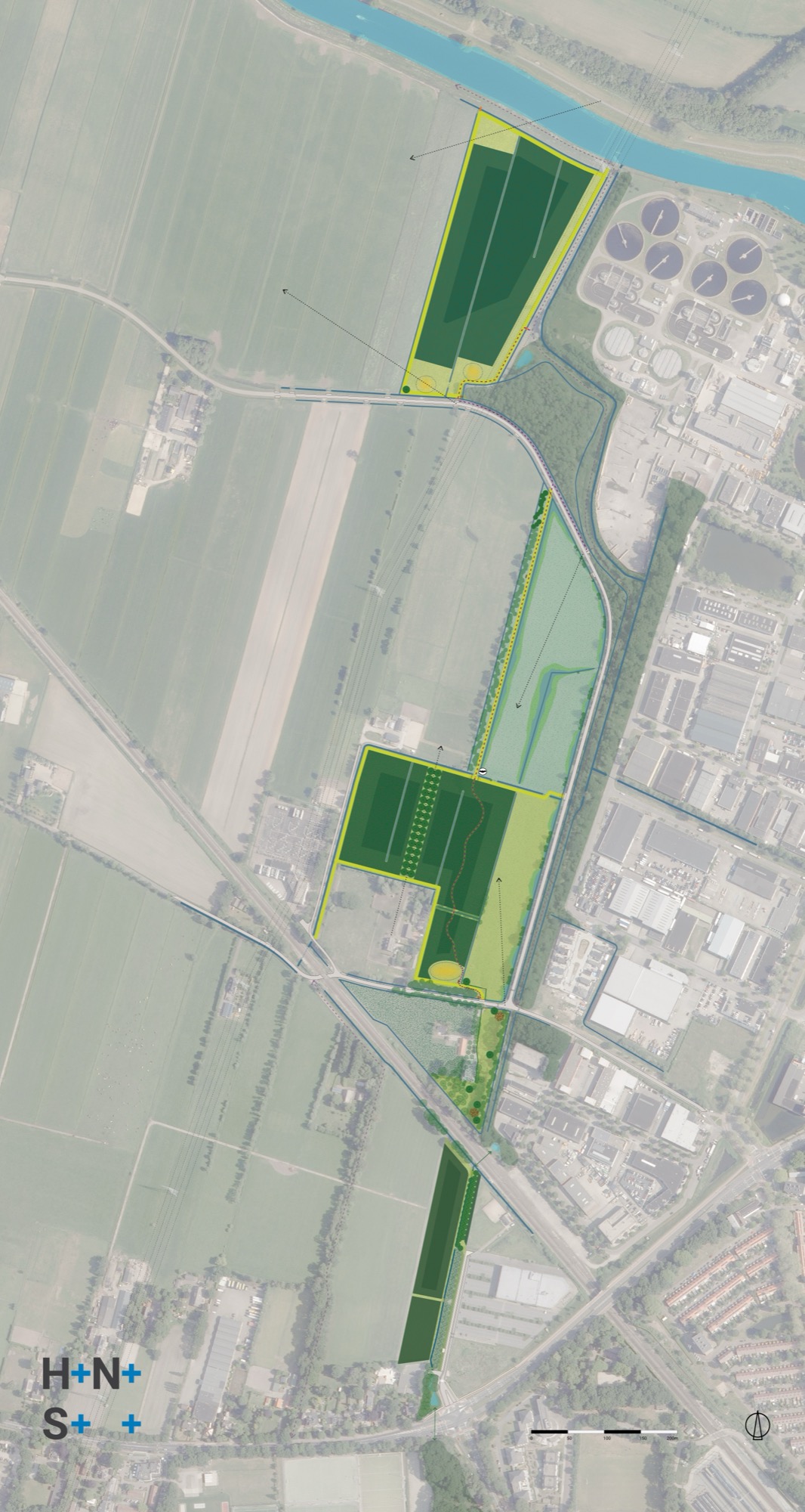
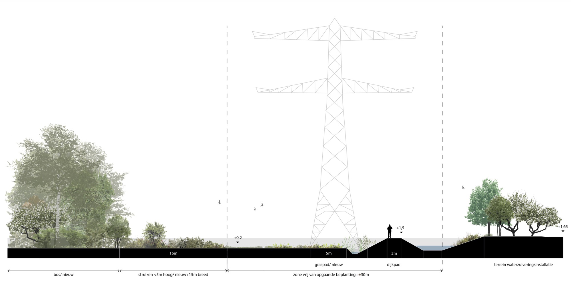
From a spatial perspective, this development can be seen as a much-needed ‘completion’ of the city edge of Amersfoort. A robust forest block was added near the water treatment plant to improve the view from the open Eempolders. Furthermore, this planting also helps to conceal the nearby high-voltage substation as much as possible. The design follows the existing lines in the landscape: Woodland blocks, open (wet) flower-rich grassland, and hedgerows to facilitate a various interplay of open views with framed sightlines and seclusion. Ecohydrological and archaeological research was conducted to support the design process. The results have been translated into the design to preserve, enhance, and make the values readable and enriched the design.


ARCHAEOLOGY AS A SPECIAL FEATURE
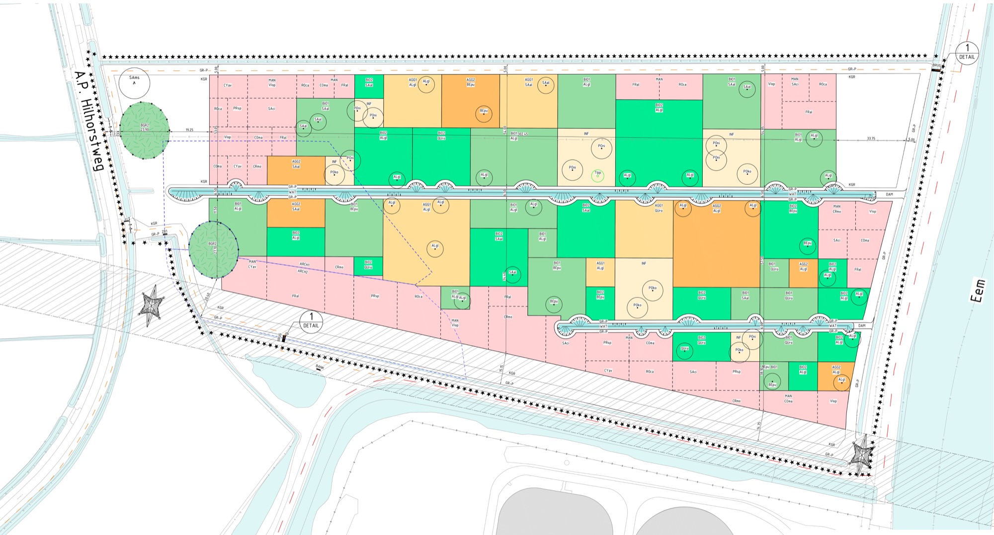
The archaeologically valuable sites can be directly identified through the spatial design: These locations have been kept free of tall vegetation and have been raised in a convex shape using a maximum of 1 m of soil. As a result, the archaeological sites are better protected against external influences, and made readable through the distinct slope in the ground surface.
DESIGNING THE GRADIENTS
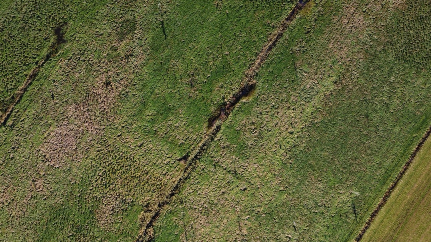
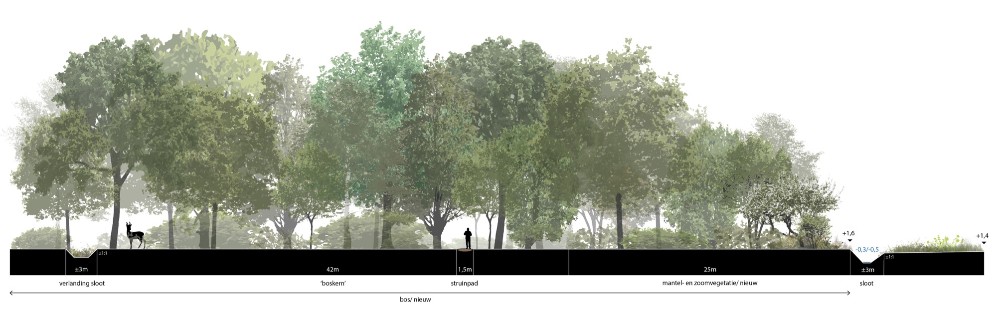
Beyond its role as a corridor, the area itself is also a new and valuable nature reserve. It is a mixed terrain featuring forest, rows of trees, ponds, ditches with wide, nature-friendly banks, flower-rich grassland, and wet hay meadows. This varied mosaic provides habitat for many species found locally. The design also utilizes the underground supply of clean groundwater from the Utrechtse Heuvelrug to create high-quality wet nature. By choosing wide nature-friendly banks, robust forest sections with edge and transition vegetation, and ‘frayed’ forest margins, the aim is to maximize natural transition zones, enhancing diversity of flora and fauna.
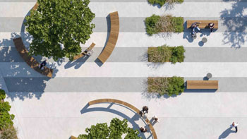
GUIDING RECREATIONAL CO-USE
From the start, it was clear that the focus was not only on increasing natural value, but also on enabling recreational co-use. A new walking path has been constructed to offer extra walking opportunities and make the new landscape accessible. This will primarily be a simple strolling path with a few bridges. The specific terrain design subtly guides visitors while protecting the most sensitive habitats.
SMART PLANTING PLAN
The landscape strategy addresses the ambition to strengthen the area’s existing natural systems and create the conditions for nature to thrive and shape the further development of the landscape. A specific new planting method was designed for the project. Instead of creating large mixed forest sections we created smaller sections each dominated by one single species and carried out at different densities within each section to mimic variations in natural forest phases. As a result, the plants have better growing conditions, creating a natural forest mosaic with great variety.
RESULT
The realization phase has been completed, and nature is now allowed to take over the area. The project demonstrates how a well-designed landscape with a clear spatial composition cannot only be a service to the landscape and people but can also be a fertile basis for a nature reserve that will continue to evolve freely and gain ecological significance over the years.
https://maps.app.goo.gl/T6qokSvpwiEP3fLG8
LILA 2026 Sponsor