Huangge South Road and Adjacent Infrastructure Enhancement Project, Guangzhou
2026 Public Projects / China / Built in 2025 /

![Since 2022, Shenzhen has advanced the high-quality development of a green and livable city through its “Mountain-Sea Connection” initiative, promoting the integration of mountains, coastline, urban space, and public parks. Located along the Qianhai Bay waterfront, Shuangjie River Park serves as a key node within this vision, transforming fragmented coastal green space into a resilient […]](https://landezine-award.com/wp-content/uploads/2026/05/01-©S.P.I-Design-600x449.jpg "Shuangjie River Park, Qianhai, Shenzhen")
![Hongfu Road Urban Axis Regeneration redefines the transformation of urban infrastructure in Dongguan from a vehicle-oriented traffic corridor into an inclusive, ecological, and people-centered public realm. Located along the city’s central axis, the 4.5-kilometer-long and 520,000-square-meter project explores a regeneration pathway that shifts from rapid urban expansion toward refined, high-quality urban living. Guided by the […]](https://landezine-award.com/wp-content/uploads/2026/05/00_Hero-Image-14-600x333.jpg "Hongfu Road Urban Axis Regeneration, Dongguan")
![Context Located in Liwan District, Guangzhou, the Dachongkou Creek Landscape Project lies within a historic Lingnan urban fabric. With China’s first Taikoo commercial district planned along both sides of the creek, the project redefines the waterfront as an open public landscape, positioning it as a critical interface between heritage preservation and future urban development. Site […]](https://landezine-award.com/wp-content/uploads/2026/04/00_Hero-Image-600x338.jpg "Dachongkou Creek Landscape, Julong Bay Area, Guangzhou")
![Project Statement The Senior Retired Officials Activity Center, located on Xinhua Street – the primary thoroughfare of Huadu District, Guangzhou City, Guangdong Province – occupies a site area of 8,514 square meters. The site was once the political, economic, cultural, and international exchange hub of historic Huaxian County. With rapid urbanization, the urgent need for […]](https://landezine-award.com/wp-content/uploads/2025/05/00-Main-Photo-5-600x287.jpg "The Senior Retired Officials Activity Center: A Public Community Park by Guangzhou S.P.I Design")
![Sugang Park is located in the center of Shunde City, Guangdong Province, China—an area characterized by high population density, intensive urban development, and limited space for public activities. The project draws on the theoretical frameworks of landscape justice and sensory availability. For the designated study area, it proposes strategies such as the activation of underutilized […]](https://landezine-award.com/wp-content/uploads/2025/05/00-Main-Photo-4-600x400.jpg "Sugang Park, Shunde by Guangzhou S.P.I Design")
![Project Statement The Zhongguancun International Innovation Center serves as the permanent venue for the high-end international forums. Under the “Green Hill” concept, a multifunctional green urban space was created to restore ecological and social functions while integrating cultural and technological features. The site harmoniously blends with its surroundings, establishing a symbiotic city-park relationship. The landscape […]](https://landezine-award.com/wp-content/uploads/2025/05/00-Main-Photo-3-600x400.jpg "“Green Hill,” Zhongguancun International Innovation Center in Beijing by Guangzhou S.P.I Design")
![Project Statement Upon a “One Core, Two Wings” layout, Guangming Science Park was envisioned as a world-class destination integrating ecological, cultural, aesthetic, and recreational functions. Through biodiversity assessments, habitat creation, low-carbon planting design, and eco-corridor construction, the design team has rehabilitated a vital migratory bird sanctuary while boosting ecosystem resilience. Three “Science Trails” and six […]](https://landezine-award.com/wp-content/uploads/2025/05/00-Main-Photo-2-600x381.jpg "Guangming Science Park in Shenzhen, Green Heart of the Science City by Guangzhou S.P.I Design")
![The project is located in Shunde District, Guangdong Province in the south of China. The city is prospered by water, and boats play still an important role in people’s daily live and livelihood, and therefore have a strong regional cultural symbolic meaning. The project fully taps the local natural resources and traditional culture, and uses […]](https://landezine-award.com/wp-content/uploads/2023/05/00-Main-Photo-©Ne-sunshine-Photography-1-600x328.jpg "CR Land Shunde Landmark")
![West Lake Park, Chengdu is a sports and open waterfront park, which is located in Dayi County, Chengdu City, Sichuan Province, China. The park’s green space provides surrounding residents with an all-weather, all-age leisure destination. The project, with its superior waterfront scenery, unique wetland scenery, and abundant vegetation resources, lays the foundation for reconstructing an […]](https://landezine-award.com/wp-content/uploads/2023/05/00-Main-Photo-©XUEER-Space-Photography-600x449.jpg "West Lake Park, Chengdu")

![Background The project is located in a place surrounded by mountains and water, where the Bouyei people (an ethnic minority of China) live. Human settlement and nature seem to form a harmonious community. This kind of localization arouse from the initial design inspiration. The design intended to find a balance between the residents’ living needs […]](https://landezine-award.com/wp-content/uploads/2022/05/00-01©Inch-Studio-600x398.jpg "CRCC Woshan Longfu, Guiyang, China")
![The client proposed to bring a natural but artistic atmosphere to the site. The project respects the original natural mountain atmosphere and the essence of the orchard. It features three elements: The design of a pure cherry orchard, elevated in the sky. A base of emerging curved textured walls made from local granite boulders form […]](https://landezine-award.com/wp-content/uploads/2022/05/00-1©S.P.I-Design-600x344.jpg "Bailuwan Cherry Blossom Town, Rizhao, China")
![This project provides a novel solution for the community park in Guiyang, China. It respects the existing site and represents the local Karst topography, which is famous for its variant landscapes and complex water system, by reshaping the landform with historical construction methods. The project aims to preserve the original characters of the site and […]](https://landezine-award.com/wp-content/uploads/2021/04/Reshaping-Karst-Topography-1-600x293.jpg "Reshaping Karst Topography with Farming Culture: A New Community Park Design in Guiyang")
![With the growth of the urban population, Chinese cities are undergoing rapid construction and renewal. Datansha Island, formerly a low-income neighborhood in the city suburbs, is now being revitalized by the garden city initiatives that include urban greening and active transport. With the transit-oriented development concept in creating a vibrant, livable community, Datansha Transit-Center encourages […]](https://landezine-award.com/wp-content/uploads/2021/04/00-Main-photo-600x346.jpg "Datansha Transit-Center: a hub for transportation and community")
![Jingkai Central Park locates at the heart of Nanchang’s Economic and Technological Development District, north of the city center. The park serves as a transit hub for the city’s Changbei National Airport, the International Wharf, and Ganjiang New District. Therefore, as the pivot point for the practical and cultural lives in Nanchang, the park represents […]](https://landezine-award.com/wp-content/uploads/2021/04/00-Jingkai_Main-Photo©PRISM-Architectural-Photography-600x400.jpg "Jingkai Central Park – A New Developmental Method of Sustainable Park")
![1. Site analysis On a street corner in jianyang city, sichuan province, we sent a return to the forest ideal for the people who live there.The project is located in the east of the jianyang tuojiang river and the west of the trieshan park in sichuan, with high-quality natural landscape resources.The project’s buildings appear to rise […]](https://landezine-award.com/wp-content/uploads/2020/04/00-Project-main-photo-1-600x375.jpg "Yunyuemingdi, Jianyang")
![The site is located in Dalian, Liaoning province, China, only 3 kilometers from the coast, and is surrounded by mountains, with beautiful natural scenery.We hope to integrate the advantages of the site, respect nature, and let the landscape truly integrate into the mountains and nature.We combine Chinese garden design techniques, the unique quietly elegant free […]](https://landezine-award.com/wp-content/uploads/2020/04/00-Project-main-photo-600x400.jpg "Sea Oriental")
Context and Core Problems
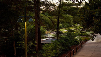
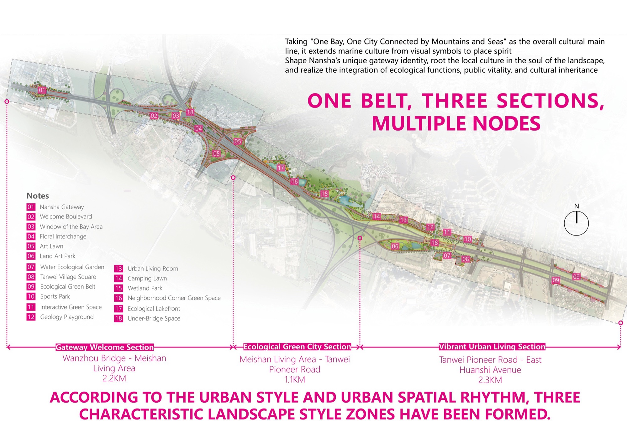
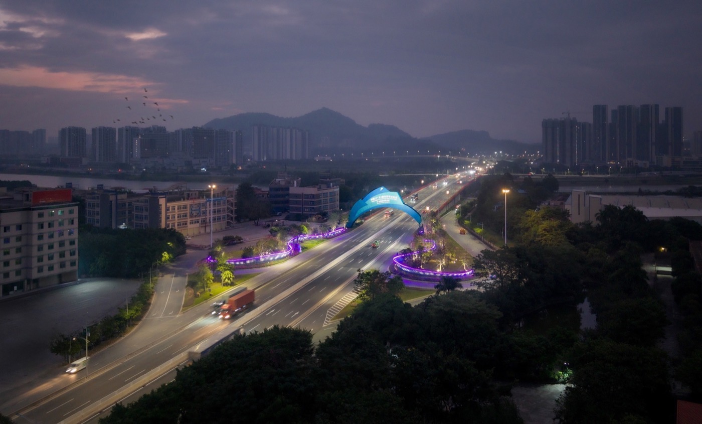
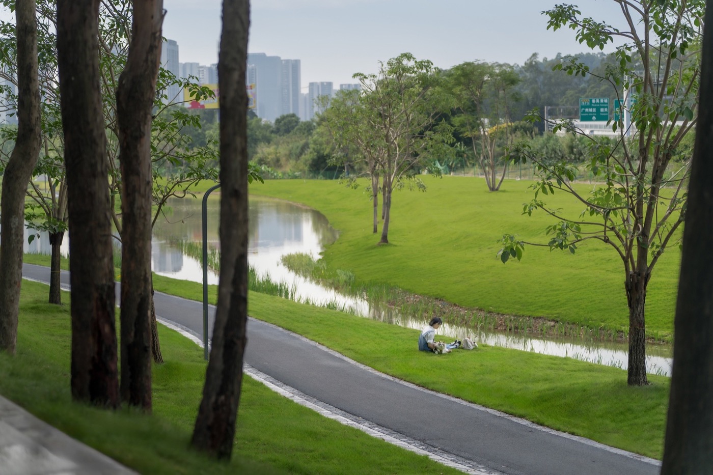
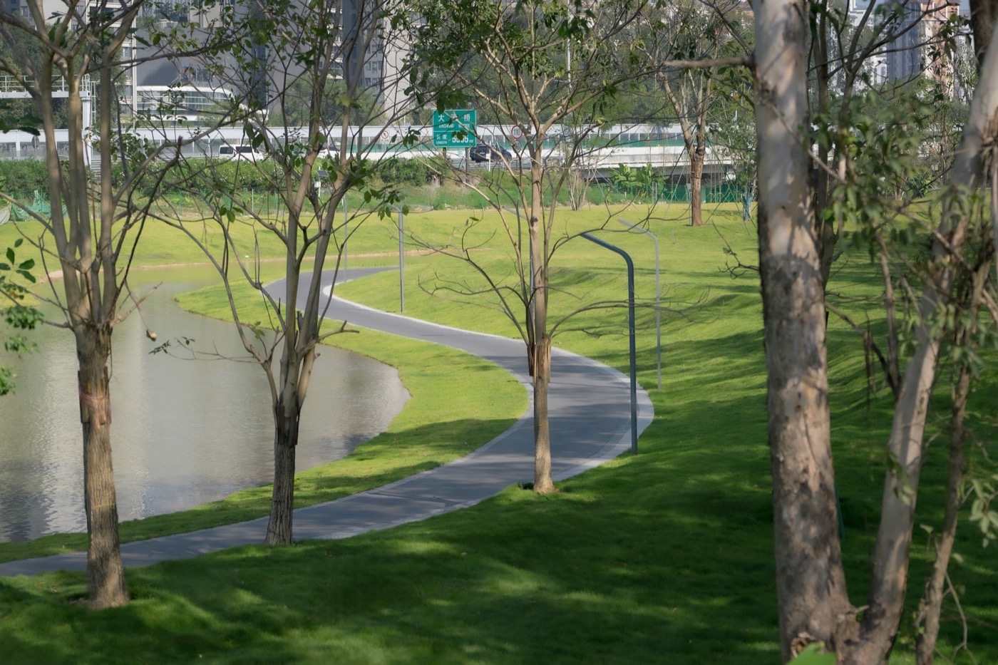
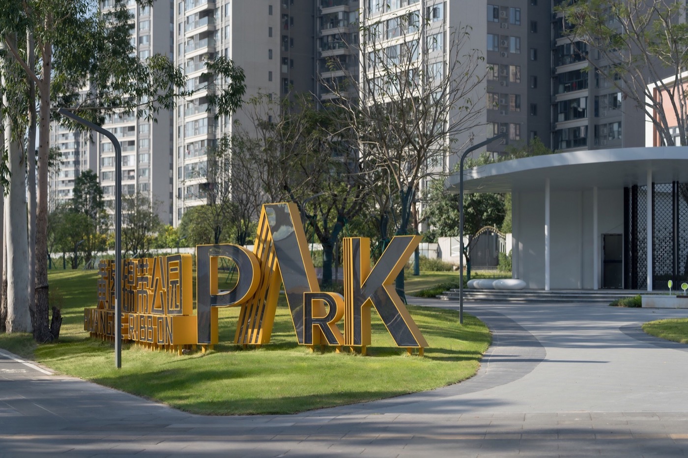
Located in the core area of Nansha District, Guangzhou, Huangge South Road is a 5.6 km-long strategic corridor serving as a key gateway for the National Games and a showcase for the Greater Bay Area.
Prior to intervention, the site suffered from five systemic challenges:
Spatial deficiency—extensive under-bridge areas, roadside vacant land, and community wastelands were informally occupied or left derelict, resulting in a severe lack of public space;
Ecological fragility—fragmented green infrastructure, absence of stormwater systems, and low climate resilience;
Mobility disruption—a completely broken slow-traffic network disconnecting communities, wetlands, and arterial roads;
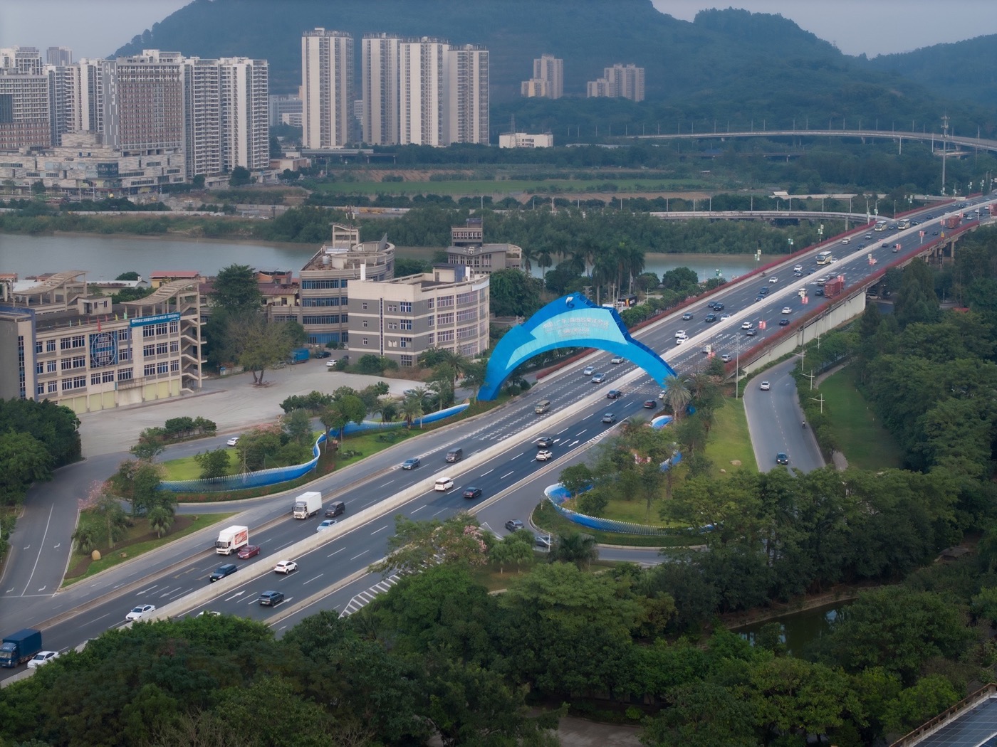
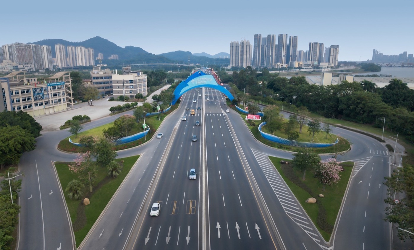
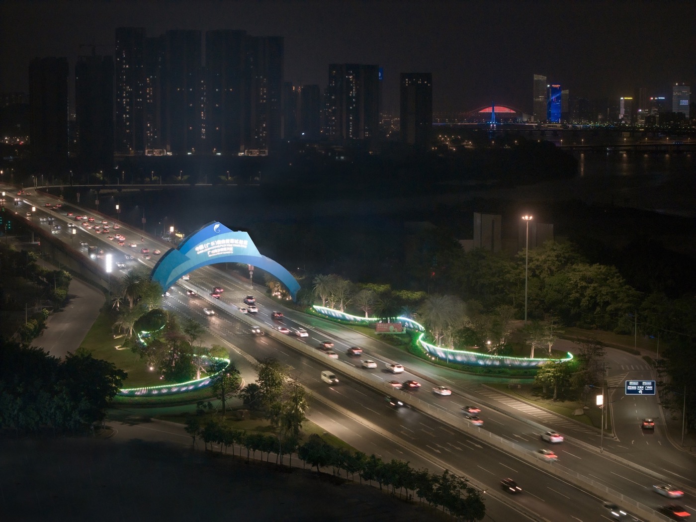
Cultural absence—a lack of gateway identity and failure to express Nansha’s marine character;
Livability decline—noise, disorder, and poor environmental quality inconsistent with its metropolitan role.
Design Process
The project follows a full-cycle methodology: site investigation – problem diagnosis – goal setting – systematic design – implementation coordination. A comprehensive survey of terrain, vegetation, mobility systems, land ownership, and community needs informed a four-dimensional database (space, ecology, transportation, culture). Guided by principles of low intervention and high adaptability, the design integrates sectional strategies, node-based interventions, and cross-disciplinary coordination to ensure long-term feasibility and resilience.
Design Strategy: An Integrated Urban Landscape Corridor
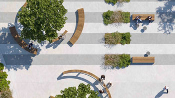
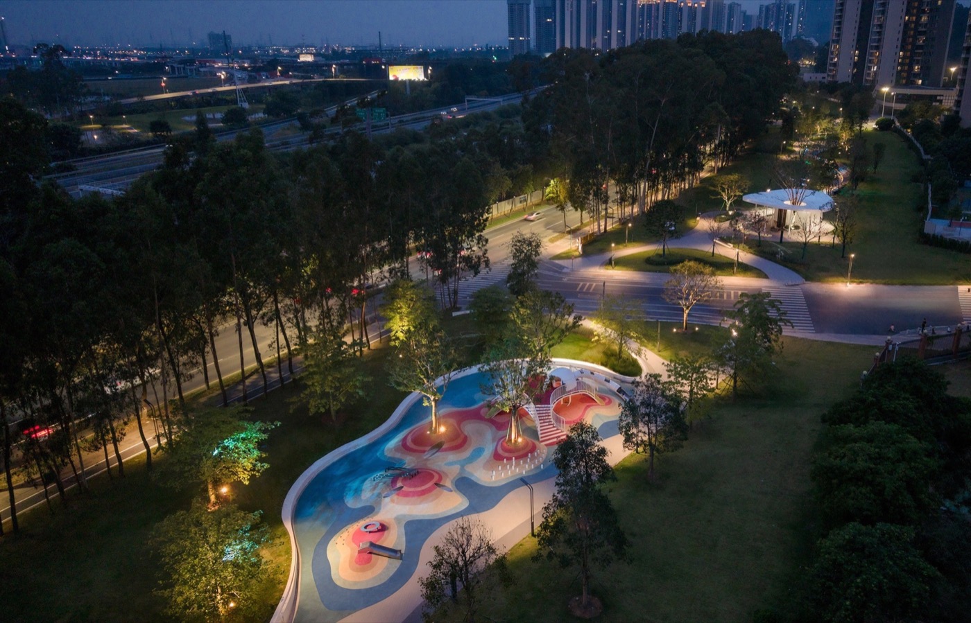
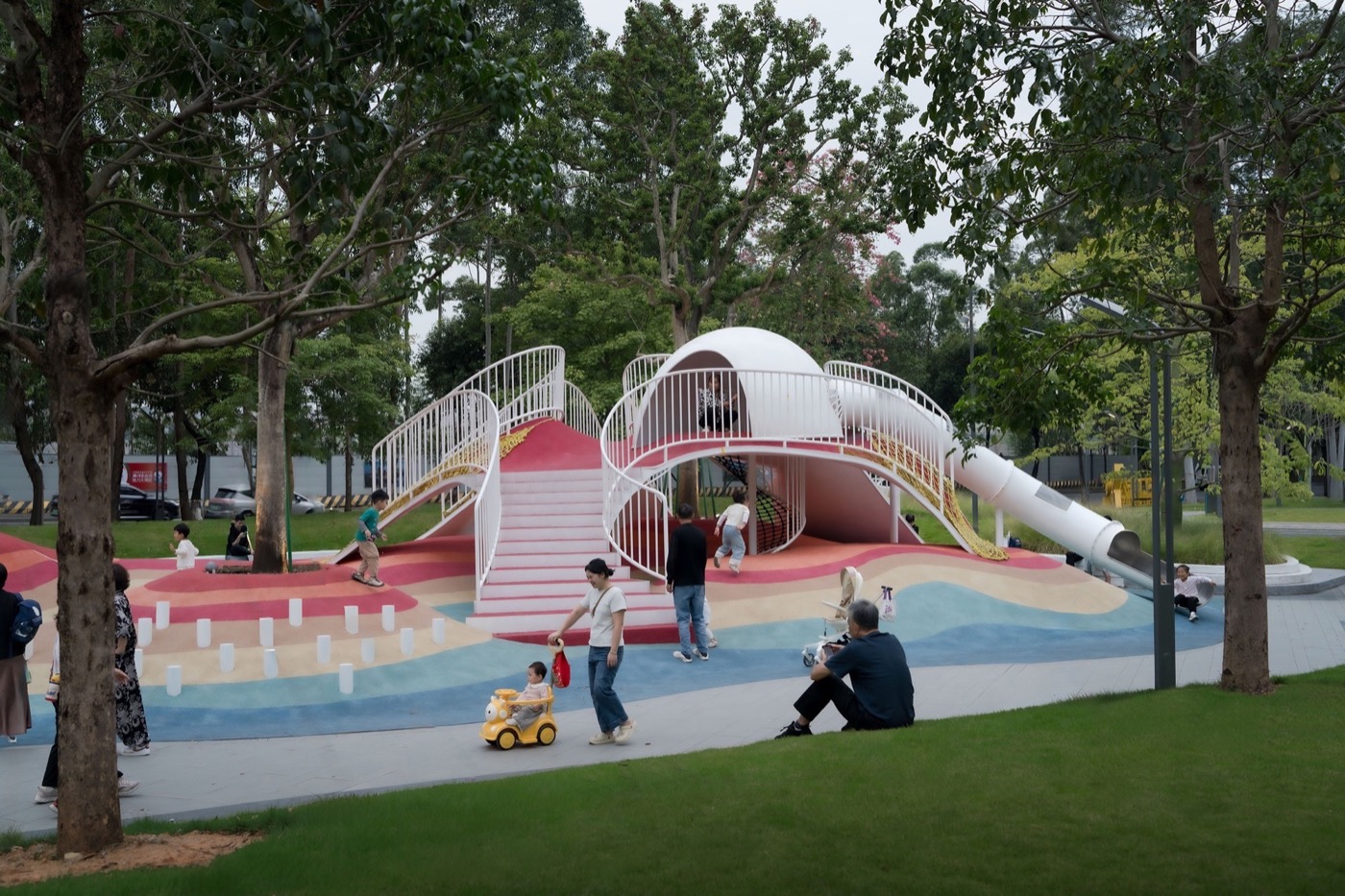
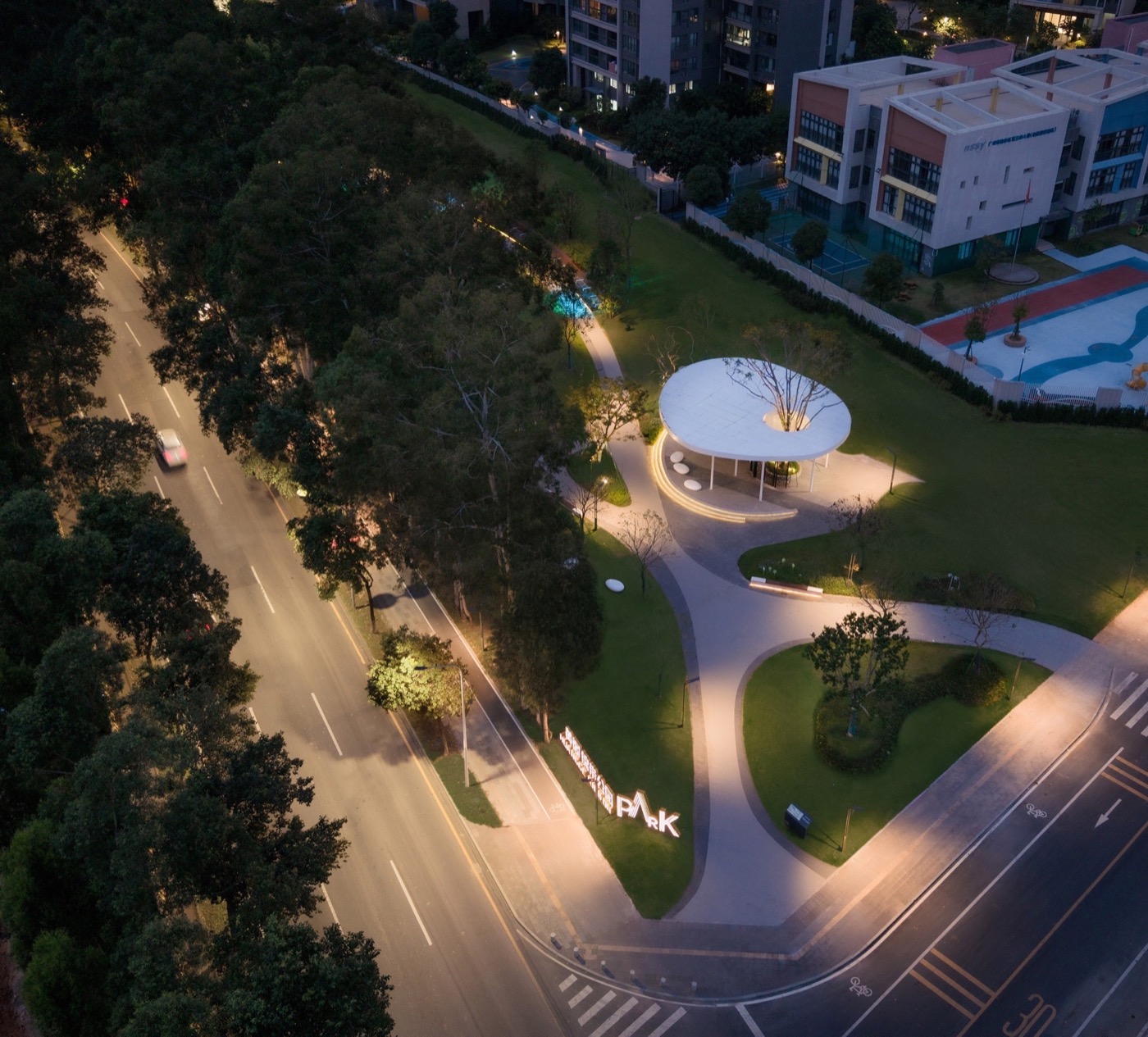
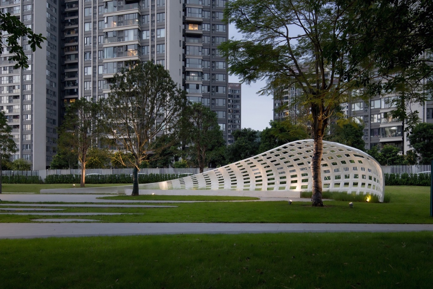
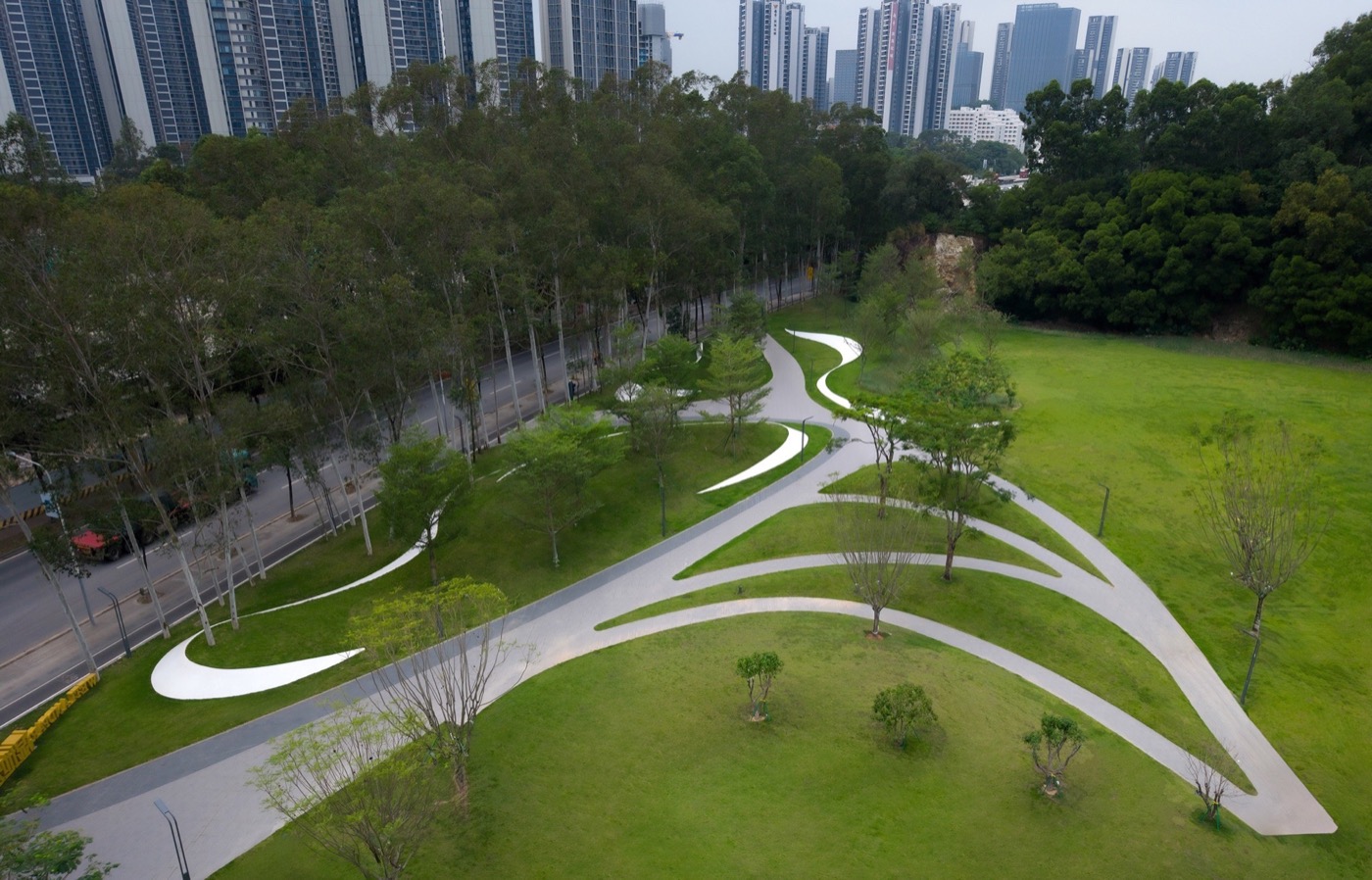
Under the concept of “Landscape Ribbon of Mountain and Sea, Gateway to the Future,” the project establishes a “one corridor, three sections, multiple nodes” framework, transforming infrastructure into a multi-functional public landscape.
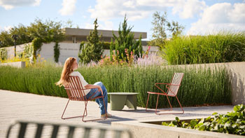
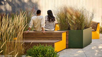
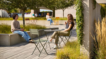
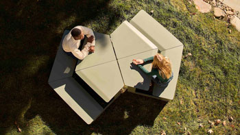
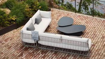
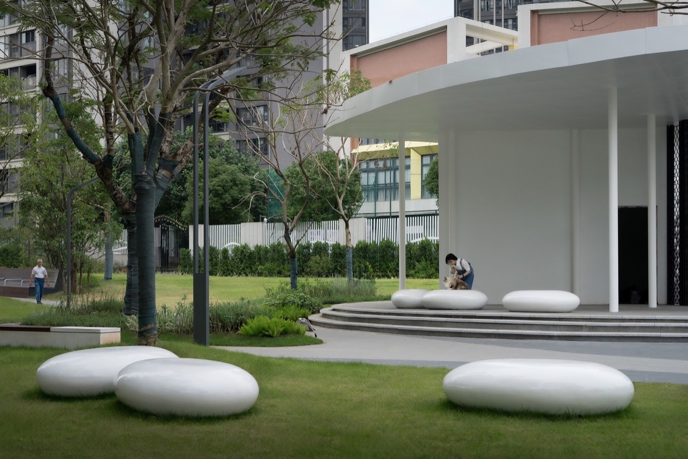
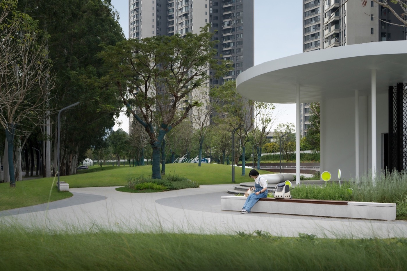
Spatial Activation
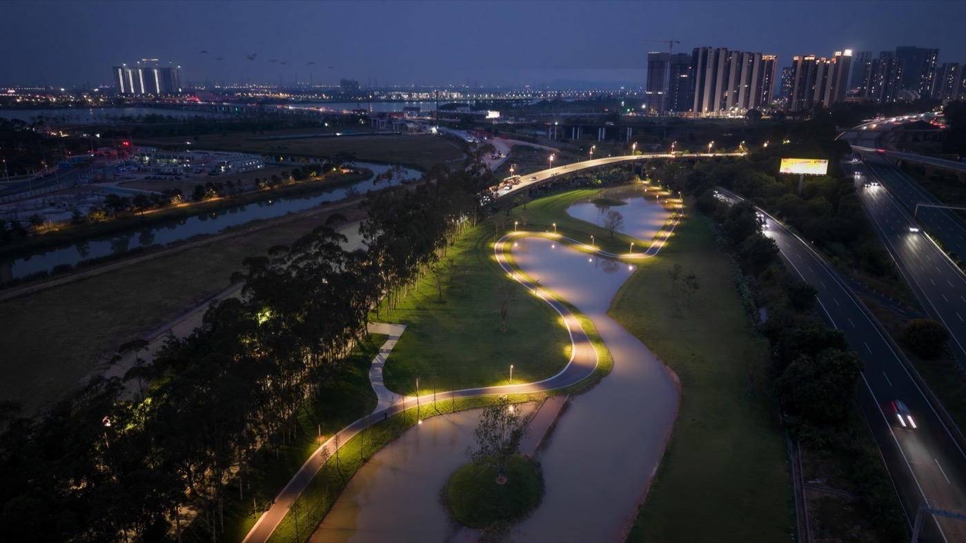
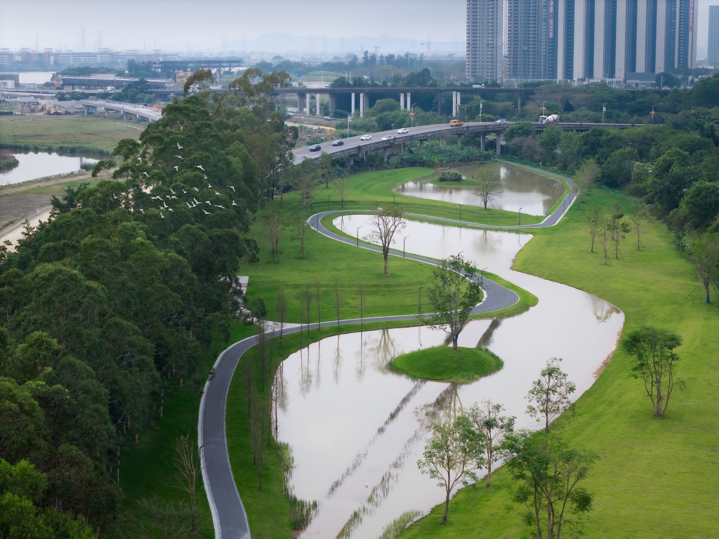
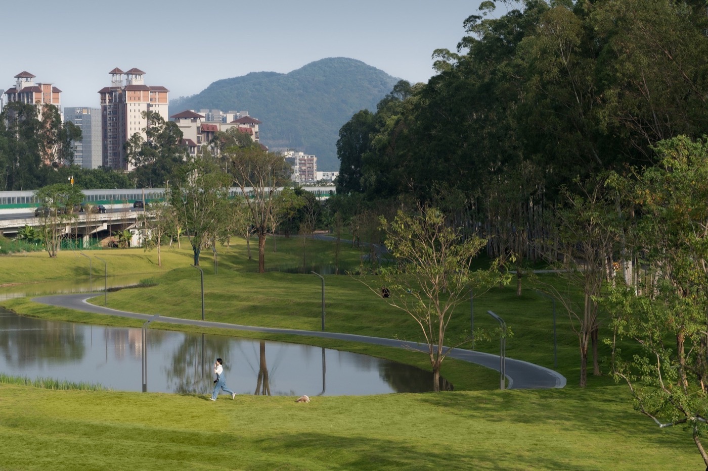
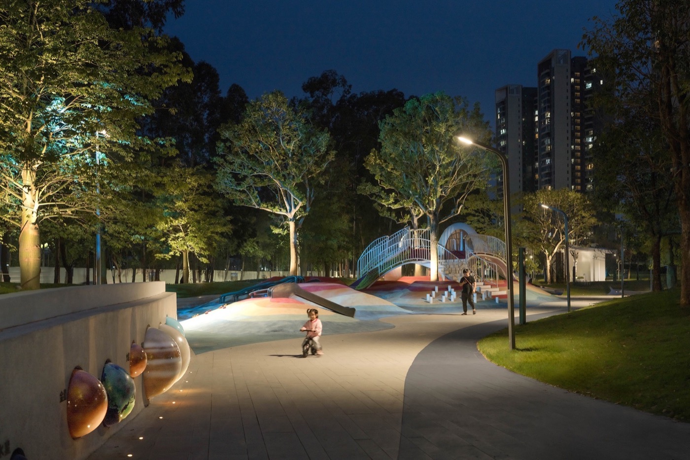
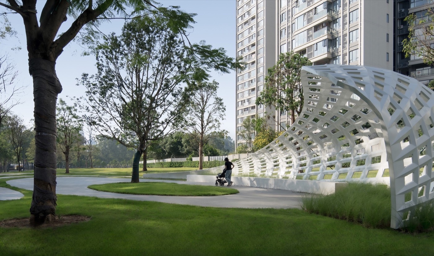
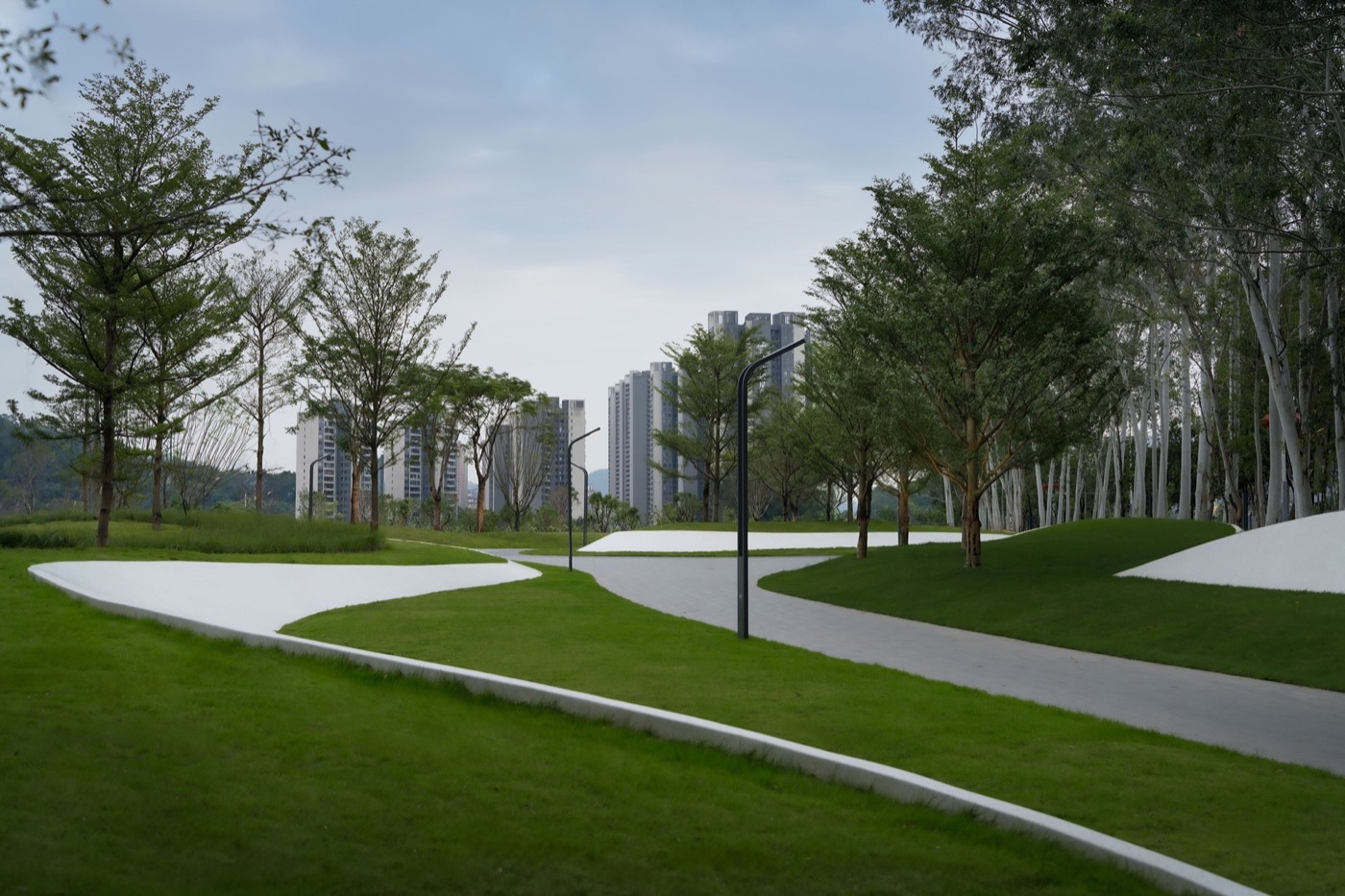
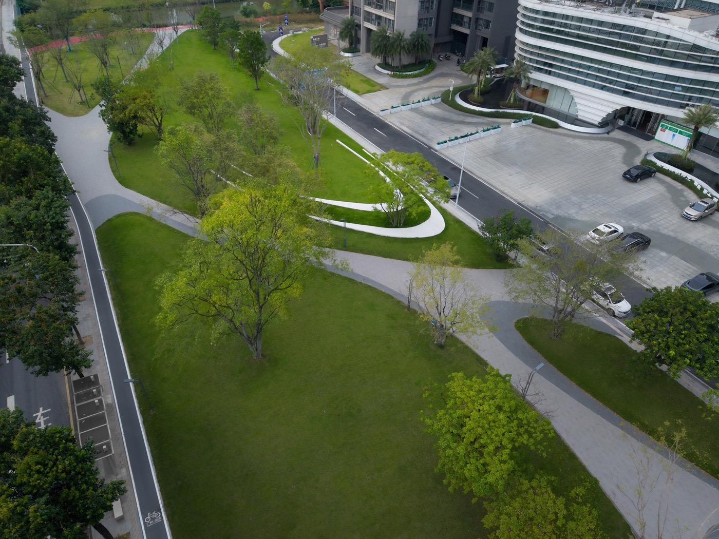
Underutilized spaces—under bridges, roadside voids, and community wastelands—are systematically reclaimed. Informal uses are removed, topography is reshaped, and artistic landforms are introduced, converting fragmented land into all-age parks, pocket plazas, and buffer green spaces.
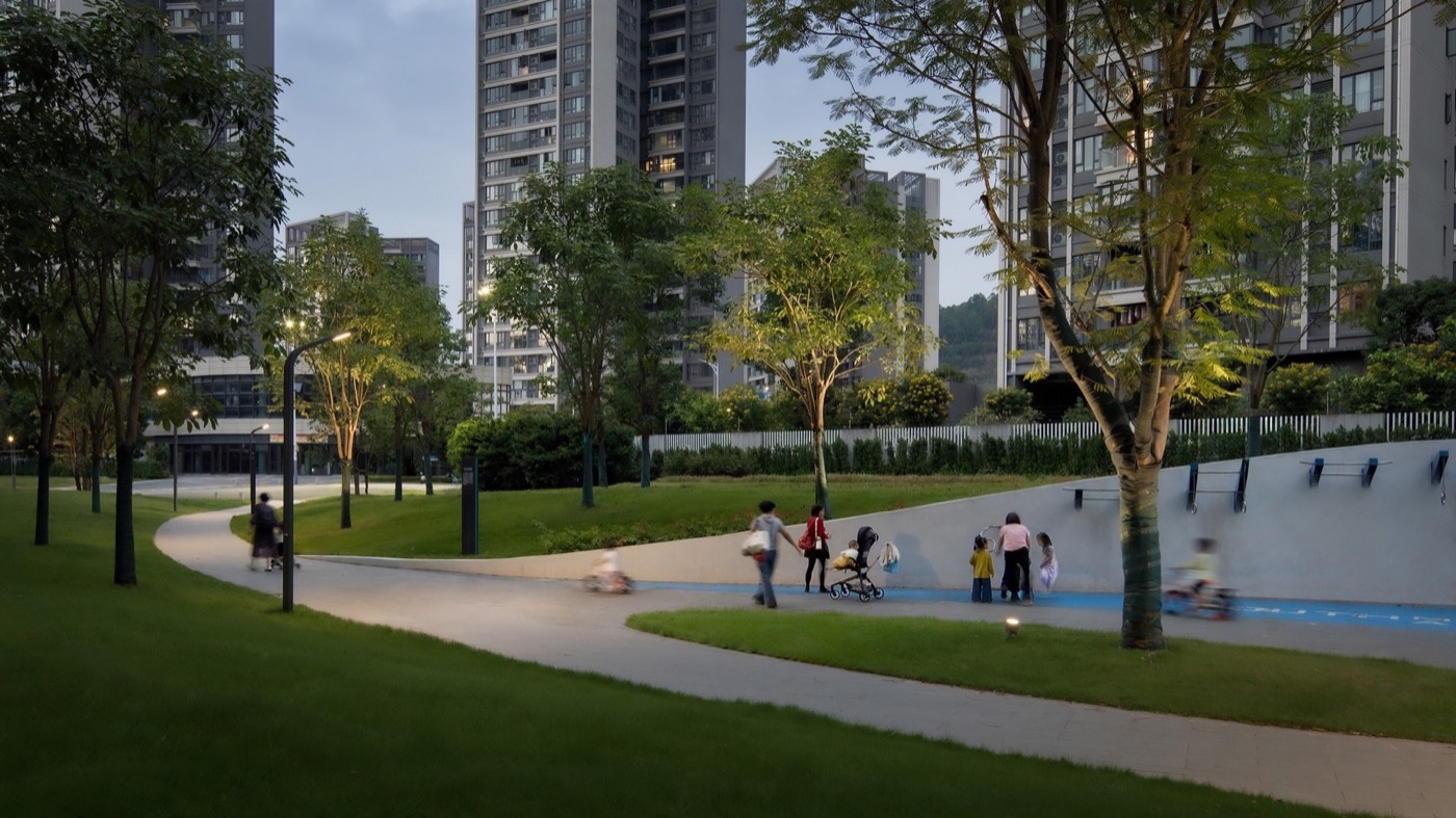
Slow-Traffic Reconstruction
A continuous network of pedestrian paths, cycling routes, and greenways reconnects broken links across road boundaries, community entrances, and wetland edges. The system forms a north–south corridor with east–west connectivity, supported by integrated lighting, safety infrastructure, and wayfinding.
Sponge Infrastructure Integration
Permeable paving, bioswales, sunken green spaces, rain gardens, and retention systems form a multi-layered stormwater management network, enabling runoff reduction, purification, and reuse while enhancing climate resilience.
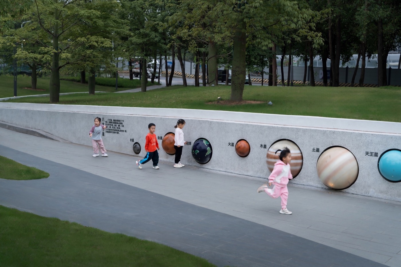
Cultural Translation
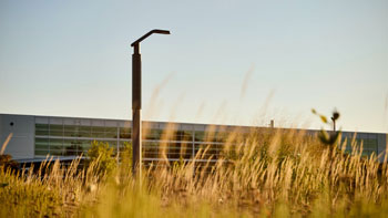
Marine cultural elements—waves, tides, coastlines, and ship trajectories—are abstracted into spatial forms, including fluid structures, sculptural retaining walls, thematic paving, and dynamic lighting, establishing a strong and recognizable gateway identity.
Sectional Differentiation
Three distinct yet coherent segments—Gateway Reception, Ecological Green City, and Vibrant Residential—respond to varying urban conditions, balancing representation, ecology, and everyday life.
Social Impact
The project delivers inclusive, high-quality public space for recreation, fitness, and community interaction, eliminating informal land occupation and significantly improving living conditions. As a supporting project for the National Games, it enhances the urban image of Nansha while strengthening local identity, social cohesion, and community vitality. It demonstrates how infrastructure can directly contribute to everyday well-being.
Environmental Impact
Through integrated sponge city strategies, the project achieves stormwater retention, purification, and reuse, reducing flood risk and improving climate adaptability. Articulated landforms and continuous green systems mitigate heat, reduce noise, and improve air quality. Existing vegetation is preserved and enhanced to form a continuous ecological corridor, strengthening biodiversity and habitat connectivity.
Spatial Impact
The project transforms fragmented and underutilized land into a continuous, open, and shared public landscape system. It reconstructs urban connectivity, linking roads, communities, and wetlands into an efficient micro-mobility network. Gateway nodes establish strong visual identity, while the overall corridor achieves a balance between unity and diversity, redefining the spatial quality of a major urban artery.
Project Credits
Landscape Architect: Guangzhou S.P.I Design Co., Ltd.
Design Team: Hu Sun, Yansheng Huang, Bin Liu, Lijian Liu, Chuangqiang Ye, Hao Peng, Ying Zeng, Runhao Xie, Shengyu Zeng, Chengyuan Gu, Yinglun Fu, Jiapeng Long, Yaoji Zhang, Zhihui Chen, Xiangheng Yang, Jingshu Chen, Qingyang Li
Client: Guangzhou Nansha Economic and Technological Development Zone Construction Center, China Construction Southwest Consulting Co., Ltd.
https://www.google.com/maps/place/%E4%B8%AD%E5%9B%BD%E5%B9%BF%E4%B8%9C%E7%9C%81%E5%B9%BF%E5%B7%9E%E5%B8%82%E5%8D%97%E6%B2%99%E5%8C%BA%E9%BB%84%E9%98%81%E5%8D%97%E8%B7%AF/@22.7887249,113.5127551,17z/data=!3m1!4b1!4m6!3m5!1s0x3403b6d3ae67cc8f:0xd9380eef17f130d2!8m2!3d22.78872!4d113.51533!16s%2Fg%2F11g_w5r96?entry=ttu&g_ep=EgoyMDI2MDQxNC4wIKXMDSoASAFQAw%3D%3D
74276
LILA 2026 Sponsor