Parkstadroute Limburg
www.lola.land + https://lola.land/project/parkstadroute-limburg/
2026 Infrastructure Projects / 2026 Landscape and Architecture / Netherlands / Built in 2025 /
![It all starts with nature, and so does the Biotech HQ Science Campus. Guided by its mission to build a stronger future for rural China through cutting-edge agricultural and animal husbandry technologies, the HAID Group has established its headquarters in Guangzhou, Guangdong. To bring this vision to life, HAID Group commissioned LOLA Landscape Architects to […]](https://landezine-award.com/wp-content/uploads/2026/05/lola-landscape-architects-haid-campus-3-3-600x400.jpg "Haid Science Park")
![Haitang River Eco Park: A Tropical Ecotopia at 18°N Haitang River Eco Park is a visionary masterplan located just inland from Haitang Bay in Sanya, a nationally recognized tourism destination. The project transforms nearly 14 km of former industrial riverfront into a thriving tropical ecological corridor. As Asia’s first urban rewilding initiative, it integrates three […]](https://landezine-award.com/wp-content/uploads/2026/05/00-2-600x400.jpg "Haitang River Eco Park II")
![Monumental industrial site
De Meelfabriek is a landmark industrial complex in the city of Leiden, the Netherlands. Covering an area of no less than 55.000 square metres and listed as a national monument, De Meelfabriek is a major redevelopment project. For nearly four decades, Meelfabriek initiator Ab van der Wiel has been the driving force […]](https://landezine-award.com/wp-content/uploads/2025/05/00-LOLA-Landscape-Architects-4-De-Meelfabriek-garden-seating-edge-photo-Studio-Akkerhuis-Corentin-Haubruge-600x400.jpg "The Meelfabriek Garden by LOLA Landscape Architects")
![De Groene Kaap is a nature-inclusive stepping stone in the urban nature network of Rotterdam. LOLA Landscape Architects’ approach to the built environment is centered around creating a nature-based city. A series of courtyards and roof landscape gardens allows people, animals, and plants to thrive in their habitat. With 450 homes spread across four residential […]](https://landezine-award.com/wp-content/uploads/2024/05/00-LOLA-DGK-de-groene-kaap-rotterdam-08-bridge-to-enterance-inner-garden-photo-laurens-kuipers-copy-600x400.jpg "De Groene Kaap")
![Etzenrade Castle Garden publicly opened in September 2021 and has grown into a popular destination for national and international walkers and garden lovers. The public garden holds its name after the castle that once stood on those grounds. Today, visitors can see the ‘Etzenrader Huisken’ (Etzenrader House), a national and provincial monumental building made from […]](https://landezine-award.com/wp-content/uploads/2022/05/00-LOLA-Landscape-Architects-Etzenrade-Castle-garden-600x401.jpg "Etzenrade Castle Public Garden")
![The new adidas World of Sports Campus is a former military airbase that turned into a fresh and future-oriented 14.000 m2 campus. The world-renowned sports brand adidas Group commissioned LOLA Landscape Architects to design its headquarters campus expansion in collaboration with consultants and designers. The ambition is to immerse employees and visitors into the sports […]](https://landezine-award.com/wp-content/uploads/2020/05/00-ADI-LOLA-image-06-red-star-arena-©-Hanns-Joosten-600x400.jpg "Adidas World of Sports Campus")
![LOLA landscape architects is an office for progressive landscape architecture. The name LOLA is an abbreviation of LOst LAndscapes, which symbolizes our focus on spatial optimization of existing cultural landscapes, while embracing and using their local particularities and re-establishing them as strong features for the future. With thoughtful ideas and targeted interventions, LOLA wants to […]](https://landezine-award.com/wp-content/uploads/2022/05/POR-20170330-office-team-photo-bw-600x397.jpg "LOLA Landscape Architects")
![LOLA Landscape Architects, TALLER and L+CC won the international competition for a 600 hectare forest and sports park in Guang Ming, Shenzhen, China. The forest and sports park is to become a destination for the Big Bay area. As this metropolitan region finds its success in innovative industries, the park focuses on innovation in sports […]](https://landezine-award.com/wp-content/uploads/2021/05/00-LOLA-TALLER-LCC-forest-sports-park_main-photo-600x400.jpg "Forest Sports Park Shenzhen")
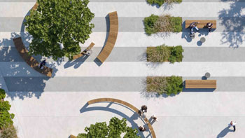
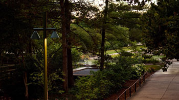
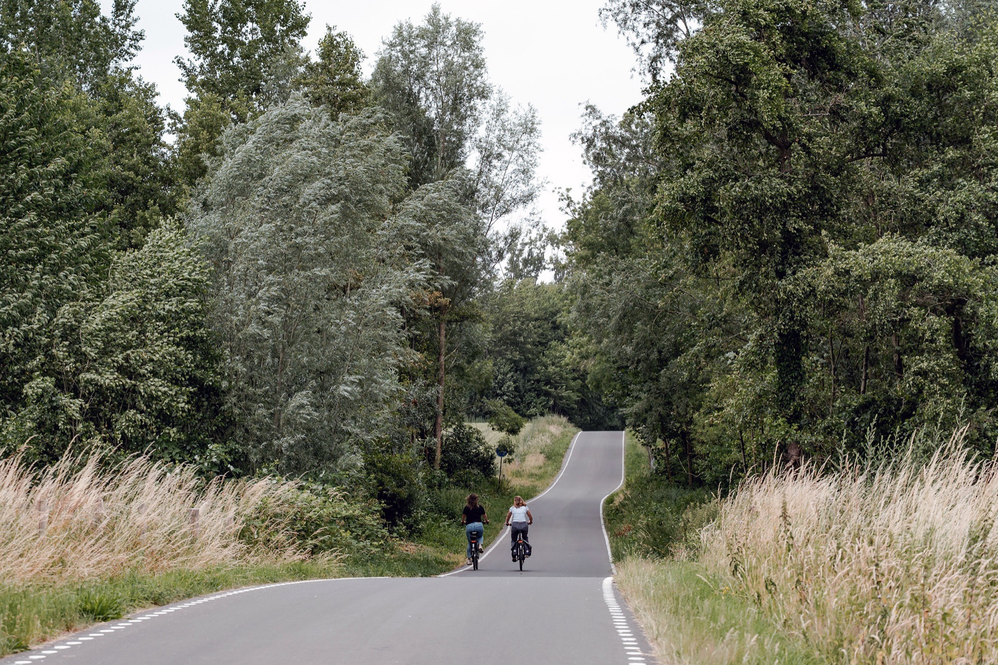
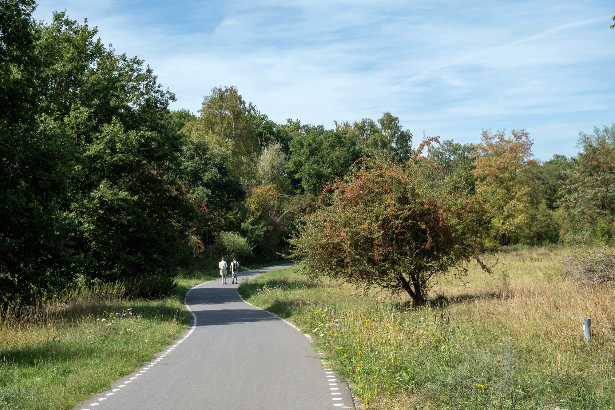
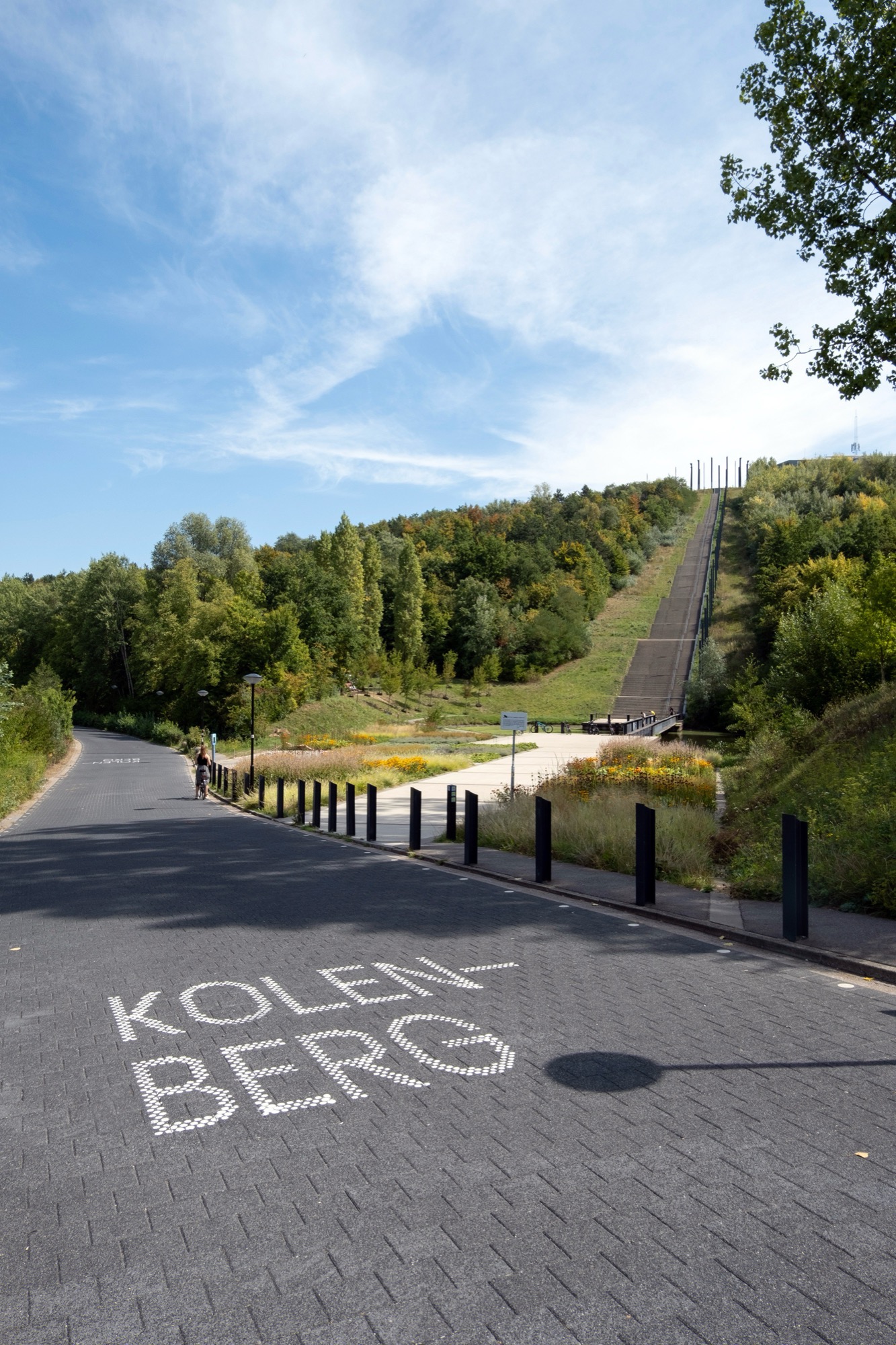
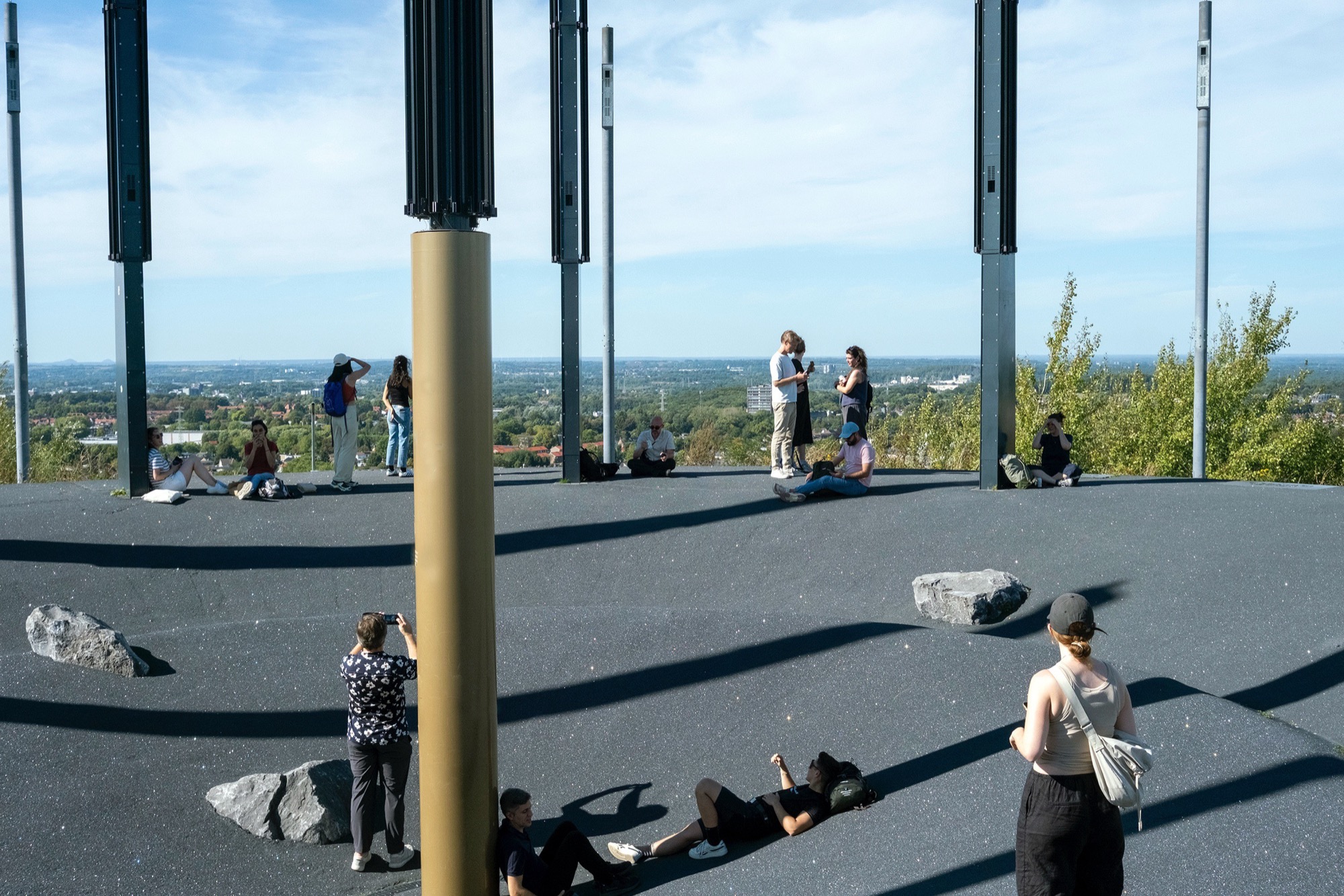
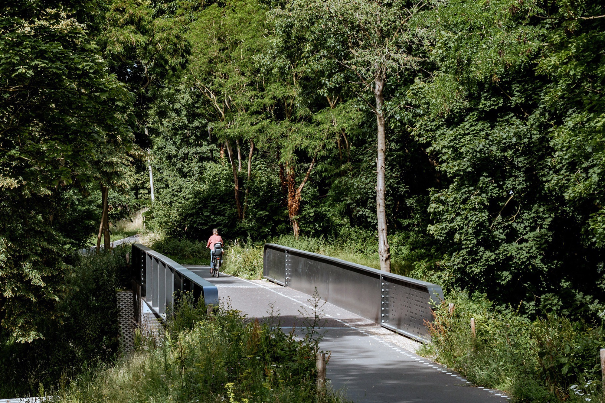
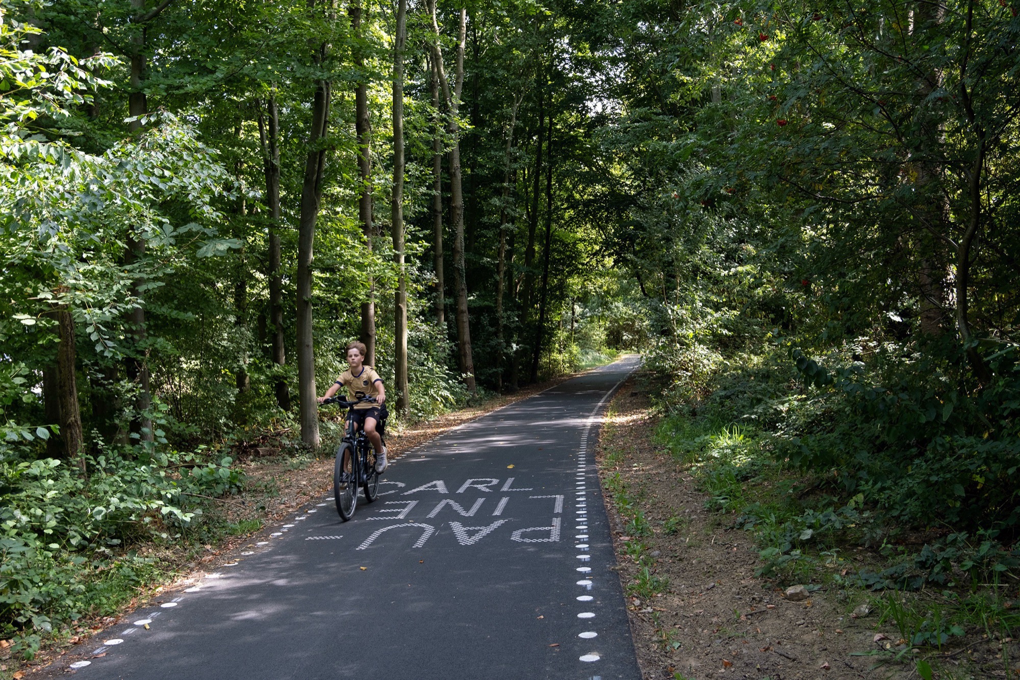
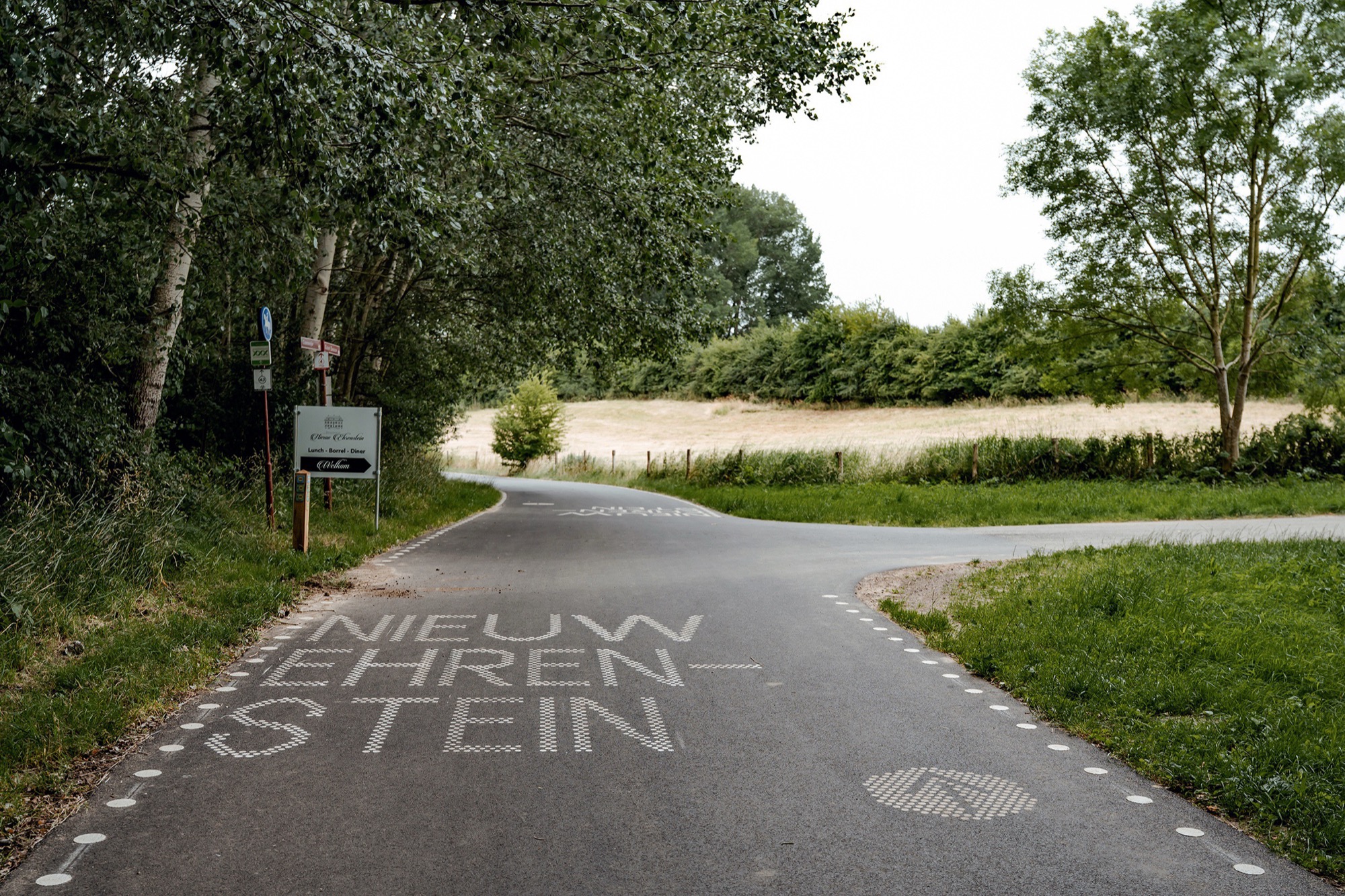
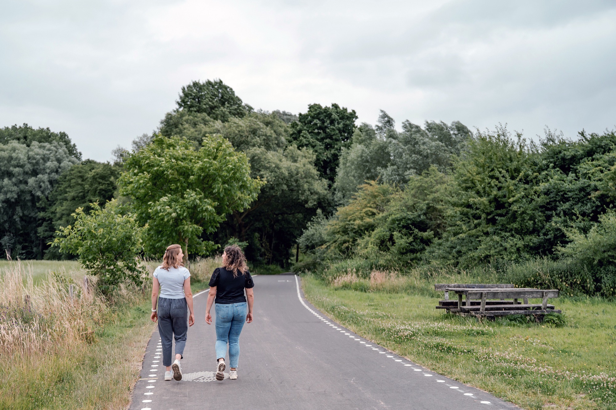
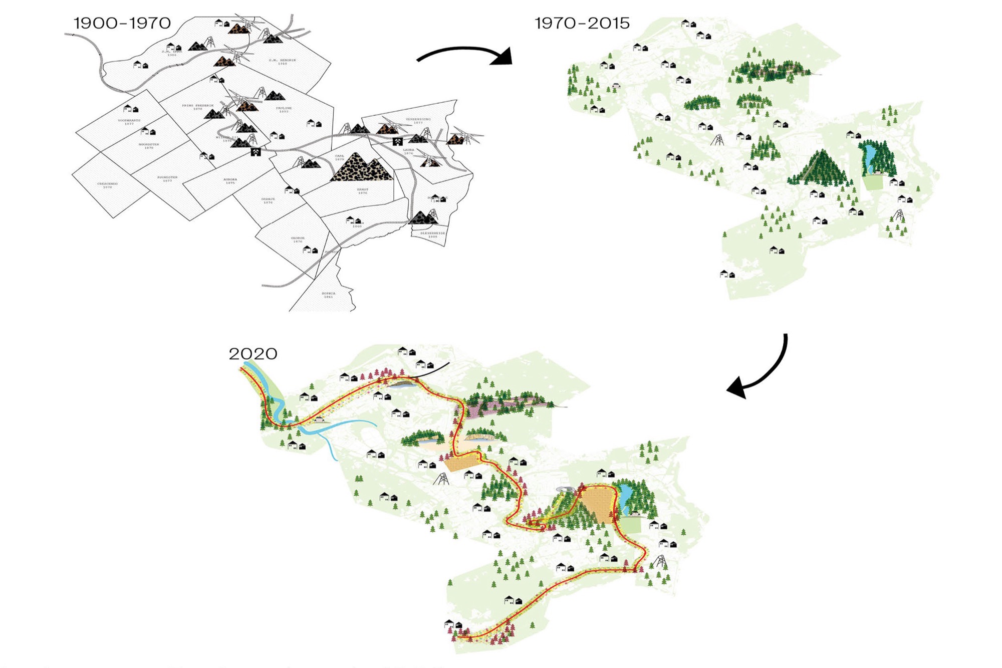
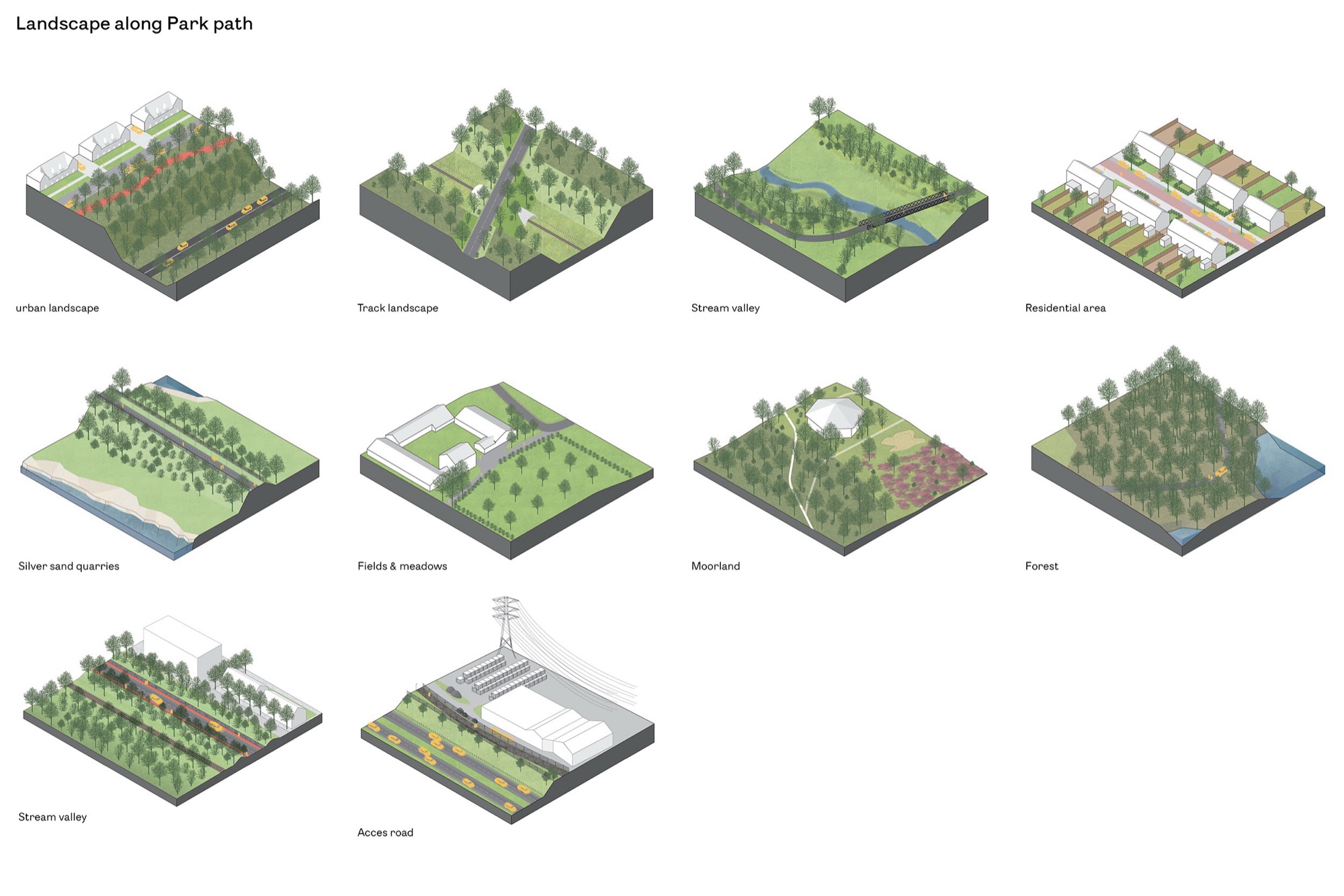
The LOLA Landsape Architects designed Parkstadroute is a recreational route for cycling and hiking with a total length of approximately 35 kilometres. It runs through IBA Parkstad, a region in the southern Netherlands historically known for coal mining. The route is conceived as a slow, landscape-oriented infrastructure that reveals most distinctive spatial, cultural and natural qualities of the region. Along its course, users encounter quartz sand quarries, purple-coloured heathlands, agricultural fields, forest edges, historic castles, remnants of mining infrastructure and man-made terril hills that rise as landmarks within the landscape.
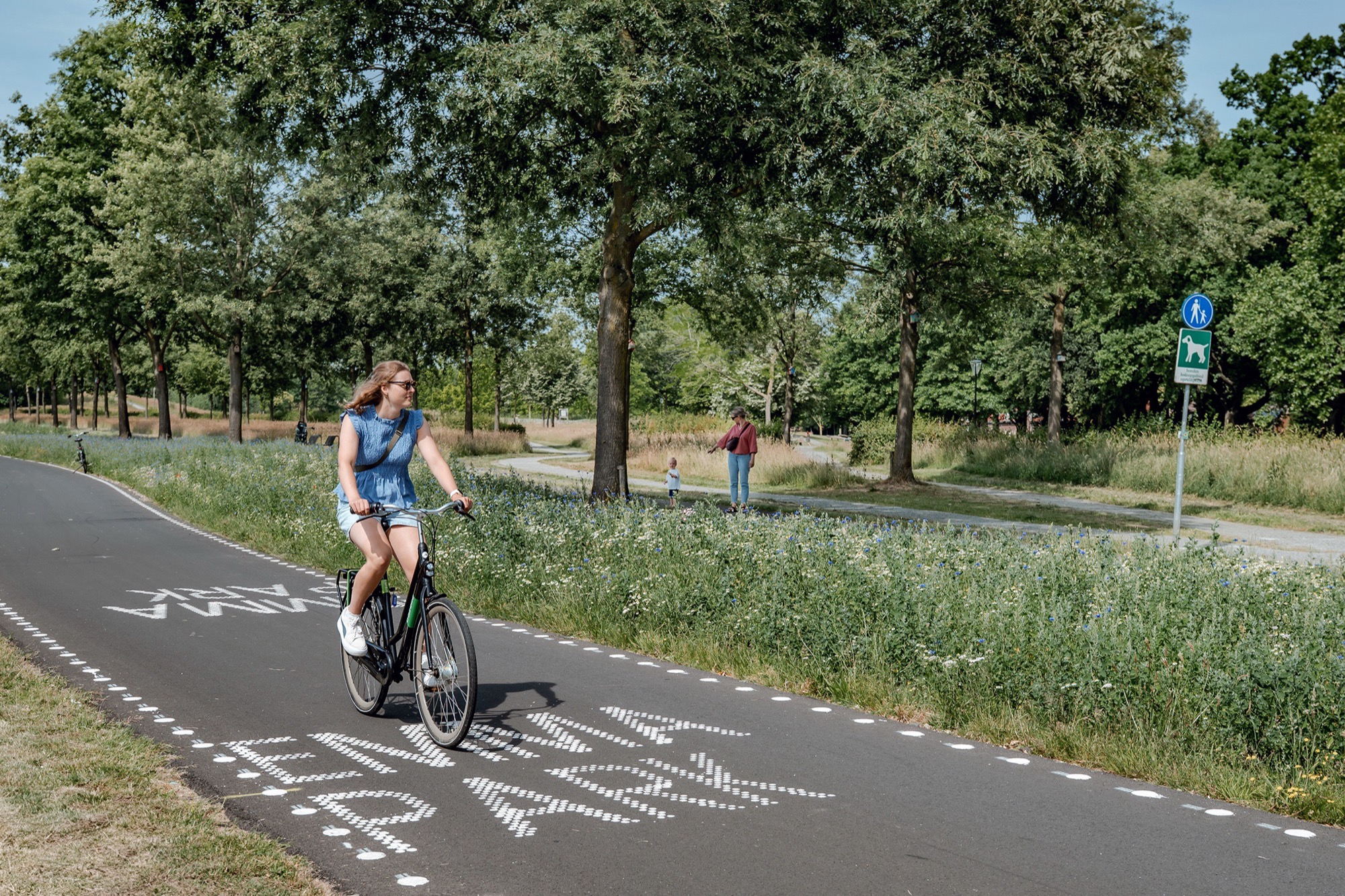
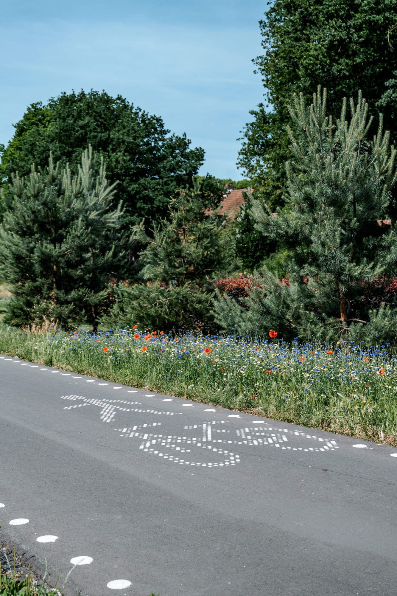
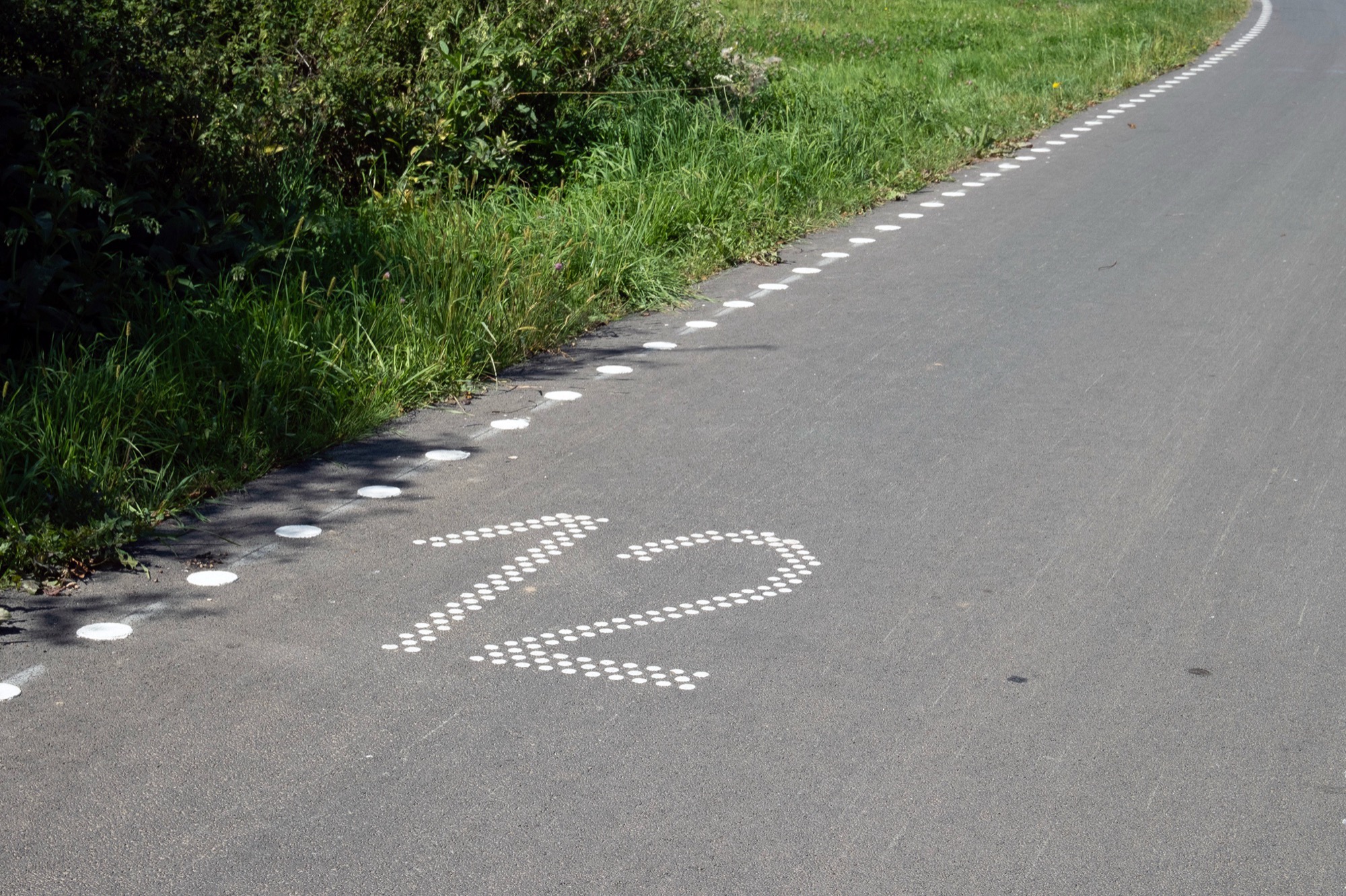
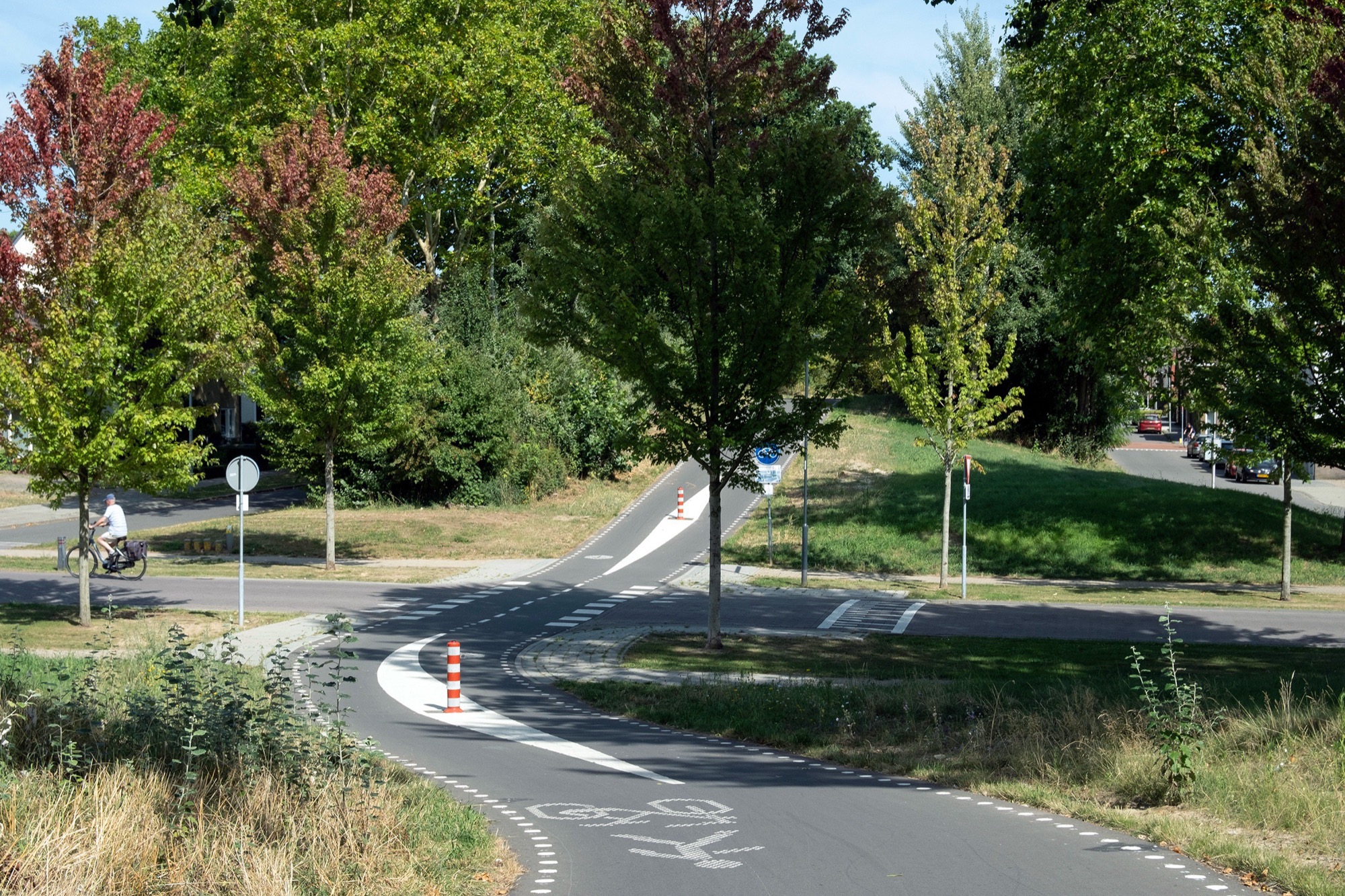
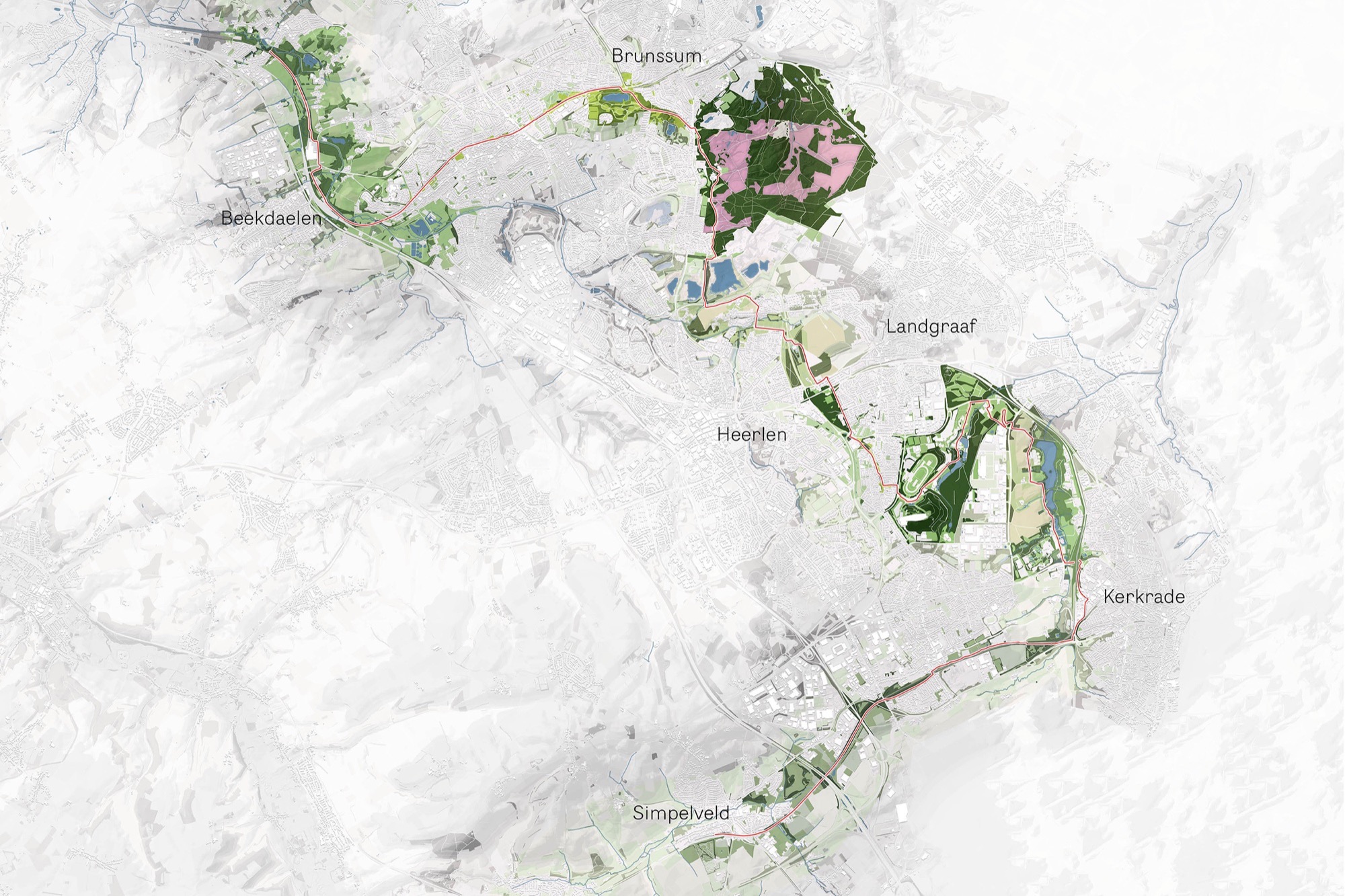
Marked by a distinctive white dotted line, the Parkstadroute weaves through and connects the towns and villages of Simpelveld, Kerkrade, Heerlen, Landgraaf, Brunssum, Hoensbroek, Nuth, Beekdaelen and Schinnen. Rather than functioning as straightforward connection between destinations, the route is designed as a continuous spatial experience in which infrastructure, landscape and ecology are closely intertwined. The overall concept of the Parkstadroute is built on three interrelated pillars: Flow, Experience and Botanics.
– Flow, Following the route by intuition
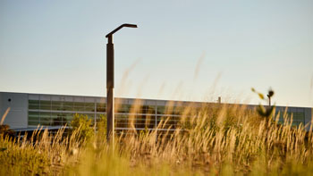
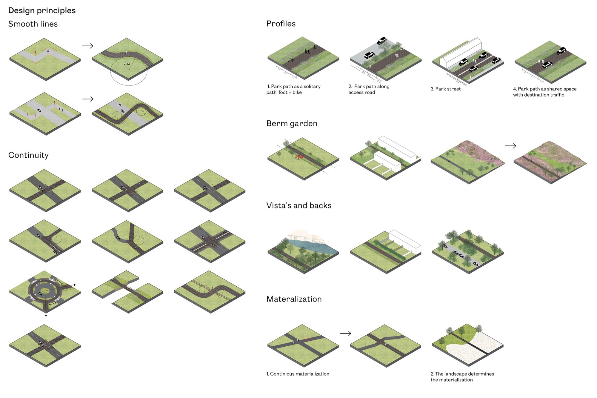
Flow refers to the intuitive legibility and continuity of the route. Once on the Parkstadroute, users can follow it without the need for conventional signage or frequent stops. The route has its own recognisable materialisation and subtle guidance embedded in the surface. Curves, intersections and resting places are carefully designed to support fluent movement. The trajectory follows natural geometries and avoids abrupt changes, creating a comfortable and uninterrupted rhythm. A continuous asphalt pavement with a vernacular appearance distinguishes the route from other roads. Its colour and texture relate directly to the regional landscape, making the route both recognisable and embedded. Together, these design choices enable intuitive navigation and allow users to focus on the surrounding environment.
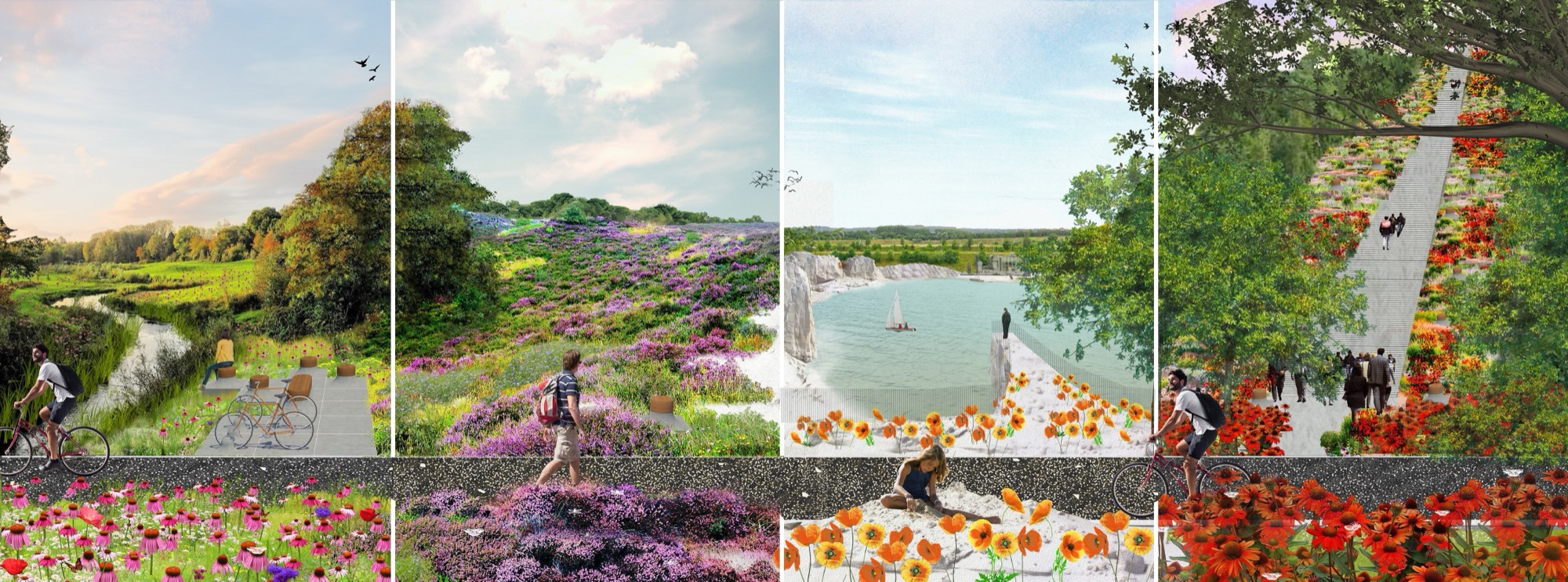
– Experience, Choreography of the landscape
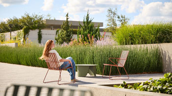
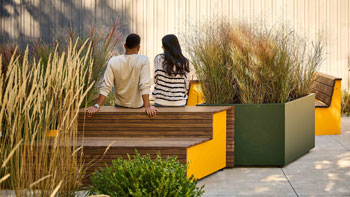
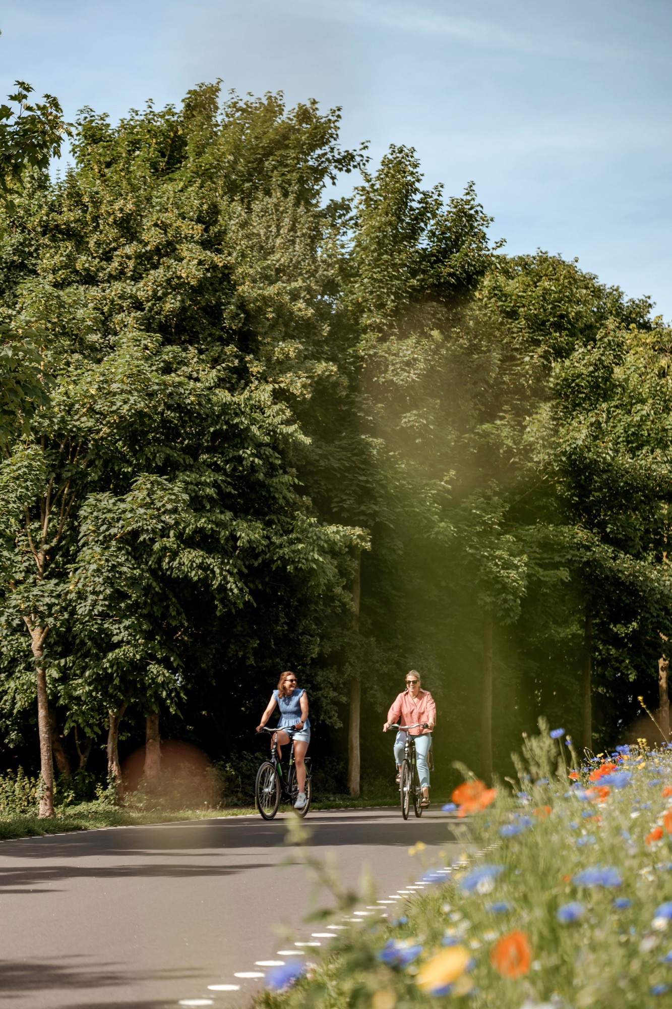
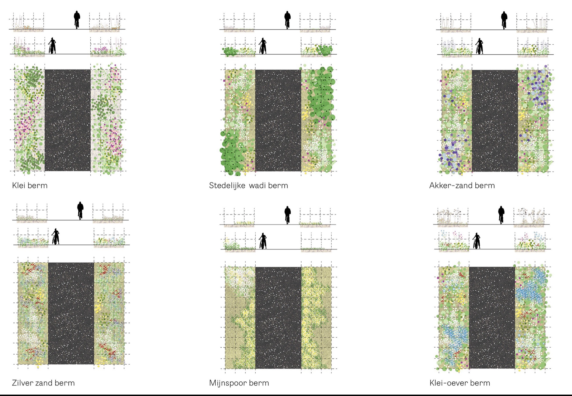
Experience concerns the choreography of the landscape along the route. Trees and shrubs are strategically planted in the flowery verge to frame views, accentuate depth and guide sightlines. Resting places are positioned at locations with panoramic views of characteristic and iconic landscapes. A key element in this approach is the berm, which is treated as an active design component rather than residual space. The berm creates a tangible foreground that connects the user to the background landscape, making it visually and sensorially accessible. At the same time, planting within the berm selectively reveals or conceals views, carefully staging what the passer-by sees and does not see.
– Botanics, 35 km botanical verge
Botanics forms the ecological backbone of the Parkstadroute. Along its entire length, the route is accompanied by a wide botanical verge that reflects the landscape it passes through. Heather dominates in heathland areas, wildflowers appear along fields, and grasses and shrubs mark transitions near woodlands and urban edges. In this way, the verge creates a strong foreground for the surrounding landscape while functioning as a continuous ecological corridor through the city and countryside. The concept of botanics is translated into two principles: the two-sided berm as a long, linear landscape garden, and plant communities based on the original soil conditions beneath the route. In spring, cyclists and walkers move through a flourishing landscape garden that changes gradually along the route.
Beyond its spatial qualities, the Parkstadroute functions as an instrument for regional transformation. By linking former mining areas, residential districts and open landscapes, the route helps to overcome fragmentation and reframe Parkstad as a coherent region. Industrial relics are not erased but integrated as visible traces of history, supporting a renewed regional identity. At the same time, the route promotes sustainable mobility and everyday recreation, inviting residents and visitors to experience the landscape at a human pace. Through its careful balance of infrastructure, ecology and perception, the Parkstadroute demonstrates how contemporary landscape design can reveal hidden qualities, strengthen connections and contribute to a lasting relationship between people and place. The route therefore acts as both connector and destination, embedding daily movement within a carefully designed landscape sequence that encourages exploration, reflection and long-term stewardship of the region’s spatial heritage.
– Project credits Parkstadroute Limburg
Landscape design: LOLA Landscape Architects
I.c.w.: Koehorst in ‘t Veld, The municipalities of Simpelveld, Kerkrade, Heerlen, Landgraaf, Brunsum, Hoensbroek, Muth, Beekdaelen and Schinnen
Client: IBA Parkstad
Photography: Sanne Creuels Photography – Visit Zuid Limburg, LOLA Landscape Architects
50.941626, 5.882049
73667
LILA 2026 Sponsor